
Bullittsburg in Boone County, Kentucky — The American South (East South Central)
Bullittsburg Baptist Church
Photographed by Steve Stoessel, April 30, 2019
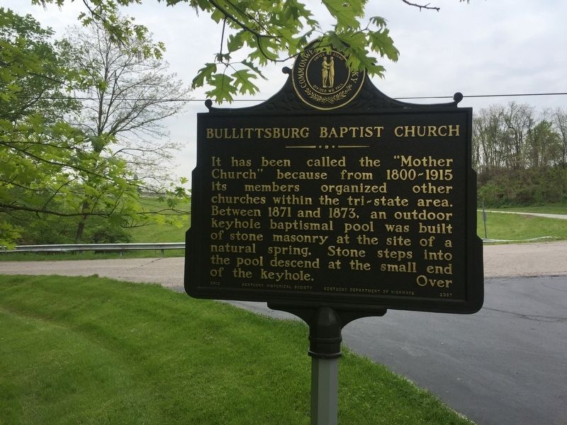
1. Bullittsburg Baptist Church Marker
It has been called the "Mother Church" because from 1800-1915 its members organized other churches within the tri-state area. Between 1871 and 1873, an outdoor keyhole baptismal pool was built of stone masonry at the site of a natural spring. Stone steps into the pool descend at the small end of the keyhole. Over
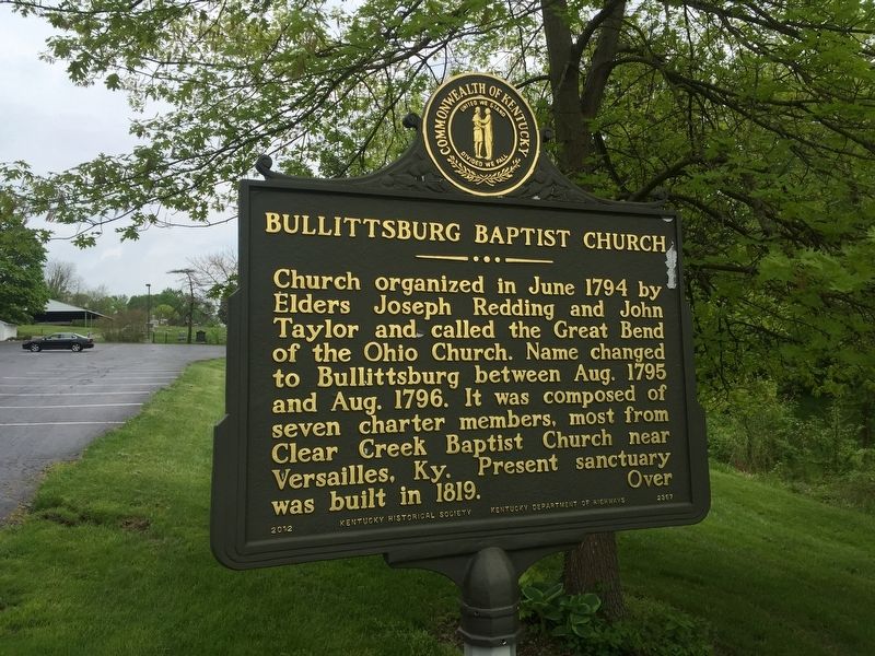
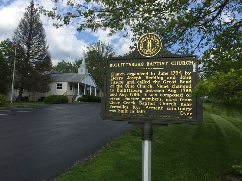
Church organized in June 1794 by Elders Joseph Redding and John Taylor and called the Great Bend of the Ohio Church. Name changed to Bullittsburg between Aug. 1795 and Aug. 1796. It was composed of seven charter members, most from Clear Creek Baptist Church near Versailles, Ky. Present sanctuary was built in 1819.
Erected 2012 by Kentucky Historical Society and Kentucky Department of Highways. (Marker Number 2367.)
Topics and series. This historical marker is listed in this topic list: Religion & Religious Structures. In addition, it is included in the Kentucky Historical Society series list. A significant historical month for this entry is June 1794.
Location. 39° 5.399′ N, 84° 47.296′ W. Marker is in Bullittsburg, Kentucky, in Boone County. It is on Bullittsburg Church Road (Kentucky Route 8) near
this page online

Regionally, this marker is in the American South, specifically in the Upper South, and in the Ohio River Valley. Globally, it is in North America, the Western Hemisphere, the Western World, and the Anglosphere. Historically, it finds itself in what was once the territory of the Mississippian Culture and also the Antebellum South.
Other nearby markers. At least 8 other markers are within 4 miles of this marker, measured as the crow flies: Point Farm (approx. 2.2 miles away in Ohio); Fort Finney (approx. 2.2 miles away in Ohio); Miami Fort / Fort Finney (approx. 2.2 miles away in Ohio); Lawrenceburg's First Hospital (approx. 3.1 miles away in Indiana); Whitewater Canal (approx. 3.1 miles away in Indiana); Isaac Dunn House (approx. 3.1 miles away in Indiana); Rescued Row Houses (approx. 3.1 miles away in Indiana); Abraham Lincoln (approx. 3.1 miles away in Indiana).
Photographed by Steve Stoessel, April 30, 2019
2. Bullittsburg Baptist Church Marker
Photographed by Steve Stoessel, April 29, 2019
3. Bullittsburg Baptist Church Marker
Credits. This page was last revised on June 3, 2021. It was originally submitted on May 1, 2019, by Steve Stoessel of Niskayuna, New York. This page has been viewed 442 times since then and 36 times this year. Photos: 1, 2, 3. submitted on May 1, 2019, by Steve Stoessel of Niskayuna, New York. • Andrew Ruppenstein was the editor who published this page.
