Long Beach in Nassau County, New York — The American Northeast (Mid-Atlantic)
The LIRR Station
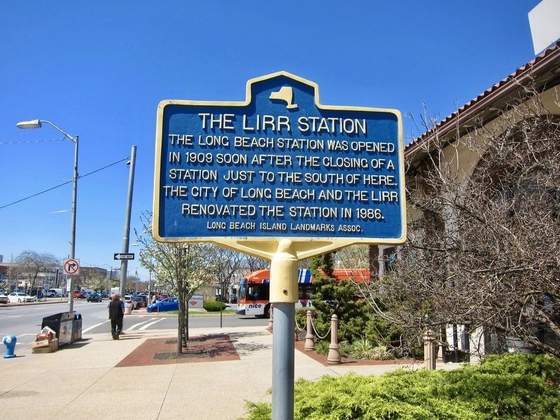
Photographed by Andrew Ruppenstein, April 24, 2019
1. The LIRR Station Marker
Erected by Long Beach Island Landmarks Association.
Topics. This historical marker is listed in this topic list: Railroads & Streetcars. A significant historical year for this entry is 1909.
Location. 40° 35.325′ N, 73° 39.894′ W. Marker is in Long Beach, New York, in Nassau County. It is at the intersection of West Park Avenue and Reverend JJ Evans Boulevard, on the right when traveling west on West Park Avenue. Touch for map. Marker is in this post office area: Long Beach NY 11561, United States of America. Touch for directions.

Regionally, this marker is in the New York City Metropolitan Area and on Long Island. It is also in the American Northeast, in the Mid-Atlantic, and on the Eastern Seaboard. Globally, it is in the North Atlantic Region, North America, the Western Hemisphere, the Western World, and the Anglosphere. Historically, it finds itself in what was once New Netherland and also one of the original Thirteen Colonies.
this page online
Other nearby markers. At least 8 other markers are within 4 miles of this marker, measured as the crow flies: Cobble Villa (approx. half a mile away); Wreck of the Mexico (1837) (approx. ¾ mile away); Louis Chimeri, Jr. Memorial (approx. 1.4 miles away); Mayor Joseph F. Carrigan Point (approx. 3½ miles away); Vigilant Engine Co. and Protector H.L. & Hose Co. World War II Memorial (approx. 3½ miles away); Historic Waterfront (approx. 3½ miles away); Site of Oven (approx. 3½ miles away); Dave Push (approx. 3½ miles away). Touch for a list and map of all markers in Long Beach.
Also see . . . Long Beach Station (LIRR) (Wikipedia). "Due to repeated storm damage to rails and other equipment, the LIRR petitioned the New York State Public Service Commission to move the station 1000 feet north in January 1909, which was fully endorsed by the Estates of Long Beach who even offered to exchange land with the railroad. That permission was granted in February of the same year. The present depot at Park Avenue was built in June 1909, and is larger than the previous station off the Atlantic Coast. It was designed by Kenneth M. Murchison,
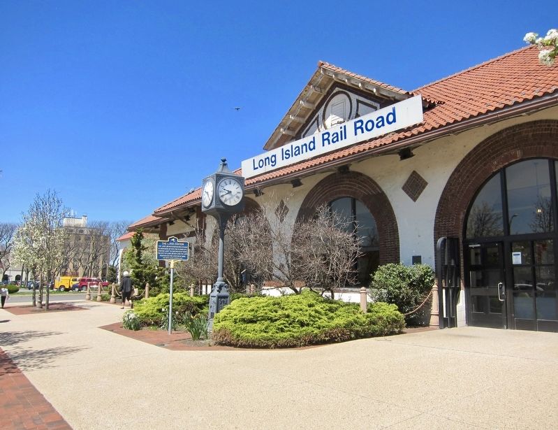
Photographed by Andrew Ruppenstein, April 24, 2019
2. The LIRR Station Marker - wide view
Credits. This page was last revised on May 1, 2019. It was originally submitted on May 1, 2019, by Andrew Ruppenstein of Lamorinda, California. This page has been viewed 484 times since then and 53 times this year. Photos: 1, 2. submitted on May 1, 2019, by Andrew Ruppenstein of Lamorinda, California.
