St. Charles in St. Charles County, Missouri — The American Midwest (Upper Plains)
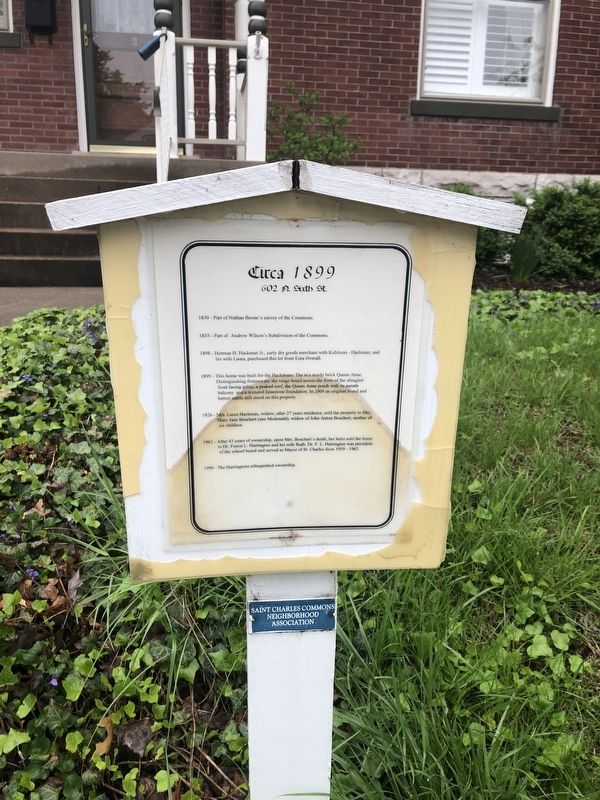
Circa 1899
602 N. Sixth St.
— Saint Charles Commons Neighborhood Association —
1830 - Part of Nathan Boone's survey of the Commons.
1835 - Part of Andrew Wilson's Subdivision of the Commons.
1898 - Herman H. Hackman Jr., early dry goods merchant with Kuhlman - Hackman, and his wife Laura, purchased this lot from Ezra Overall.
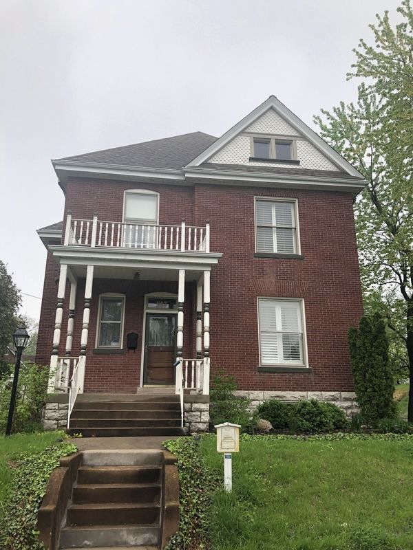
1899 - This home was built for the Hackmans. The is a sturdy brick Queen Anne. Distinguishing features are the verge board across the front of the shingled front facing gable, a peaked roof, the Queen Anne porch with its parade balcony and a textured limestone foundation. In 2004 an original boardand batten stable still stood on this property.
1926 - Mrs. Laura Hackman, widow, after 27 years residence, sold the property to Mrs. Mary Jane Boschert (nee Mcdonald), widow of John Anton Boschert, mother of six children.
1961 - After 43 years of ownership, upon Mrs. Boschert's death, her heirs sold the home to Dr. Forest L. Harrington and his wife Ruth. Dr. F. L. Harrington was president of the school board and served as Mayor of St. Charles from 1959 - 1963.
1990 - The Harringtons relinquished ownership.
Erected by Saint Charles Commons Neighborhood Association.
Topics. This historical marker is listed in these topic lists: Architecture • Government & Politics • Settlements & Settlers • Women. A significant historical year for this entry is 1830.
Location. 38° 47.293′ N, 90° 29.148′ W. Marker is in St. Charles, Missouri, in St. Charles County. Marker is on North 6th Street north of Lewis Street. Touch for map. Marker is at or near this postal address: 602 North 6th Street, Saint Charles MO 63301, United States of America. Touch for directions.
Other nearby markers. At least 8 other markers are within walking distance of this marker. 1889 (a few steps from this marker); 612 North Sixth Street (a few steps from this marker); Circa 1940 (within shouting distance of this marker); Circa 1894 (about 400 feet away, measured in a direct line); Circa 1904 (about 400 feet away); 1900 (about 600 feet away); Circa 1939 (about 700 feet away); 1902 (about 700 feet away). Touch for a list and map of all markers in St. Charles.
Credits. This page was last revised on May 1, 2019. It was originally submitted on May 1, 2019, by Devry Becker Jones of Washington, District of Columbia. This page has been viewed 202 times since then and 8 times this year. Photos: 1, 2. submitted on May 1, 2019, by Devry Becker Jones of Washington, District of Columbia.

