St. Charles in St. Charles County, Missouri — The American Midwest (Upper Plains)
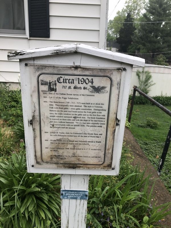
Circa 1904
717 N. Sixth St.
— Saint Charles Commons Neighborhood Association —
1830 - Part of the Nathan Boone survey of the Commons.
1835 - Lot 13 of the Riggs Subdivision
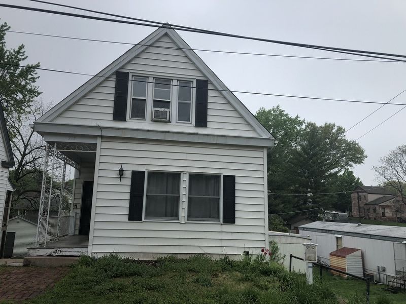
1904 - The three houses (709 - 713 - 717) were built at or about this time. They originally were identical. The style is Victorian Folk with front gable — cross gable construction. Distinguishing features are the pent roof board across the front gable at the cave, the triple windows on the gable and on the first floor with simple windows surrounds and block trim. The brick foundation is exposed on three sides and with the slope of the land forms a full story walkout basement. The porches were originally Queen Anne turned posts with cut spindle work. The porches under the principle roof are unusual.
1904 - Joseph H. Nacke, clerk for Kuhlmann's Dry Goods Store, and his wife Pilomena reside here till the start of World War I.
1918 - ☆ John Nacke, son of Joseph and Philomena served in World War I in the battle of Argone and was killed☆.
1918 - Louis Hallemeier (wife Anna) worked at A. C. F. resided here till 1924.
☆ Louis served in the St. Charles Home Guard as a private during World War I ☆
Erected by Saint Charles Commons Neighborhood Association.
Topics. This historical marker is listed in these topic lists: Architecture • Industry & Commerce • Settlements & Settlers • War, World I. A significant historical year for this entry is 1830.
Location. 38° 47.363′ N, 90° 29.123′ W. Marker is in St. Charles, Missouri, in St. Charles County. Marker is on North 6th Street north of Decatur Street, on the left when traveling north. Touch for map. Marker is at or near this postal address: 717 North 6th Street, Saint Charles MO 63301, United States of America. Touch for directions.
Other nearby markers. At least 8 other markers are within walking distance of this marker. Circa 1894 (a few steps from this marker); 1900 (within shouting distance of this marker); Circa 1939 (within shouting distance of this marker); 1902 (about 300 feet away, measured in a direct line); Circa 1906 (about 300 feet away); Circa 1940 (about 400 feet away); 612 North Sixth Street (about 400 feet away); 1889 (about 400 feet away). Touch for a list and map of all markers in St. Charles.
Credits. This page was last revised on May 1, 2019. It was originally submitted on May 1, 2019, by Devry Becker Jones of Washington, District of Columbia. This page has been viewed 219 times since then and 21 times this year. Photos: 1, 2. submitted on May 1, 2019, by Devry Becker Jones of Washington, District of Columbia.

