St. Charles in St. Charles County, Missouri — The American Midwest (Upper Plains)
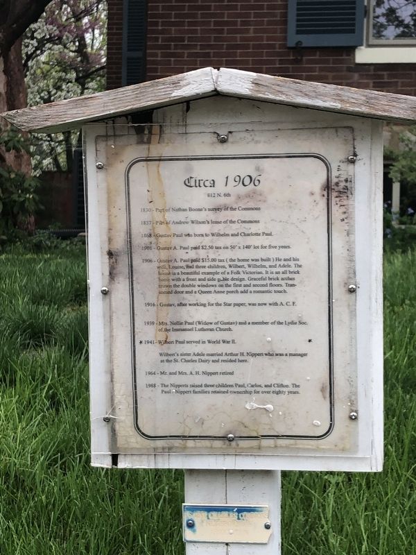
Circa 1906
812 N. 6th
— Saint Charles Commons Neighborhood Association —
1830 - Part of Nathan Boone's survey of the Commons
1837 - Part of Andrew Wilson's lease of the Commons.
1868 - Gustav - Paul was born to Wilhelm and Charlotte Paul.
1901 - Gustav A. Paul paid $2.50 tax on 50' x 140' lot for five years.
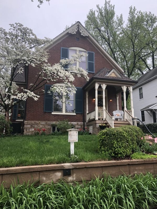
1906 - Gustav A. Paul paid $15.00 tax ( the home was built ) He said his wife, Louise, had three children, Wilbert, Wilhelm, and Adele. The house is a beautiful example of a Folk Victorian. IT is an all brick home with a front and side gable design. Graceful brick arches crown the double windows on the first and second floors. Transomed door and a Queen Anne porch add a romantic touch.
1916 - Gustav, after working for the Star paper, was now with A. C. F.
1939 - Mrs. Nellie Paul (Widow of Gustav) and a member of the Lydia Soc. of the Immanuel Lutheran Church.
1941 - Wilbert Paul served in World War II.
Wilbert's sister Adele married Arthur H. Kippert who was manager at the St. Charles Dairy and resided here.
1964 - Mr. and Mrs. A. H. Nippert retired
1988 - The Nipperts raised three children Paul, Carlos, and Clifton. The Paul / Nippert families retained ownership for over eighty years.
Erected by Saint Charles Commons Neighborhood Association.
Topics. This historical marker is listed in these topic lists: Architecture • Churches & Religion • Industry & Commerce • Settlements & Settlers. A significant historical year for this entry is 1830.
Location. 38° 47.408′ N, 90° 29.087′ W. Marker is in St. Charles, Missouri, in St. Charles County. Marker is on North 6th Street north of Franklin Street, on the right when traveling north. Touch for map. Marker is at or near this postal address: 812 North 6th Street, Saint Charles MO 63301, United States of America. Touch for directions.
Other nearby markers. At least 8 other markers are within walking distance of this marker. 1902 (a few steps from this marker); Circa 1939 (within shouting distance of this marker); 1900 (within shouting distance of this marker); Circa 1904 (about 300 feet away, measured in a direct line); Circa 1894 (about 300 feet away); 1911 (about 600 feet away); Circa 1888 (about 600 feet away); Circa 1940 (about 700 feet away). Touch for a list and map of all markers in St. Charles.
Credits. This page was last revised on May 1, 2019. It was originally submitted on May 1, 2019, by Devry Becker Jones of Washington, District of Columbia. This page has been viewed 197 times since then and 8 times this year. Photos: 1, 2. submitted on May 1, 2019, by Devry Becker Jones of Washington, District of Columbia.

