Rochelle in Ogle County, Illinois — The American Midwest (Great Lakes)
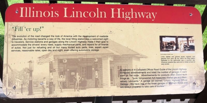
"Fill 'er up!"
Illinois Lincoln Highway
The evolution of the road changed the look of America with the development of roadside industries. As motoring became a way o f life, the local filling station was welcomed sight to travelers. Service stations and garages along the Lincoln Highway made it their goal to accommodate the drivers' every need, supply mechanical parts and repairs for all brands of autos. Not just for refueling and oil but many touted auto parts, tires, expert repair services, reasonable rates, open day and night, even offering automobile storage.
All editions of A Complete Official Road Guide of the Lincoln Highway contained advertisements and listed the number of garages in each town on the route. Advertisements for products often stated such things as... pure, full-powered, full-measured, filtered gas and clean, velvety lubricants." A garage ad claimed "Lincoln Highway Official Garage… We have one of the finest garages in Northern Illinois and are always prepared to take care of tourists."
Livery stables and general stores originally sold gasoline from cans. By the 1920's the filling station dedicated to the automobile was a common site. Wherever possible they were built on street corners for easy access.
Topics and series. This historical marker is listed in this topic list: Roads & Vehicles . In addition, it is included in the Lincoln Highway series list.
Location. 41° 55.219′ N, 89° 4.347′ W. Marker is in Rochelle, Illinois, in Ogle County. Located at the Rochelle Railroad Park. Touch for map. Marker is at or near this postal address: 206 N 10th Street, Rochelle IL 61068, United States of America. Touch for directions.
Other nearby markers. At least 8 other markers are within 10 miles of this marker, measured as the crow flies. Better Roads for a Bright Future (here, next to this marker); The Lincoln Highway - The nation's first coast-to-coast highway! (here, next to this marker); City of Rochelle (here, next to this marker); Creston (approx. 5.6 miles away); Gross Saw Mill (approx. 7.1 miles away); Morgan Grist Mill (approx. 7.9 miles away); Aikens Saw Mill (approx. 10 miles away); Lincoln Highway Seedling Mile (approx. 10.1 miles away). Touch for a list and map of all markers in Rochelle.
Credits. This page was last revised on May 6, 2019. It was originally submitted on May 5, 2019, by Ruth VanSteenwyk of Aberdeen, South Dakota. This page has been viewed 208 times since then and 10 times this year. Photo 1. submitted on May 5, 2019, by Ruth VanSteenwyk of Aberdeen, South Dakota. • Andrew Ruppenstein was the editor who published this page.
