Cobble Hill in Brooklyn in Kings County, New York — The American Northeast (Mid-Atlantic)
Ponkiesberg Fortification
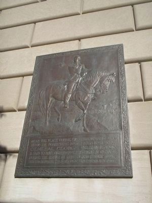
Photographed by Bill Coughlin, April 24, 2010
1. Ponkiesberg Fortification Marker
Erected 1926 by South Brooklyn Savings Institution.
Topics. This historical marker is listed in this topic list: War, US Revolutionary. A significant historical year for this entry is 1776.
Location. 40° 41.376′ N, 73° 59.554′ W. Marker is in Brooklyn, New York, in Kings County. It is in Cobble Hill. It is at the intersection of Court Street and Atlantic Avenue, on the right when traveling south on Court Street. Marker is on the side of the building at the southwest corner of the intersection of Atlantic Avenue and Court Street. Touch for map. Marker is at or near this postal address: 130 Court Street, Brooklyn NY 11201, United States of America. Touch for directions.

Regionally, this marker is in New York City and on Long Island. It is also in the American Northeast, in the Mid-Atlantic, and on the Eastern Seaboard. Globally, it is in the
this page online
Other nearby markers. At least 8 other markers are within walking distance of this marker: Brooklyn (about 600 feet away, measured in a direct line); Burial Site of Cornelius Heeney (about 800 feet away); Gene's Tree (approx. 0.2 miles away); Did You Know? (approx. 0.2 miles away); Cornelius Heeney (approx. 0.2 miles away); Brooklyn Civic Center / Downtown Brooklyn (approx. 0.2 miles away); St. Paul Catholic Church (approx. 0.2 miles away); 133 Clinton Street (approx. 0.2 miles away). Touch for a list and map of all markers in Brooklyn.
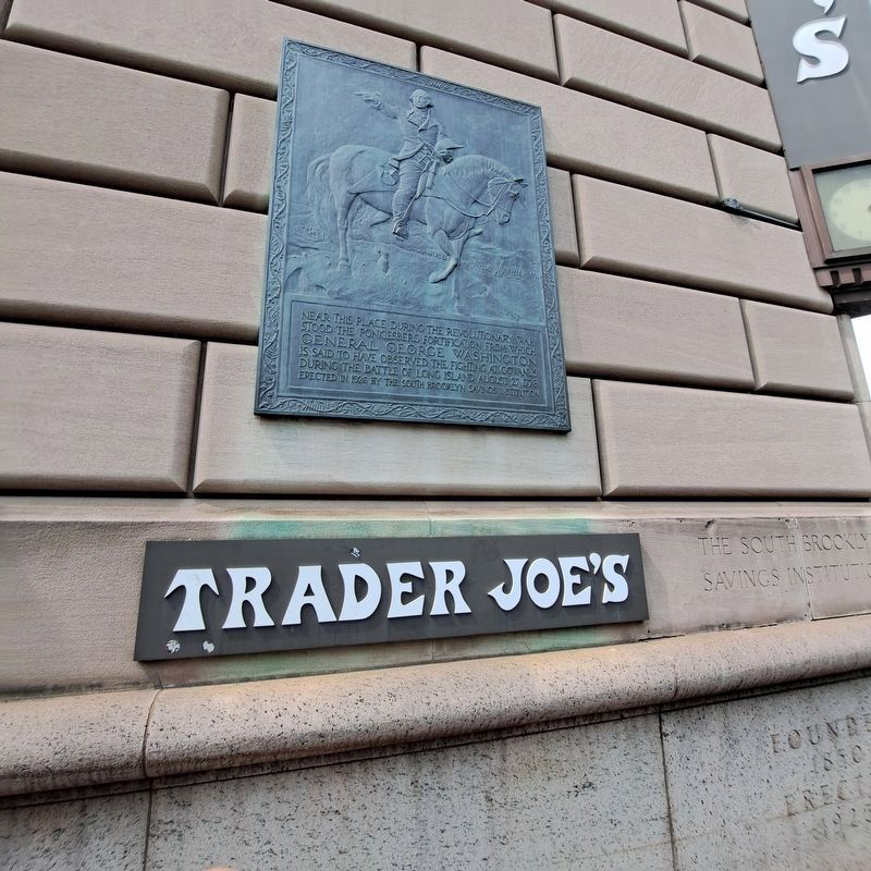
More about this marker. The top of the marker contains an image of Washington on horseback looking towards his fighting troops.
Regarding Ponkiesberg Fortification. The building is listed in the "AIA (American Institute of Architects) Guide to New York City, Fifth Edition".
Also see . . .
1. The Battle of Long Island, August 27, 1776 at Long Island, New York. The
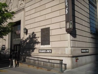
Photographed by Bill Coughlin, April 24, 2010
2. Marker on Court Street
2. Battle of Long Island, August 27, 1776. (Submitted on April 24, 2010, by Bill Coughlin of Woodland Park, New Jersey.)
3. The Battle of Long Island 1776. A British perspective of the battle from BritishBattles.com. (Submitted on April 24, 2010, by Bill Coughlin of Woodland Park, New Jersey.)
Additional commentary.
1. Battle of Brooklyn, And the Squirmish at the Stone House at Gowanus.
The Monument in Prospect Park to the Maryland 400. Note To Editor only visible by Contributor and editor
— Submitted September 12, 2025, by Jack DePalma of Brooklyn,NY, New York.
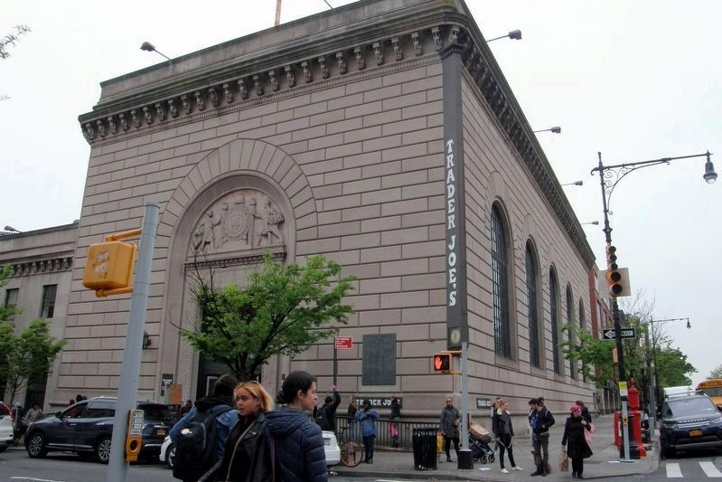
Photographed by Larry Gertner, May 3, 2019
3. Trader Joe's/formerly Independence Savings Bank/originally South Brooklyn Savings Institution
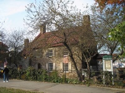
Photographed by Bill Coughlin, November 1, 2008
4. Old Stone House
Major fighting took place near this house during the Battle of Long Island. It was this action that Washington watched from the site of the marker.
Photographed by Jack DePalma, September 6, 2025
5. Ponkiesberg Fortification Marker
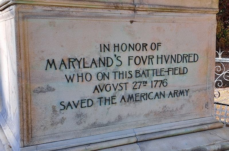
Photographed by Jack DePalma, Aug 1,2025
6. Monument to the Maryland 400 fighting in Gowanus
In SE Prospect Park
Along the Lake Drive
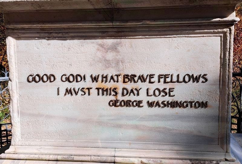
Photographed by Jack DePalma, October 25, 2024
7. Maryland 400 Monument in Prospect Park
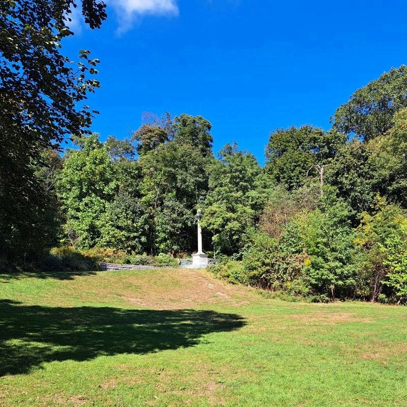
Photographed by Jack DePalma, Aug 1,2025
8. Monument to the Maryland 400
South East Prospect Park off the main drive

Photographed by Jack DePalma, October 10, 2025
9. Ponkiesberg Fortification Marker
Nearby, this marker has information about the
Cobble Hill fortification.

Photographed by Jack DePalma, October 3, 2025
10. Ponkiesberg Fortification Marker
Found in the Fort Greene Vistor center, nearby to the
Prison Ship Martyrs memorial, and the Spanish Memorial found there.
About the American Revolution.

Photographed by Jack DePalma, March 24, 2026
11. The Last Run

Photographed by Jack DePalma, March 24, 2026
12. The Last Run mural
Credits. This page was last revised on March 31, 2026. It was originally submitted on April 24, 2010, by Bill Coughlin of Woodland Park, New Jersey. This page has been viewed 1,993 times since then and 116 times this year. Last updated on May 7, 2019, by Larry Gertner of New York, New York. Photos: 1, 2. submitted on April 24, 2010, by Bill Coughlin of Woodland Park, New Jersey. 3. submitted on May 7, 2019, by Larry Gertner of New York, New York. 4. submitted on April 24, 2010, by Bill Coughlin of Woodland Park, New Jersey. 5. submitted on September 6, 2025, by Jack DePalma of Brooklyn,NY, New York. 6, 7, 8. submitted on September 12, 2025, by Jack DePalma of Brooklyn,NY, New York. 9, 10. submitted on October 10, 2025, by Jack DePalma of Brooklyn,NY, New York. 11, 12. submitted on March 24, 2026, by Jack DePalma of Brooklyn,NY, New York. • Andrew Ruppenstein was the editor who published this page.
