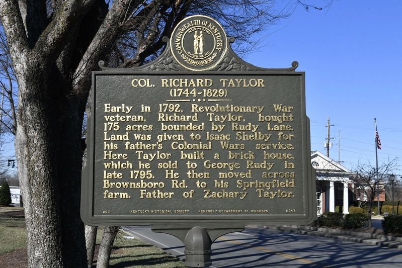
Col. Richard Taylor (1744-1829)/George Rudy (1744-1806)
(reverse). Pennsylvanian George Rudy and his son-in-law John Herr bought 175 acres here in 1795, naming the survey line Rudy's Lane in 1797. Herr & Rudy, who were blacksmiths, farriers, roadbuilders & farmers once owned all of present-day Windy Hills. Six family homes are still standing. Rudy Lane became a Jefferson County road in 1909.
Erected 2011 by Kentucky Historical Society/Kentucky Department of Highways. (Marker Number 2347.)
Topics and series. This historical marker is listed in this topic list: Settlements & Settlers. In addition, it is included in the Kentucky Historical Society series list. A significant historical year for this entry is 1792.
Location. 38° 16.667′ N, 85° 38.254′ W. Marker is in Louisville, Kentucky, in Jefferson County. Marker is on Rudy Lane, 0.1 miles south of Brownsboro Road, on the right when traveling south. Two blocks southeast of Zachary Taylor National cemetery. Touch for map
Other nearby markers. At least 8 other markers are within walking distance of this marker. Address by President Lincoln (approx. ¼ mile away); World War II 75th Division Memorial (approx. ¼ mile away); U.S.S. Canberra CA-70 (approx. ¼ mile away); First Marine Division Memorial (approx. ¼ mile away); Zachary Taylor National Cemetery (approx. ¼ mile away); Locust Grove (approx. half a mile away); Zachary Taylor Home (approx. half a mile away); a different marker also named Zachary Taylor Home (approx. 0.6 miles away). Touch for a list and map of all markers in Louisville.
Regarding Col. Richard Taylor (1744-1829)/George Rudy (1744-1806). Zachary Taylor's first known home in Louisville, KY.
Additional keywords. U.S. President
Credits. This page was last revised on May 19, 2019. It was originally submitted on May 17, 2019, by Michael Cunningham, Ph.D. of Louisville, Kentucky. This page has been viewed 477 times since then and 32 times this year. Photos: 1, 2, 3. submitted on May 17, 2019, by Michael Cunningham, Ph.D. of Louisville, Kentucky. • Andrew Ruppenstein was the editor who published this page.


