Chetumal in Othón P. Blanco, Quintana Roo, Mexico — The Yucatan Peninsula (The Southeast)
Hurricane Janet
Paseo de los Héroes
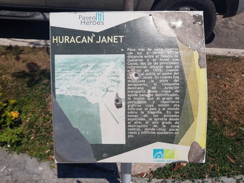
Poco más de siete cuadras (de sur a norte) es la distancia entre el Palacio de Gobierno y el hotel Los Cocos, dos de las principales referencias urbanas que ya estaban en 1955, cuando Chetumal sufrió el azote del huracán Janet. En cuanto fue despejada la pista del aeropuerto, la Compañía Mexicana de Aviación transportó toda clase de ayuda para los damnificados, lo mismo que al grupo de periodistas y reporteros gráficos cuya misión era informar al país y al mundo sobre la tragedia. En las tomas de los enviados especiales, se aprecia desde el aire, el alto grado de destrucción de la zona central, donde muy pocas casas y edificios quedaron en pie.
Hurricane Janet
Just over seven blocks (from south to north) is the distance between the Government Palace and the Los Cocos Hotel, two of the main urban reference points that already existed in 1955, when Chetumal suffered the scourge of Hurricane Janet. As soon as the airport runway was cleared, the Compañía Mexicana de Aviación (Mexican Aviation Company) transported all kinds of help for the victims, as well as the groups of journalists and photojournalists whose mission was to inform the country and the world about the tragedy. In the shots of the special envoys, the high degree of destruction of the central zone can be seen from the air, where very few houses and buildings were left standing.
Topics. This historical marker is listed in this topic list: Disasters. A significant historical year for this entry is 1955.
Location. 18° 30.118′ N, 88° 17.759′ W. Marker is in Chetumal, Quintana Roo, in Othón P. Blanco. Marker is on Avenida de los Héroes just south of Avenida Efraín Aguilar, on the right when traveling south. Touch for map. Marker is in this post office area: Chetumal QR 77000, Mexico. Touch for directions.
Other nearby markers. At least 8 other markers are within walking distance of this marker. The History of Chetumal: 1940-1950 (a few steps from this marker); Avenida 5 de Mayo (within shouting distance of this marker); Vice Admiral Othón Pompeyo Blanco Núñez de Cáceres (within shouting distance of this marker); Belisario Domínguez (within shouting distance of this marker); Juventino Rosas Theater (within shouting distance of this marker); The History of Chetumal: 1960-1970 and 1970-1980 (within shouting distance of this marker); Hospital Morelos (within shouting distance of this marker); Juan Erlindo Erales (within shouting distance of this marker). Touch for a list and map of all markers in Chetumal.
Credits. This page was last revised on May 18, 2019. It was originally submitted on May 18, 2019, by J. Makali Bruton of Accra, Ghana. This page has been viewed 133 times since then and 3 times this year. Photos: 1, 2. submitted on May 18, 2019, by J. Makali Bruton of Accra, Ghana.

