Divis Street
The Gaeltacht Quarter
⎯⎯⎯
Sráid Dhuibhise
An Cheathrú Ghaeltachta
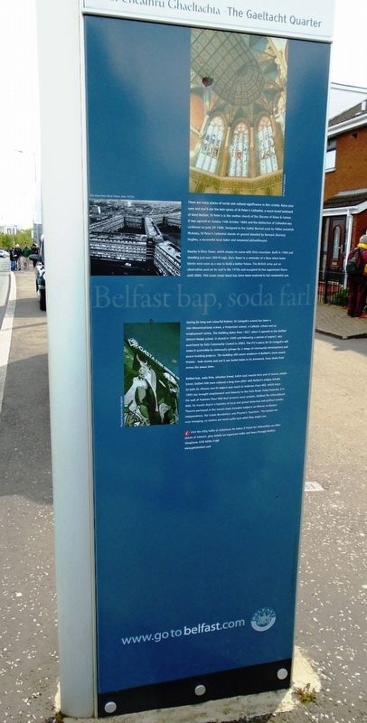
There are many places of social and cultural significance in this vicinity. Raise your eyes and you'll see the twin spires of St Peter's Cathedral, a much-loved landmark of West Belfast. St Peter's is the mother church of the Diocese of Down & Connor. It was opened on Sunday 14th October 1866 and the distinction of Cathedral was conferred on June 29 1986. Designed in the Gothic Revival style by Father Jeremiah McAuley, St Peter's Cathedral stands on ground donated by Bernard (Barney) Hughes, a successful local baker and renowned philanthropist.
Nearby is Divis Tower, which shares its name with Divis mountain. Built in 1966 and standing just over 200 ft high, Divis Tower is a reminder of a time when tower blocks were seen as a way to build a better future. The British army put an observation post on its roof in the 1970s and occupied its two uppermost floors until 2005. This iconic tower block has since been restored to full residential use.
During its long and colourful history, St Comgall's school has been a non-denominational school, a Protestant school, a Catholic school and an employment centre. The building dates from 1857, when it opened as the Belfast District Model school. It closed in 1999 and following a period of neglect, was purchased by Falls Community Council in 2002. The FCC's plans for St Comgall's will make it accessible to community groups for a range of community development and peace-building projects. The building still wears the evidence of Belfast's more recent history - look closely and you'll see bullet holes in its brickwork, from shots fired across the peace lines.
Belfast bap, soda farls, wheaten bread, batch loaf, treacle farls and of course, potato bread. Belfast folks have enjoyed a long love affair with Belfast's unique breads. So both its citizens and its bakers owe much
this page online
[Photo captions, from top to bottom, read]
• St Peter's Cathedral
• The view from Divis Tower, late 1970s
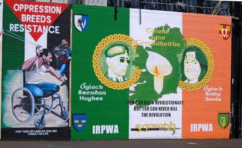
• Picasso's Guernica reimagined
Erected by the City of Belfast.
Topics. This historical marker is listed in these topic lists: Government & Politics • Patriots & Patriotism • Peace • Wars, Non-US. A significant historical date for this entry is June 29, 1986.
Location. 54° 35.985′ N, 5° 56.729′ W. Marker is in Belfast, Northern Ireland. It is on Divis Street (Northern Ireland Route A501) 0.4 kilometers west of Westlink ( Route A12), on the right when traveling west. Touch for map. Marker is in this post office area:

Regionally, this marker is in Armagh, Banbridge & Craigavon, and in Belfast. Globally, it is on the Atlantic Ocean, in the North Atlantic Region, in Europe, on the Island of Ireland, on the Celtic Fringe, in Atlantic Europe, on one of the British Isles, in the Western World, and in the Anglosphere.
Other nearby markers. At least 8 other markers are within walking distance of this marker: Abhainn na Feirste / River Belfast (within shouting distance of this marker); Fall Road Carnegie Library / Leabharlann Carnegie na bhFál (approx. half a kilometer away); Bayardo Bar Bombing Victims (approx. half a kilometer away); Séamus Mac Roibín / Seamus Robinson (approx. half a kilometer away); Michael O'Dwyer, Paddy Loughran, and Pat McBride (approx. half a kilometer away); Bobby Sands MP (approx. half a kilometer away); Pat (Beág) McGeown (approx. half a kilometer away); Máire Drumm (approx. half a kilometer away). Touch for a list and map of all markers in Belfast.
Credits. This page was last revised on May 27, 2019. It was originally submitted on May 27, 2019, by William Fischer, Jr. of Reynoldsburg, Ohio. This page has been viewed 476 times since then and 64 times this year. Photos: 1, 2, 3, 4, 5. submitted on May 27, 2019, by William Fischer, Jr. of Reynoldsburg, Ohio.
