Potomac West in Alexandria, Virginia — The American South (Mid-Atlantic)
The Columns of This Portico
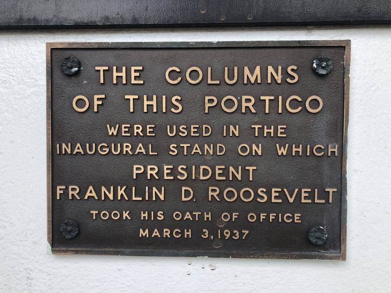
of this portico
were used in the
Inaugural stand on which
President
Franklin D. Roosevelt
took his oath of office
March 3, 1937
Topics and series. This historical marker is listed in this topic list: Government & Politics. In addition, it is included in the Former U.S. Presidents: #32 Franklin D. Roosevelt series list. A significant historical date for this entry is March 3, 1937.
Location. 38° 50.475′ N, 77° 3.808′ W. Marker is in Alexandria, Virginia. It is in Potomac West. It is at the intersection of Mount Vernon Avenue and Bruce Street, on the right when traveling south on Mount Vernon Avenue. Touch for map. Marker is at or near this postal address: 3900 Mount Vernon Avenue, Alexandria VA 22305, United States of America. Touch for directions.

Regionally, this marker is in the Washington Metropolitan Area and in Northern Virginia. It is also in the American South, specifically in the Upper South, in the Mid-Atlantic, and on the Eastern Seaboard. Globally, it is in the North Atlantic Region, North America, the Western Hemisphere, the Western World, and the Anglosphere. Historically, it finds itself
this page online
Other nearby markers. At least 8 other markers are within walking distance of this marker: Four Mile Run Park Wetland (about 700 feet away, measured in a direct line); In Memory of an African-American Family (approx. 0.2 miles away); Dr. Betty Louise Josephson King (approx. 0.2 miles away); Four Mile Run and Flooding / The Restoration Project / I Live Here...Can You Find Me? / Public Art (approx. 0.3 miles away); History at Four Mile Run Park (approx. 0.3 miles away); Shirley N. Tyler (approx. half a mile away); Transportation (approx. half a mile away); Fort Scott (approx. half a mile away). Touch for a list and map of all markers in Alexandria.
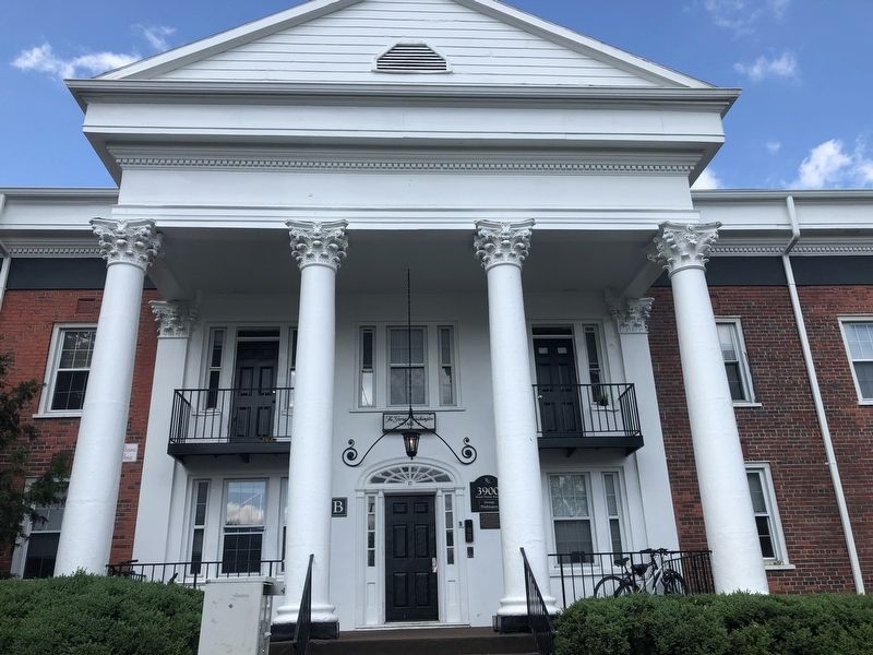
Photographed by Devry Becker Jones (CC0), May 27, 2019
2. The Columns
The plaque is below the address number sign.
Credits. This page was last revised on January 27, 2023. It was originally submitted on May 27, 2019, by Devry Becker Jones of Washington, District of Columbia. This page has been viewed 371 times since then and 30 times this year. Photos: 1, 2. submitted on May 27, 2019, by Devry Becker Jones of Washington, District of Columbia.
