Medina in Medina County, Ohio — The American Midwest (Great Lakes)
Saint Paul’s Episcopal Church
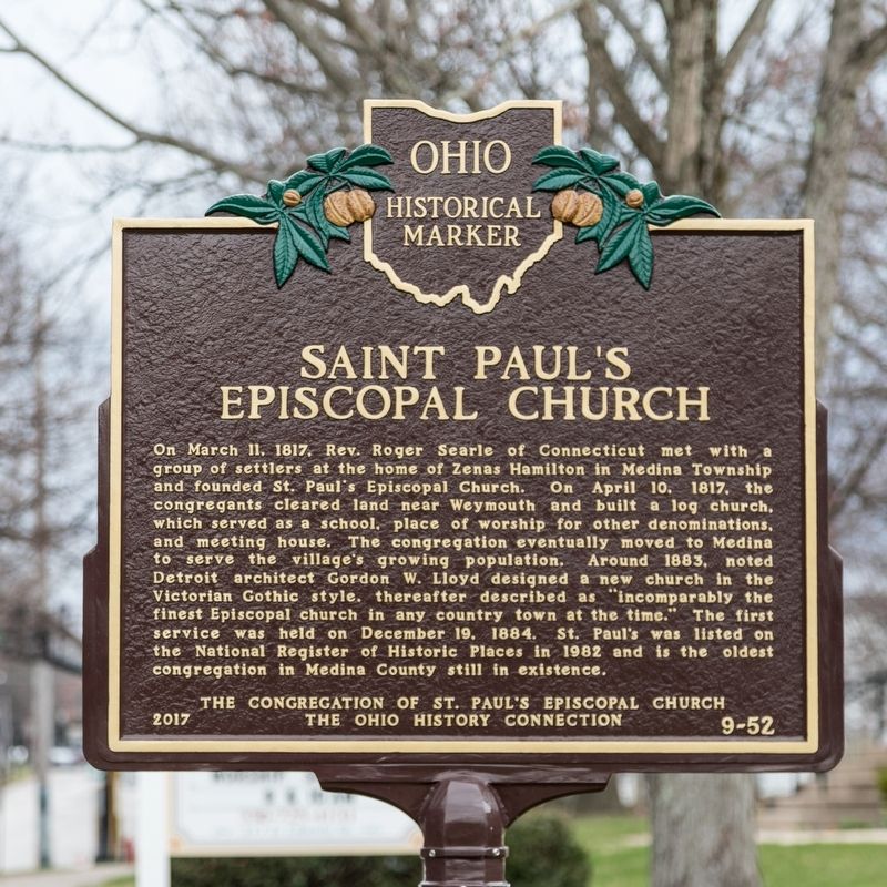
Photographed by J. J. Prats, April 7, 2019
1. Saint Paul’s Episcopal Church Marker
Erected 2017 by the congregation of St. Paul’s Episcopal Church and The Ohio History Connection. (Marker Number 9-52.)
Topics and series. This historical marker is listed in these topic lists: Architecture • Religion & Religious Structures. In addition, it is included
this page online
Location. 41° 8.355′ N, 81° 51.591′ W. Marker is in Medina, Ohio, in Medina County. It is on East Liberty Street (Ohio Route 3) east of South Jefferson Street, on the left when traveling east. Touch for map. Marker is at or near this postal address: 317 E Liberty St, Medina OH 44256, United States of America. Touch for directions.

Regionally, this marker is in Greater Cleveland and in the Western Reserve. It is also in the American Midwest and in the Corn Belt. Globally, it is in North America, the Western Hemisphere, the Western World, and the Anglosphere. Historically, it finds itself in what was once the Haudenosaunee (Iroquois) Confederacy, the territory of the Mississippian Culture, and the Northwest Territory.
Other nearby markers. At least 8 other markers are within walking distance of this marker: First Congregational Church of Medina (about 700 feet away, measured in a direct line); Medina County Courthouse (about 700 feet away); The Court House (about 700 feet away); Medina County Veterans Memorial
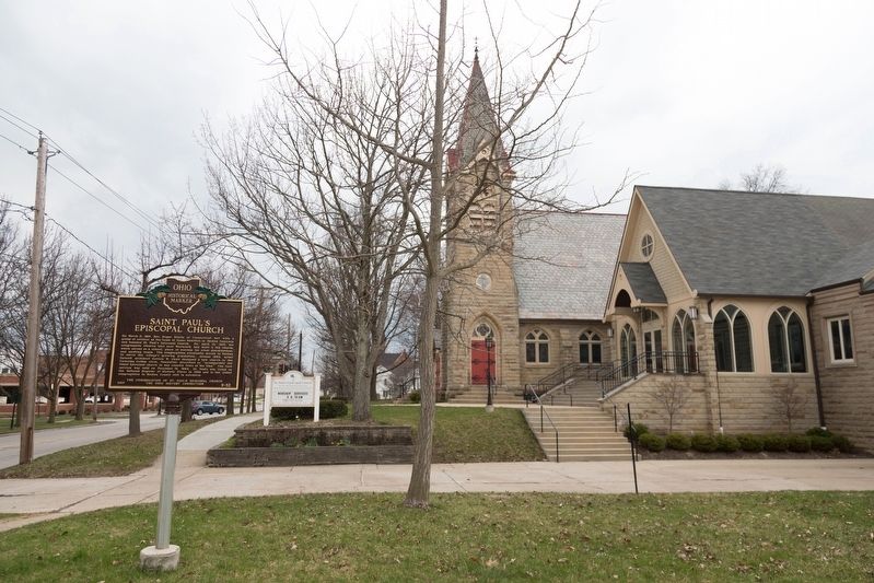
Photographed by J. J. Prats, April 7, 2019
2. Saint Paul’s Episcopal Church and Marker

Photographed by J. J. Prats, April 7, 2019
3. Saint Paul’s Episcopal Church, Medina Ohio
Credits. This page was last revised on June 3, 2019. It was originally submitted on June 3, 2019, by J. J. Prats of Powell, Ohio. This page has been viewed 419 times since then and 29 times this year. Photos: 1, 2, 3. submitted on June 3, 2019, by J. J. Prats of Powell, Ohio.
