Near Clinton in Laurens County, South Carolina — The American South (South Atlantic)
Summer Camp
Erected by South Carolina State Park Service.
Topics. This historical marker is listed in these topic lists: Notable Places • Science & Medicine • War, US Revolutionary.
Location. 34° 35.581′ N, 81° 51.179′ W. Marker is near Clinton, South Carolina, in Laurens County. Marker is on Musgrove Mill Road (State Park Road), half a mile north of State Highway 56, on the right when traveling north. Marker is in Musgrove Mill State Historic Site, south of the Enoree River. Touch for map. Marker is in this post office area: Clinton SC 29325, United States of America. Touch for directions.
Other nearby markers. At least 10 other markers are within walking distance of this marker. No Rest for the Weary (here, next to this marker); Musgrove Mill State Historic Site (within shouting distance of this marker); Where There's a Mill… (about 300 feet away, measured in a direct line); "Patriot in Petticoats" (about 600 feet away); Battle of Musgrove Mill (approx. 0.2 miles away); Ford Country (approx. 0.2 miles away); Into the Backcountry (approx. 0.3 miles away); Americans in British Uniform (approx. 0.3 miles away); A Band of Brothers (approx. 0.3 miles away); True to Their King (approx. 0.4 miles away). Touch for a list and map of all markers in Clinton.
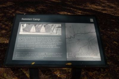
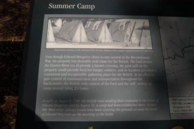
More about this marker. The illustration in the upper left of the marker shows tents set up for camp. The illustration is provided for the marker courtesy of the National Park Service, Harpers Ferry Center Commissioned Art Collection. Text the bottom left of the marker references the illustration with the following remark: "As early as August 8, 1780, the British were sending their wounded to the home of Edward Musgrove, and by August 10, a camp had been established there. Scenes like these tents (above) would have been covering the grounds around the home of Edward Musgrove on the morning of the battle."
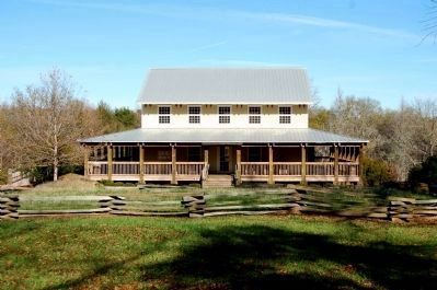
Also see . . . Musgrove's Mill Historic Battle Site. The battle of Musgrove’s Mill, fought on August 18, 1780, was an early American victory in the South during the Revolution. (Submitted on November 22, 2008, by Brian Scott of Anderson, South Carolina.)

Photographed By Michael Sean Nix, November 7, 2008
3. Summer Camp Marker
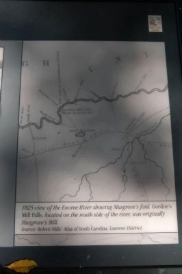
Close up of map on marker. The caption reads:
1825 view of the Enoree River showing Musgrove’s ford. Gordon’s Mill Falls, located on the south side of the river, was originally Musgrove’s Mill.
Source: Robert Mills’ Atlas of South Carolina, Laurens District.
1825 view of the Enoree River showing Musgrove’s ford. Gordon’s Mill Falls, located on the south side of the river, was originally Musgrove’s Mill.
Source: Robert Mills’ Atlas of South Carolina, Laurens District.
Credits. This page was last revised on September 18, 2020. It was originally submitted on November 11, 2008, by Michael Sean Nix of Spartanburg, South Carolina. This page has been viewed 994 times since then and 14 times this year. Photos: 1, 2, 3. submitted on November 7, 2008, by Michael Sean Nix of Spartanburg, South Carolina. 4. submitted on November 22, 2008, by Brian Scott of Anderson, South Carolina. • Kevin W. was the editor who published this page.


