East Carrollton in New Orleans in Orleans Parish, Louisiana — The American South (West South Central)
Town of Carrollton
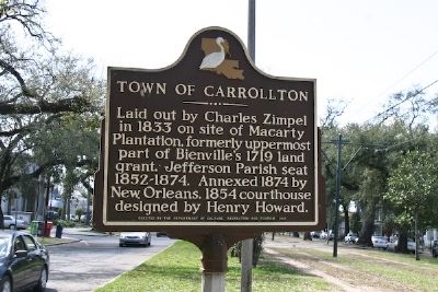
Photographed by R. E. Smith, March 2, 2008
1. Town of Carrollton Marker
Erected 1981 by Department of Culture, Recreation and Tourism.
Topics. This historical marker is listed in these topic lists: Notable Places • Settlements & Settlers. A significant historical year for this entry is 1833.
Location. 29° 56.651′ N, 90° 7.975′ W. Marker is in New Orleans, Louisiana, in Orleans Parish. It is in East Carrollton. It is on South Carrollton Avenue 0 miles west of Maple Blvd., in the median. Touch for map. Marker is in this post office area: New Orleans LA 70118, United States of America. Touch for directions.

Regionally, this marker is in one of the River Parishes. It is also in the American South, specifically in the Deep South, on the Gulf Coast, and in the Great River Road Region. Globally, it is in North America, a Gulf of Mexico state, the Western Hemisphere, the Western World, and the Anglosphere. Historically, it finds itself in what was once
this page online
Other nearby markers. At least 8 other markers are within walking distance of this marker: The St. Charles Line (about 400 feet away, measured in a direct line); 7927 St. Charles Avenue (about 700 feet away); Mater Dolorosa Church (approx. 0.3 miles away); Carrollton No. 1 (approx. 0.7 miles away); H. Sophie Newcomb Memorial College (approx. 0.7 miles away); Newcomb Pottery Garden (approx. ¾ mile away); Carrollton No. 2 (approx. 0.8 miles away); Tulane University (approx. 0.9 miles away). Touch for a list and map of all markers in New Orleans.
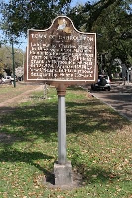
Photographed by R. E. Smith, March 2, 2008
2. Town of Carrollton Marker
Credits. This page was last revised on February 12, 2023. It was originally submitted on November 11, 2008, by R. E. Smith of Nashville, Tennessee. This page has been viewed 1,504 times since then and 22 times this year. Photos: 1, 2. submitted on November 11, 2008, by R. E. Smith of Nashville, Tennessee. • Bill Pfingsten was the editor who published this page.
