Tehachapi in Kern County, California — The American West (Pacific Coastal)
What a Shock! The 1952 Earthquake
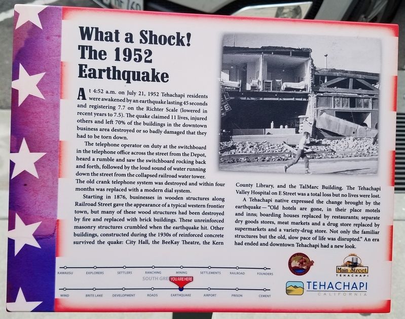
The telephone operator on duty at the switchboard in the telephone office across the street from the Depot, heard a rumble and saw the switchboard rocking back and forth, followed by the loud sound of water running down the street from the collapsed railroad water tower.
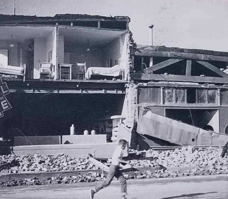
Starting in 1876, business in wooden structures along Railroad Street gave the appearance of a typical western frontier town, but many of these wood structures had been destroyed by fire and replaced with brick buildings. These unreinforced masonry structures crumbled when the earthquake hit. Other buildings, constructed during the 1930s of reinforced concrete survived the quake: City Hall, the BeeKay Theatre, the Kern County Library, and the TalMarc Buidling. The Tehachapi Valley Hospital on E Street was a total loss but no lives were lost.
A Tehachapi native expressed the change brought by the earthquake – “Old hotels are gone, in their place motels and inns; boarding houses replaced by restaurants; separate dry goods stores, meat markets and a drug store replaced by supermarkets and a variety-drug store replaced by supermarkets and a variety-drug store. Not only the familiar structures but the old, slow pace of life was disrupted.” An era had ended and downtown Tehachapi had a new look.
Erected by Main Street Tehachapi, Tehachapi Heritage League and The City of Tehachapi.
Topics. This historical marker is listed in these topic lists: Disasters • Settlements & Settlers. A significant historical date for this entry is July 21, 1952.
Location. 35° 7.848′ N, 118° 26.861′ W. Marker is in Tehachapi, California, in Kern County. Marker is on Green Street, on the right when traveling north. Touch for map. Marker is at or near this postal address: 200 S Green St, Tehachapi CA 93561, United States of America. Touch for directions.
Other nearby markers. At least 8 other markers are within walking distance of this marker. Hitching Post Theatre (a few steps from this marker); Mining, Gold, Salt and Limestone (within shouting distance of this marker); People of the Mountains (within shouting distance of this marker); Tehachapi Airport and Gliderport (within shouting distance of this marker); Monolith (within shouting distance of this marker); Early Settlements in The Tehachapi Area (within shouting distance of this marker); Ranching, Farming and Orchards (within shouting distance of this marker); First Roads and Highway 58 (within shouting distance of this marker). Touch for a list and map of all markers in Tehachapi.
Credits. This page was last revised on September 19, 2023. It was originally submitted on June 8, 2019, by Denise Boose of Tehachapi, California. This page has been viewed 335 times since then and 44 times this year. Photos: 1, 2, 3, 4. submitted on June 8, 2019, by Denise Boose of Tehachapi, California. 5. submitted on September 10, 2023, by Denise Boose of Tehachapi, California. • Andrew Ruppenstein was the editor who published this page.


