Marinette in Marinette County, Wisconsin — The American Midwest (Great Lakes)
Milwaukee Road Depot
Marinette, Wisconsin
Photographed by Joel Seewald, June 8, 2019
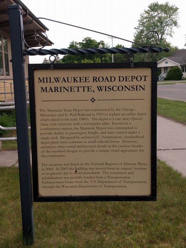
1. Milwaukee Road Depot Marker
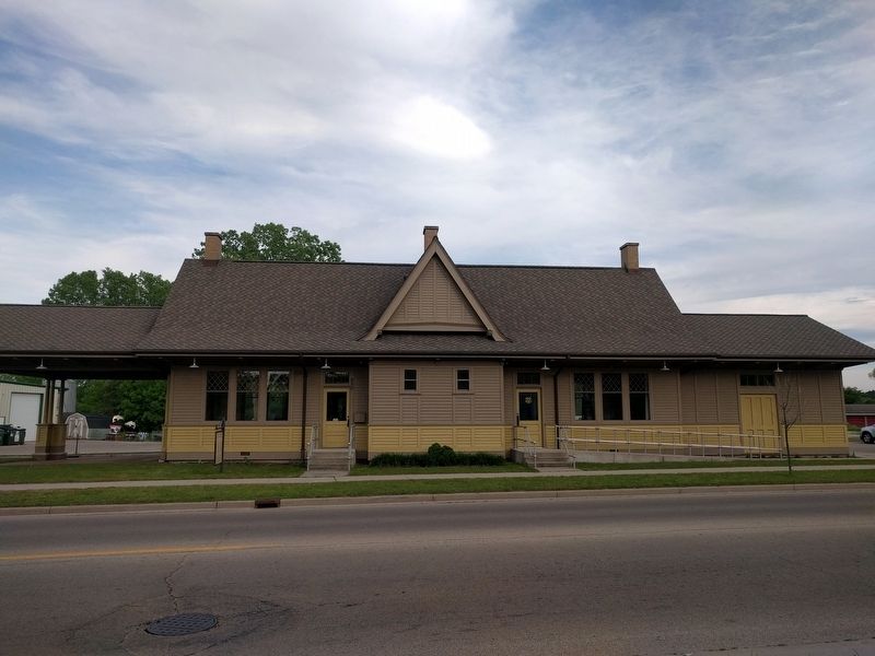
The Marinette Train Depot was constructed by the Chicago Milwaukee and St. Paul Railroad in 1903 to replace an earlier depot which dated to the 1880's. The depot is a one story Queen Anne style structure with a rectangular plan. Known as a combination station, the Marinette Depot was constructed to provide shelter to passengers, freight, and train control under a single roof. Designed by architect J.U. Nettenstrom, standardized depot plans were common in small railroad towns. However, architects often varied architectural details to the exterior facades of the standard designs to provide a unique visual appearance for the community.
The structure was listed on the National Register of Historic Places in 2004. In 2003 the building was moved from its original location to its present site to avoid demolition. The restoration and rehabilitation was partially funded from a Transportation Enhancement Grant from the U.S. Department of Transportation, through the Wisconsin Department of Transportation.
Topics and series. This historical marker is listed in these topic lists: Architecture • Railroads & Streetcars.
this page online
Location. 45° 5.882′ N, 87° 38.293′ W. Marker is in Marinette, Wisconsin, in Marinette County. It is at the intersection of Hattie Street and State Street, on the left when traveling south on Hattie Street. Touch for map. Marker is at or near this postal address: 650 Hattie Street, Marinette WI 54143, United States of America. Touch for directions.

Regionally, this marker is in Northern Wisconsin. It is also in the American Midwest and in the Corn Belt. Globally, it is in North America, in the Great North Woods, on the Great Lakes, in the Western Hemisphere, in the Western World, and in the Anglosphere. Historically, it finds itself in what was once the territory of the Mississippian Culture and also the Northwest Territory.
Other nearby markers. At least 8 other markers are within 2 miles of this marker, measured as the crow flies: Isaac Stephenson (approx. 0.4 miles away); John Hubley (approx. 0.4 miles away); Queen Marinette (approx. half a mile away); Evancheck Cabin (approx.
Photographed by Joel Seewald, June 8, 2019
2. Milwaukee Road Depot and Marker
Marker is in front of the left-most window.
Also see . . . Milwaukee Road Depot (Marinette, Wisconsin). Wikipedia article (Submitted on June 14, 2019, by Joel Seewald of Madison Heights, Michigan.)
Credits. This page was last revised on June 27, 2019. It was originally submitted on June 14, 2019, by Joel Seewald of Madison Heights, Michigan. This page has been viewed 792 times since then and 51 times this year. Photos: 1, 2. submitted on June 14, 2019, by Joel Seewald of Madison Heights, Michigan.
