
Stonycreek Township near Indian Lake in Somerset County, Pennsylvania — The American Northeast (Mid-Atlantic)
Flight 93 National Memorial
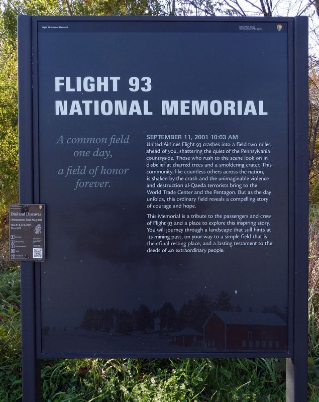
A common field one day, a field of honor forever.
Photographed by Allen C. Browne, October 15, 2016
1. Flight 93 National Memorial Marker
September 11, 2001 10:03 AM
United Airlines Flight 93 crashes into a field two miles ahead of you, shattering the quiet of the Pennsylvania countryside. Those who rush to the scene look on in disbelief at charred trees and a smoldering crater. This community, like countless others across the nation, is shaken by the crash and the unimaginable violence and destruction al-Qaeda terrorists bring to the World Trade Center and the Pentagon. But as the day unfolds, this ordinary field reveals a compelling story of courage and hope.
This Memorial is a tribute to the passengers and crew of Flight 93 and a place to explore this inspiring story. You will journey through a landscape that still hints at its mining past, on your way to a simple field that is their final resting place, and a lasting testament to the deeds of 40 extraordinary people.
Topics. This memorial is listed in these topic lists: 9/11 Attacks • Air & Space. A significant historical date for this entry is September 11, 2001.
Location. 40° 4.757′ N, 78° 53.23′ W. Memorial is near Indian Lake, Pennsylvania, in Somerset County. It is in Stonycreek Township. It is on Approach
this page online

Regionally, this memorial is in Pennsylvania’s Laurel Highlands. It is also in the American Northeast, in the Mid-Atlantic, in Appalachia, and specifically in Northern Appalachia. Globally, it is in North America, the Western Hemisphere, the Western World, and the Anglosphere. Historically, it finds itself in what was once the Haudenosaunee (Iroquois) Confederacy and also one of the original Thirteen Colonies.
Other nearby markers. At least 8 other markers are within walking distance of this marker: Tower of Voices (about 700 feet away, measured in a direct line); Gold Star Memorial (approx. 0.4 miles away); Field of Heroes Flag Display (approx. 0.4 miles away); SSgt Brian Hause (approx. 0.4 miles away); PFC Nils George Thompson (approx. 0.4 miles away); Patriot Park Memorial (approx. 0.4 miles away); Operation Inherent Resolve Continues (approx. 0.4 miles away); Global War on Terrorism (approx. 0.4 miles away).

Photographed by Allen C. Browne, October 15, 2016
2. Dial and Discover
Orientation Tour Stop 102
Dial 814-619-2065
Press 102
Dial 814-619-2065
Press 102
Photographed by Allen C. Browne, October 15, 2016
3. Flight 93 National Memorial
Credits. This page was last revised on February 7, 2023. It was originally submitted on December 19, 2016, by Allen C. Browne of Silver Spring, Maryland. This page has been viewed 847 times since then and 36 times this year. Last updated on June 17, 2019, by Patricia G Leibfreid of Bedford, Pennsylvania. Photos: 1, 2, 3. submitted on December 19, 2016, by Allen C. Browne of Silver Spring, Maryland. • Syd Whittle was the editor who published this page.
