
Incorporation
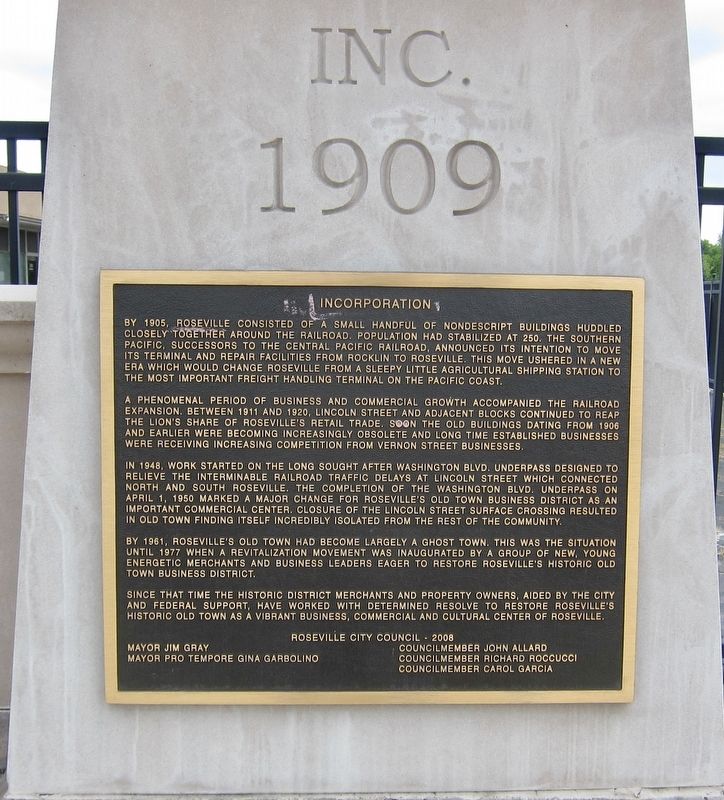
A phenomenal period of business and commercial growth accompanied the railroad expansion. Between 1911 and 1920, Lincoln Street and adjacent blocks continued to reap the lion's share of Roseville's retail trade. Soon the old buildings dating from 1906 and earlier were becoming increasingly obsolete and long time established businesses were receiving increasing competition from Vernon Street businesses.
In 1948, work started on the long sought after Washington Blvd. underpass designed to relieve the interminable railroad traffic delays at Lincoln Street which connected north and south Roseville. The completion of the Washington
this page online
By 1961, Roseville's Old Town had become largely a ghost town. This was the situation until 1977 when a revitalization movement was inaugurated by a group of new, young energetic merchants and business leaders eager to restore Roseville's historic Old Town business district.
Since that time the Historic District merchants and property owners, aided by the city and federal support, have worked with Determined Resolve To Restore Roseville's Historic Old Town as a vibrant business, commercial and cultural center of Roseville.
Roseville City Council 2008
Mayor Jim Gray
Councilmember John Allard
Councilmember Richard Roccucci
Councilmember Carol Garcia
Mayor Pro Tempore Gina Garbolino
Topics. This historical marker is listed in these topic lists: Industry & Commerce • Railroads & Streetcars. A significant historical date for this entry is April 1, 1950.
Location. 38° 45.107′ N,

Regionally, this marker is in California’s Sacramento Metro, in the Sierra Nevada, and in the Lake Tahoe Basin. It is also in the American Mountain West. Globally, it is in North America, on the Ring of Fire, in the Pacific Rim, in the Western Hemisphere, in the Western World, and in the Anglosphere. Historically, it finds itself in what was once New Spain and also Mexico’s Alta California.
Other nearby markers. At least 8 other markers are within walking distance of this marker: Roseville The Beginning (here, next to this marker); Roseville's First Hospital (about 300 feet away, measured in a direct line); The Roseville Methodist Church (about 400 feet away); Onyx Club (about 400 feet away); Chicago West Building (about 400 feet away); Roseville (about 400 feet away); Roseville Tribune and Register Building (about 400 feet away); The Owl Club Building (about 400 feet away). Touch for a list and map of all markers in Roseville.
Credits. This page was last revised on June 18, 2019. It was originally submitted on June 18, 2019, by Andrew Ruppenstein of Lamorinda, California. This page has been viewed 333 times since then and 23 times this year. Photos: 1, 2. submitted on June 18, 2019, by Andrew Ruppenstein of Lamorinda, California.
