Lower East Side in Manhattan in New York County, New York — The American Northeast (Mid-Atlantic)
Henry Street Settlement
Landmarks of New York
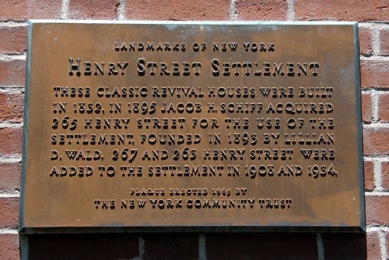
Photographed by Larry Gertner, July 4, 2017
1. Henry Street Settlement Marker
Plaque erected 1965 by The New York Community Trust
Erected 1965 by The New York Community Trust.
Topics. This historical marker is listed in these topic lists: Architecture • Charity & Public Work. A significant historical year for this entry is 1832.
Location. 40° 42.838′ N, 73° 59.071′ W. Marker is in Manhattan, New York, in New York County. It is in the Lower East Side. It is on Henry Street near Samuel Dickstein Plaza, on the left when traveling east. Touch for map. Marker is at or near this postal address: 265 Henry Street, New York NY 10002, United States of America. Touch for directions.

Regionally, this marker is in New York City. It is also in the American Northeast, in the Mid-Atlantic, and on the Eastern Seaboard. Globally, it is in the North Atlantic Region, North America, the Western Hemisphere, the Western World, and the Anglosphere. Historically, it
this page online
Other nearby markers. At least 8 other markers are within walking distance of this marker: Lillian Wald House (a few steps from this marker); St. Augustine’s Chapel (about 400 feet away, measured in a direct line); Henry Street Settlement and Neighborhood Playhouse (about 500 feet away); Luther Gulick Playground (approx. 0.2 miles away); “Togo” (approx. ¼ mile away); Williamsburg Bridge, New York (approx. ¼ mile away); Lower East Side War Memorial (approx. 0.3 miles away); East River Park (approx. 0.3 miles away). Touch for a list and map of all markers in Manhattan.
Regarding Henry Street Settlement. Settlement houses were first established to bring health care, and eventually education and the arts, to the immigrant poor.
The buildings are listed in the "AIA (American Institute of Architects) Guide to New York City, Fifth Edition".
Also see . . .
1. Henry Street Settlement. Wikipedia entry (Submitted on June 19, 2019, by Larry Gertner of New York, New York.)
2. The Henry Street Settlement House -- No. 265 Henry Street.
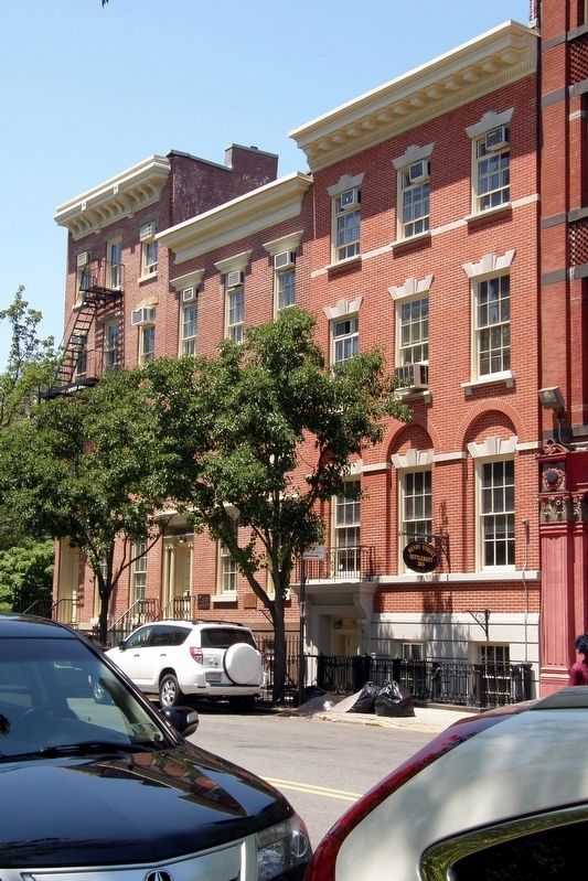
Photographed by Larry Gertner, July 4, 2017
2. Henry Street Settlement buildings
The marker is visible on 265, the center building.
3. Lillian Wald. Wikipedia biography. (Submitted on April 10, 2020, by Larry Gertner of New York, New York.)
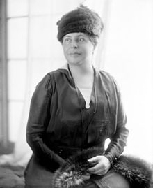
via Wikipedia
3. Lillian Wald (1867-1940)
Credits. This page was last revised on January 31, 2023. It was originally submitted on June 19, 2019, by Larry Gertner of New York, New York. This page has been viewed 352 times since then and 34 times this year. Photos: 1, 2, 3. submitted on June 19, 2019, by Larry Gertner of New York, New York. • Bill Pfingsten was the editor who published this page.
