Ansonborough in Charleston in Charleston County, South Carolina — The American South (South Atlantic)
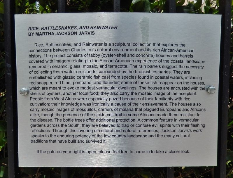
Rice, Rattlesnakes, and Rainwater
By Martha Jackson Jarvis
Photographed by Cosmos Mariner, May 2, 2019
1. Rice, Rattlesnakes, and Rainwater Marker
this page online
If the gate on your right is open, please feel free to come in to take a closer look.
Topics. This historical marker is listed in these topic lists: African Americans • Agriculture • Arts, Letters, Music.
Location. 32° 47.129′ N, 79° 55.957′ W. Marker is in Charleston, South Carolina, in Charleston County. It is in Ansonborough. It is on George Street west of George Burges Lane, on the right when traveling west. Marker is mounted at eye-level on the wrought-iron fence in front of the Middleton-Pinckney House. The gardens and subject sculpture are located behind the marker, within the
Photographed by Cosmos Mariner, May 2, 2019
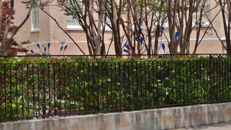
2. The Marion and Wayland Capo, Jr. Garden
(marker is mounted on fence • just right of image)
(marker is mounted on fence • just right of image)
"Bottle" trees visible in garden (behind the fence).

Regionally, this marker is in Historic Charleston and in the Lowcountry. It is also in the American South, specifically in the Deep South, and on the Eastern Seaboard. Globally, it is in the North Atlantic Region, North America, the Western Hemisphere, the Western World, and the Anglosphere. Historically, it finds itself in what was once the territory of the Mississippian Culture, one of the original Thirteen Colonies, one of the Confederate States of America, and the Antebellum South.
Other nearby markers. At least 8 other markers are within walking distance of this marker: 14 George Street (a few steps from this marker); The Noyer-Wildhagen House (within shouting distance of this marker); Federal Emergency Administration of Public Works Project SC 1233 F (about 300 feet away, measured in a direct line); Washington Light Infantry (about 300 feet away); St. Stephen's Episcopal Church (about
Photographed by Cosmos Mariner, May 2, 2019
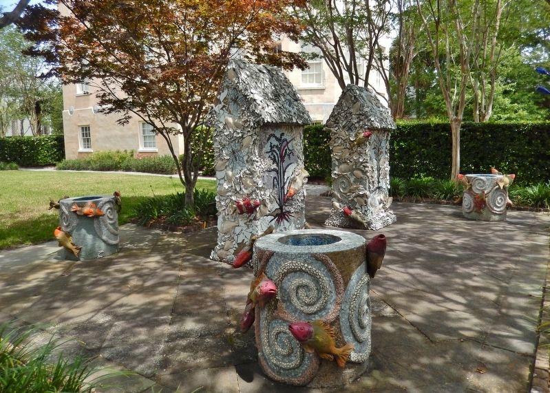
3. Rice, Rattlesnakes, and Rainwater Sculpture collection
Also see . . .
1. Slavery on South Carolina Rice Plantations. Rice was not native to the Americas. Nor were the techniques used to grow rice. Both the knowledge and the seed were introduced to the New World by explorers and African slaves that were brought here. As rice grew more profitable the towns of Charleston and Georgetown in South Carolina grew into wealthy ports that imported slaves from West Africa and exported rice to European countries that paid a premium for the “Carolina Gold.” These ports were entrances for the West Africans coming into the colonies and slave trading firms flourished in these towns. (Submitted on June 20, 2019, by Cosmos Mariner of Cape Canaveral, Florida.)
2. Human/Nature: Art and Landscape in Charleston and the Low Country. Martha Jackson-Jarvis’ “Rice, Rattlesnakes, and Rainwater” incorporates African symbols and four
Photographed by Cosmos Mariner, May 2, 2019
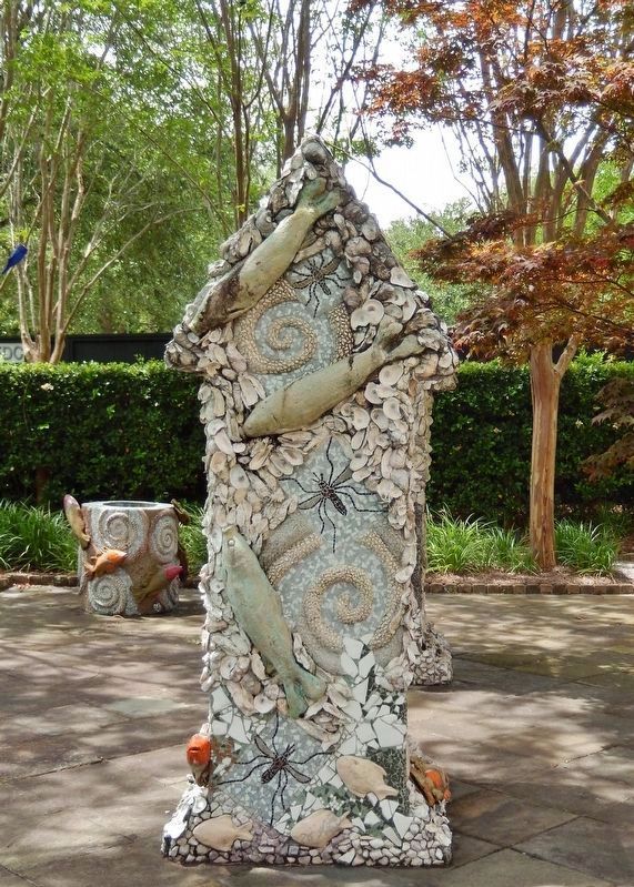
4. Rice, Rattlesnakes, and Rainwater Sculpture
(symbolic vernacular house & mosquitos)
(symbolic vernacular house & mosquitos)
Photographed by Cosmos Mariner, May 2, 2019
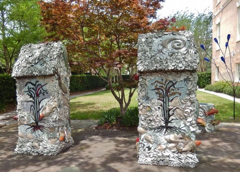
5. Rice, Rattlesnakes, and Rainwater Sculpture
(symbolic vernacular houses with rice plants)
(symbolic vernacular houses with rice plants)
Photographed by Cosmos Mariner, May 2, 2019
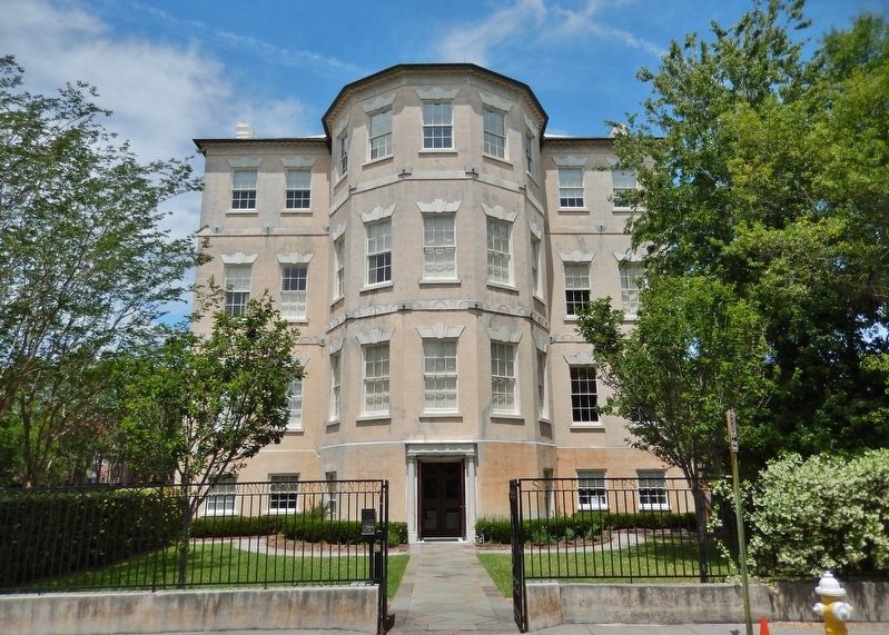
6. Middleton-Pinckney House
(enter here then turn left to access garden & sculpture)
(enter here then turn left to access garden & sculpture)
Credits. This page was last revised on February 16, 2023. It was originally submitted on June 19, 2019, by Cosmos Mariner of Cape Canaveral, Florida. This page has been viewed 571 times since then and 31 times this year. Photos: 1, 2, 3, 4, 5, 6. submitted on June 20, 2019, by Cosmos Mariner of Cape Canaveral, Florida.
