Alte Synagoge / Former Synagogue
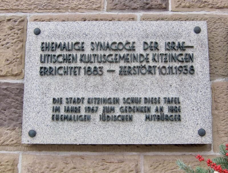
Errichtet 1883 - Zerstört 10.11.1938
Die Stadt Kitzingen schuf dies Tafel im Jahre 1967 um Gedenken an ihre ehemaligen Jüdischen Mitbürger
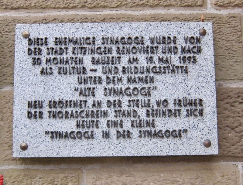
Diese ehemalige Synagoge wurde von der Stadt Kitzingen renoviert und nach 30 Monaten Bauzeit am 19 mai 1993 als Kultur und Bildungsstätte unter dem Namen "Alte Synagoge" neu eröffenet. An der Stelle, wo früher der Thoraschrein stand, befindet sich heute eine kleine "Synagoge in der Synagoge"
(English translation:)
Former synagogue of the Jewish community of Kitzingen
This former synagogue was renovated by the City of Kitzingen, and after 30 months of construction was re-opened on May 19, 1993 under the name "The Old Synagogue" as a cultural and educational center. At the spot where the former Torah ark was located there is now a small "Synagogue within the Synagogue".
Constructed 1883 - Destroyed November 10, 1938
The City of Kitzingen placed this plaque in 1967 to commemorate its former Jewish citizens.
Topics and series. This historical marker is
Location. 49° 44.205′ N, 10° 9.877′ E. Marker is in Kitzingen, Bayern (Bavaria). Marker is at the intersection of Landwehrstrasse and Kapuzinerstrasse, on the right when traveling north on Landwehrstrasse. Touch for map. Marker is in this post office area: Kitzingen BY 97318, Germany. Touch for directions.
Other nearby markers. At least 8 other markers are within 8 kilometers of this marker, measured as the crow flies. Home of Friedrich von Deuster (approx. 0.3 kilometers away); The Bombing of Kitzingen (approx. 0.3 kilometers away); Die "Kitzinger Elle" / The "Kitzingen Foot" (approx. 0.3 kilometers away); Evang.-luth. Stadtkirche / Protestant Lutheran City Church (approx. 0.4 kilometers away); Mainstockheim Synagogue (approx. 4.4 kilometers away); The Bacchus Inn (approx. 7.2 kilometers away); Dettelbach Synagogue (approx. 7.2 kilometers away); Dettelbach City Hall (approx. 7.3 kilometers away). Touch for a list and map of all markers in Kitzingen.
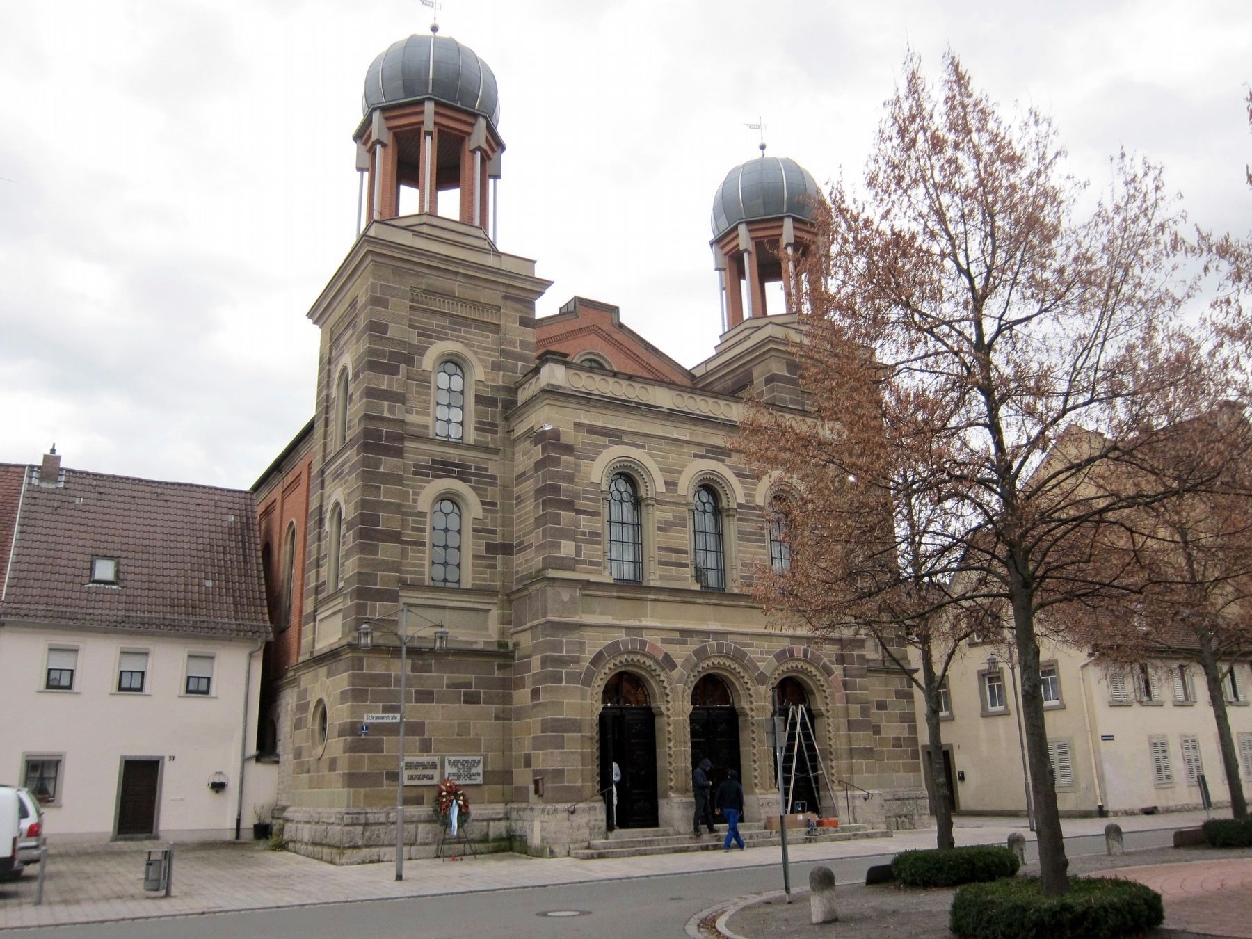
Regarding Alte Synagoge / Former Synagogue. With regard to the destruction of the synagogue, the marker is silent on the matter, except for the actual date - November 10, 1938. That date is known as Kristallnacht, commonly known in English as the "Night of Broken Glass". On November 9-11, a pogrom against the Jews was carried out all over Germany, with more than 250 synagogues destroyed and 30,000 Jews arrested. On that night, the interior of the Kitingen synagogue was destroyed by arson, although the exterior survived because of its stone construction.
Also see . . .
1. Kitzingen (Kreisstadt) Jüdische Geschichte / Synagoge (Alemannia Judaica, in German). (Submitted on June 24, 2019.)
2. History of the Kitzingen Synagogue (synagoge-kitzingen.de, in German). (Submitted on June 24, 2019.)
Credits. This page was last revised on January 28, 2022. It was originally submitted on June 24, 2019, by Andrew Ruppenstein of Lamorinda, California. This page has been viewed 290 times since then and 38 times this year. Photos: 1, 2, 3. submitted on June 24, 2019, by Andrew Ruppenstein of Lamorinda, California.


