Near Derry in Westmoreland County, Pennsylvania — The American Northeast (Mid-Atlantic)
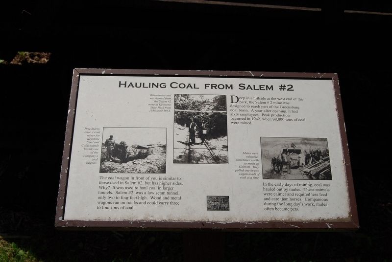
Hauling Coal From Salem #2
In the early days of mining, coal was hauled out by mules. These animals were calmer and required less feed and care than horses. Companions during the long day's work, mules often became pets.
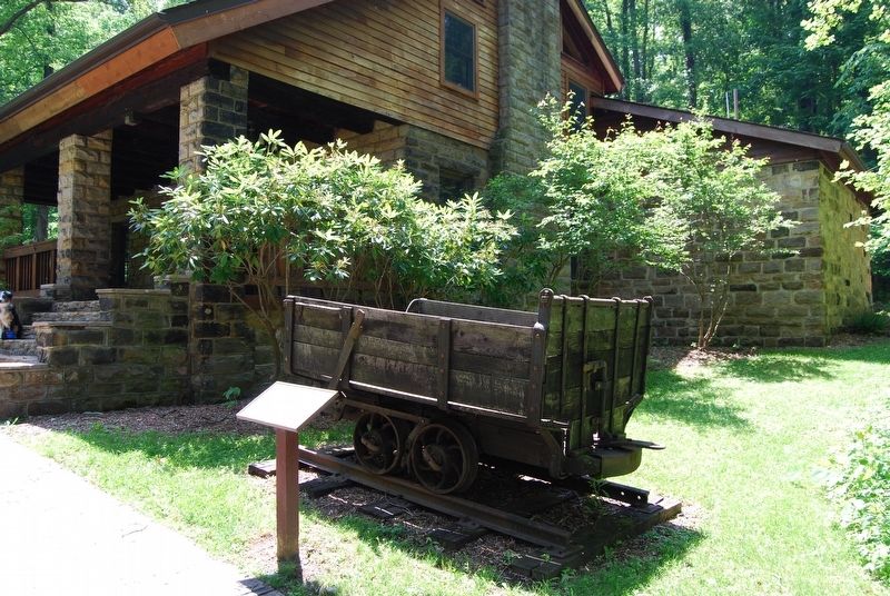
The coal wagon in front of you is similar to those used in Salem #2, but has higher sides. Why? It was used to haul coal in larger tunnels. Salem #2 was a low seam tunnel, only two to four feet high. Wood and metal wagons ran on tracks and could carry three to four tons of coal.
Topics. This historical marker is listed in this topic list: Natural Resources. A significant historical year for this entry is 1942.
Location. 40° 22.335′ N, 79° 23.157′ W. Marker is near Derry, Pennsylvania, in Westmoreland County. Marker can be reached from Stone Lodge Road, 0.6 miles east of Slag Road. Marker is located at visitors center in Keystone State Park. Touch for map. Marker is in this post office area: Derry PA 15627, United States of America. Touch for directions.
Other nearby markers. At least 8 other markers are within 4 miles of this marker, measured as the crow flies. Chalmers "Slick" Goodlin (approx. 2.6 miles away); Thomas F. Gallagher (approx. 2.8 miles away); Fort Barr (approx. 3.2 miles away); Latrobe Presbyterian Church (approx. 3.7 miles away); Veterans Memorial (approx. 3.7 miles away); a different marker also named Veterans Memorial (approx. 3.7 miles away); Second Ward School and Bell (approx. 3.8 miles away); Dainty Pastry Shoppe (approx. 3.8 miles away).
Also see . . . Keystone State Park. (Submitted on June 24, 2019, by Mike Wintermantel of Pittsburgh, Pennsylvania.)
Credits. This page was last revised on June 24, 2019. It was originally submitted on June 24, 2019, by Mike Wintermantel of Pittsburgh, Pennsylvania. This page has been viewed 312 times since then and 26 times this year. Photos: 1, 2. submitted on June 24, 2019, by Mike Wintermantel of Pittsburgh, Pennsylvania.

