Florence in Boone County, Kentucky — The American South (East South Central)
Hopeful Lutheran Church
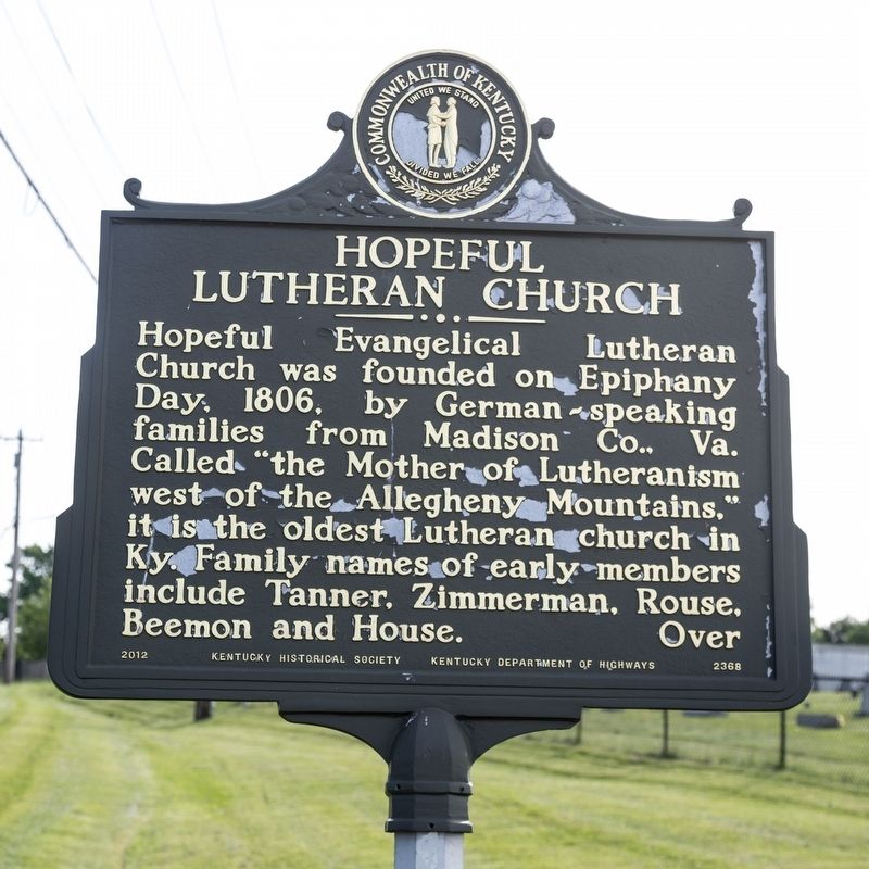
Hopeful Evangelical Lutheran Church was founded on Epiphany Day. 1806. by German-speaking families from Madison County, Virginia. Called “the Mother of Lutheranism west of the Allegheny Mountains,” it is the oldest Lutheran church in Kentucky. Family names of early members include Tanner. Zimmerman, Rouse, Beemon and House.
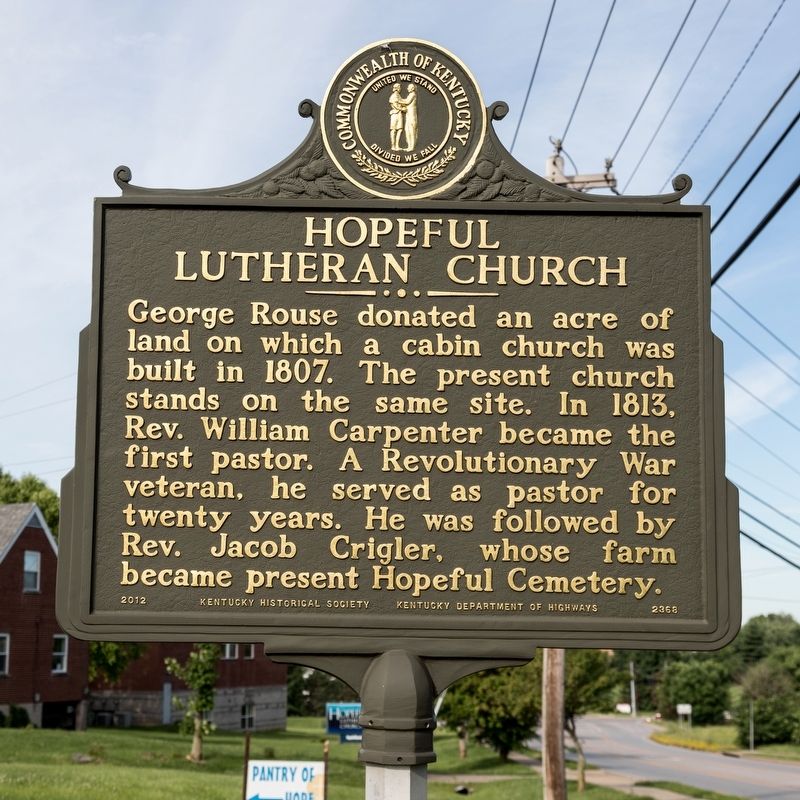
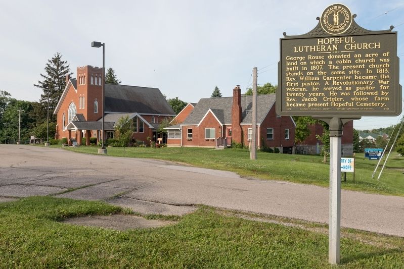
George Rouse donated an acre of land on which a cabin church was built in 1807. The present church stands on the same site. In 1813, Rev. William Carpenter became the first pastor. A Revolutionary War veteran, he served as pastor for twenty years. He was followed by Rev. Jacob Crigler, whose farm became present Hopeful Cemetery.
Erected 2012 by Kentucky Historical Society and Kentucky Department of Highways. (Marker Number 2368.)
Topics and series. This historical marker is listed in these topic lists: Churches & Religion • Settlements & Settlers. In addition, it is included in the Kentucky Historical Society series list. A significant historical year for this entry is 1806.
Location. 39° 0.02′ N, 84° 39.525′ W. Marker is in Florence, Kentucky, in Boone County. Marker is on Hopeful Church Road (Kentucky Route 842) east of Clayton Road, on the right when traveling east. Touch for map . Marker is at or near this postal address: 6430 Hopeful Church Rd, Florence KY 41042, United States of America. Touch for directions.
Other nearby markers. At least 8 other markers are within 4 miles of this marker, measured as the crow flies. Clinton Blankenbeker House (approx. 1˝ miles away); First Baptist African American Church, Florence (approx. 1.6 miles away); Skirmish at Florence (approx. 1.7 miles away); Dr. Gladys Rouse House (approx. 1.9 miles away); John Uri Lloyd (1849-1936) / Stringtown on the Pike (approx. 2 miles away); Mary Draper Ingles (approx. 2.2 miles away); John Hunt Morgan Escape Route (approx. 2.7 miles away); Center of Population of U.S. in 1880 (approx. 3.2 miles away). Touch for a list and map of all markers in Florence.
Credits. This page was last revised on June 3, 2021. It was originally submitted on July 1, 2019, by J. J. Prats of Powell, Ohio. This page has been viewed 305 times since then and 34 times this year. Photos: 1, 2, 3. submitted on July 1, 2019, by J. J. Prats of Powell, Ohio.


