Malvern in Chester County, Pennsylvania — The American Northeast (Mid-Atlantic)
The Land on Which the Battle of Paoli was Fought
Inscription.
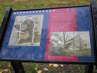
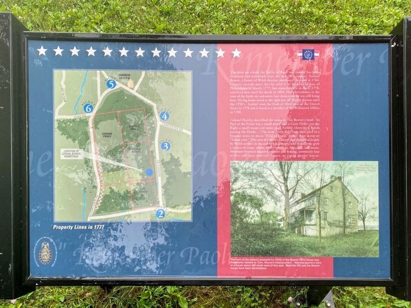
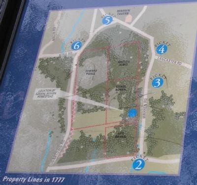
The land on which the Battle of Paoli was fought has been farmland and woodland since the mid-18th century. Ezekiel Bowen, a farmer of Welsh descent, purchased this land in 1764. County records note that he sold it to Richard Mason of Philadelphia in March, 1777, but repurchased it in April, 1778, and lived here until his death in 1804. His whereabouts at the time of the battle are unknown, but chances are he was still living here. His log home stood to the right just off Warren Avenue until the 1950’s. Ezekiel took the Oath of Allegiance to the United States in 1778 and is listed as a member of the Willistown Militia in 1780.
Colonel Hartley described the camp site on Bowen’s land: “In Part of the Front was a small wood and a Corn Field – on the Right a small wood and some open Fields – there were Roads passing the Flanks…” The term “corn field” was then used in a broader sense to mean “field of grain” rather than maize or “Indian corn.” This area of Chester County was populated largely by Welsh settlers in the early 18th century, and their farms grew a variety of crops: wheat, buckwheat, rye, oats, flax, and maize. Abundant livestock required pastures and fencing, commonly four or five-rail ‘post-and-rail’ fences, or zigzag ‘snake’ fences.
Topics. This historical marker is listed in these topic lists: Notable Places • War, US Revolutionary. A significant historical month for this entry is March 1777.
Location. 40° 1.813′ N, 75° 30.945′ W. Marker is in Malvern, Pennsylvania, in Chester County. Marker can be reached from Monument Avenue, on the left when traveling west. Marker is on the Paoli Battlefield walking trail. Touch for map. Marker is in this post office area: Malvern PA 19355, United States of America. Touch for directions.
Other nearby markers. At least 8 other markers are within walking distance of this marker. “Remember Paoli!” (within shouting distance of this marker); Camp Life (about 300 feet away, measured in a direct line); "Losing a wheel and crashing into a gap in the fence line"... (about 500 feet away); General Wayne’s Encampment (about 500 feet away); "…The most dreadful scene I have ever beheld." (about 500 feet away); Rear of the Camp (about 600 feet away); “A Dreadful scene of havock” (about 600 feet away); The Paoli Battlefield (about 700 feet away). Touch for a list and map of all markers in Malvern.
More about this marker. The bottom right of the marker contains a "turn of the century postcard (ca 1910) of the Bowen Farm house mistakenly labeled as 'Gen. Wayne's Headquarters.' Waynes quarters were in a house about 400 yards west of this spot.
Both the HQ and the Bowen house have been demolished."
The left of the marker contains a map showing the Property Lines during the time of the battle and the locations of Gen. Wayne's pickets.
Related markers. Click here for a list of markers that are related to this marker. This series of markers follow the walking trail of the Paoli Battlefield.
Also see . . .
1. Background to the Battle of Paoli. Paoli Battlefield website. (Submitted on November 16, 2008, by Bill Coughlin of Woodland Park, New Jersey.)
2. The Battle of Paoli (Massacre) September 21, 1777 at Malvern, Pennsylvania. The American Revolutionary War website. (Submitted on November 16, 2008, by Bill Coughlin of Woodland Park, New Jersey.)
3. The Battle of Paoli also known as the Paoli Massacre. A British perspective of the battle from BritishBattles.com (Submitted on November 16, 2008, by Bill Coughlin of Woodland Park, New Jersey.)
Credits. This page was last revised on May 21, 2021. It was originally submitted on November 16, 2008, by Bill Coughlin of Woodland Park, New Jersey. This page has been viewed 1,344 times since then and 17 times this year. Photos: 1. submitted on November 16, 2008, by Bill Coughlin of Woodland Park, New Jersey. 2. submitted on May 12, 2021, by Shane Oliver of Richmond, Virginia. 3, 4, 5. submitted on November 16, 2008, by Bill Coughlin of Woodland Park, New Jersey.
