Bon Weir in Newton County, Texas — The American South (West South Central)
Inman Cemetery
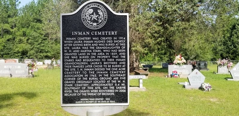
Photographed by Cajun Scrambler, July 6, 2019
1. Inman Cemetery Marker
Inman Cemetery was created in 1914 when Laura Inman Hughes died shortly after giving birth and was buried at this site. Laura was the granddaughter of W.H. and Martha Stark, who had been granted land in the area in 1859, and she was buried on property that the Starks had bequeathed to their Inman grandchildren. Laura's brothers and their families later chose to be buried at the site. T.H. Inman deeded the one acre cemetery to the Inman Cemetery Association in 1963. In the southeast corner of the burial ground are five graves originally located at the W.H. Stark Cemetery, approximately 0.4 MI. southeast of this site on the Sabine River. The graves were reinterred in 2006 because of the threat of erosion.
Erected 2005 by State of Texas. (Marker Number 15701.)
Topics. This historical marker is listed in this topic list: Cemeteries & Burial Sites.
Location. 30° 43.109′ N, 93° 37.481′ W. Marker is in Bon Weir, Texas, in Newton County. It is on County Road 4075 1.6 miles south of U.S. 190, on the right. Touch for map. Marker is in this post office area: Bon Wier TX 75928,
this page online

Regionally, this marker is in the American South, specifically in the Deep South, and in the Piney Woods. Globally, it is in North America, a Gulf of Mexico state, the Western Hemisphere, the Western World, and the Anglosphere. Historically, it finds itself in what was once New Spain, the Republic of Texas, one of the Confederate States of America, and the Antebellum South.
Other nearby markers. At least 8 other markers are within 6 miles of this marker, measured as the crow flies: Bon Wier (approx. 2 miles away); Site of the Coushatta Indian Village (approx. 5.4 miles away in Louisiana); The Atakapa-Coushatta Trace (approx. 5½ miles away in Louisiana); Sam Houston Jones (approx. 5½ miles away in Louisiana); Burk's Log Cabin (approx. 5½ miles away in Louisiana); Charles "Leather Bitches" Smith (approx. 5½ miles away in Louisiana); Leather Britches (approx. 5½ miles away in Louisiana); Ford Chapel, Cemetery, and School (approx. 5.7 miles away).
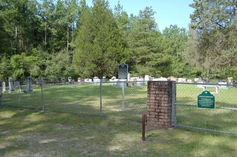
Photographed by Cajun Scrambler, July 5, 2019
2. Inman Cemetery Marker
Credits. This page was last revised on June 2, 2023. It was originally submitted on July 6, 2019, by Cajun Scrambler of Assumption, Louisiana. This page has been viewed 834 times since then and 40 times this year. Photos: 1, 2. submitted on July 6, 2019.
