Seymour in Jackson County, Indiana — The American Midwest (Great Lakes)
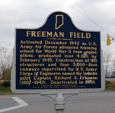
Freeman Field
Erected 1997 by Indiana Historical Bureau, City of Seymour, and Seymour Municipal Airport. (Marker Number 36.1997.2.)
Topics and series. This historical marker is listed in these topic lists: Air & Space • War, World II. In addition, it is included in the Indiana Historical Bureau Markers series list. A significant historical month for this entry is February 1945.
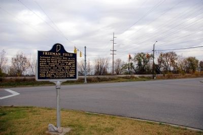
Location. 38° 57.028′ N, 85° 54.482′ W. Marker is in Seymour, Indiana, in Jackson County. Marker is at the intersection of West Tipton Street (U.S. 50) and South Airport Road, on the left when traveling east on West Tipton Street. Touch for map. Marker is in this post office area: Seymour IN 47274, United States of America. Touch for directions.
Other nearby markers. At least 8 other markers are within 9 miles of this marker, measured as the crow flies. A different marker also named Freeman Field (approx. 1.3 miles away); Alexander McClure (approx. 1.3 miles away); The Reno Gang (approx. 1.4 miles away); Indian Treaty Corner (approx. 1˝ miles away); 10 O'Clock Indian Treaty Line (approx. 1˝ miles away); B-25 Mitchell (approx. 1.7 miles away); Shieldstown Bridge (approx. 5.7 miles away); Sons Of The American Revolution Memorial (approx. 8.6 miles away). Touch for a list and map of all markers in Seymour.
Regarding Freeman Field. There is a duplicate marker at the other entrance to Freeman Field, on South Walnut Street.
Credits. This page was last revised on January 4, 2020. It was originally submitted on November 17, 2008, by David Seibert of Sandy Springs, Georgia. This page has been viewed 1,266 times since then and 18 times this year. Photos: 1, 2. submitted on November 17, 2008, by David Seibert of Sandy Springs, Georgia. • Bill Pfingsten was the editor who published this page.

