Columbia in Lancaster County, Pennsylvania — The American Northeast (Mid-Atlantic)
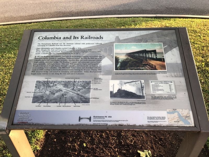
Columbia and Its Railroads
East—Philadelphia and Columbia reached Columbia in 1834.
West—Wrightsvile, York and Gettysburg crossed the Susquehanna in 1840.
North—Harrisburg, Portsmouth, Mount Joy and Lancaster completed a branch in 1850.
South—Columbia and Port Deposit finished its line in 1877.
In 1863 the Reading and Columbia, later part of the Reading Company, arrived bringing anthracite coal for transfer to canal boats Baltimore bound. By 1906 the PRR had at its Columbia hub a 360° roundhouse, turntable, machine shop, two yards, passenger station, freight station, and a steel bridge. The Reading Company had a passenger station, freight station, and a steel bridge. The Reading Company had a passenger station, freight house, turntable, and engine house. That year PRR opened its Atglen and Susquehanna Branch, a low-grade freight bypass through Columbia, and drastically cut back on the crews working from Columbia. The PRR built "Cola" tower and electrified Columbia tracks in 1938 resulting in electrically powered trains running for 50 years. During 1958 PRR closed its bridge and ceased its remaining yard operations. Today diesel-powered freight trains continue to run along the river and east to Lancaster.
Erected by Rivertownes PA USA.
Topics and series. This historical marker is listed in this topic list: Railroads & Streetcars. In addition, it is included in the Pennsylvania Railroad (PRR) series list. A significant historical year for this entry is 1834.
Location. 40° 1.845′ N, 76° 30.49′ W. Marker is in Columbia, Pennsylvania, in Lancaster County. Marker can be reached from Walnut Street west of Locust Street, on the right when traveling west. Touch for map. Marker is at or near this postal address: 100 N Front St, Columbia PA 17512, United States of America. Touch for directions.
Other nearby markers. At least 8 other markers are within walking distance of this marker. The Old Columbia Public Grounds Co. (within shouting distance of this marker); Columbia: a Transportation Hub (about 300 feet away, measured in a direct line); Pennsylvania Railroad Passenger Station (about 400 feet away); Columbia (approx. 0.2 miles away); Railroads During the Civil War (approx. 0.2 miles away); Columbia Bank & Bridge Company (approx. 0.2 miles away); Lloyd Mifflin House (approx. 0.2 miles away); John Houston Mifflin Homestead (approx. 0.2 miles away). Touch for a list and map of all markers in Columbia.
Credits. This page was last revised on July 7, 2019. It was originally submitted on July 7, 2019, by Devry Becker Jones of Washington, District of Columbia. This page has been viewed 424 times since then and 40 times this year. Photos: 1, 2. submitted on July 7, 2019, by Devry Becker Jones of Washington, District of Columbia.

