Veracruz, Mexico — The Gulf Coast (North America)
The Plaza of the Republic
500 Años Veracruz ∙ Puerta de Mar ∙ 1519-2019
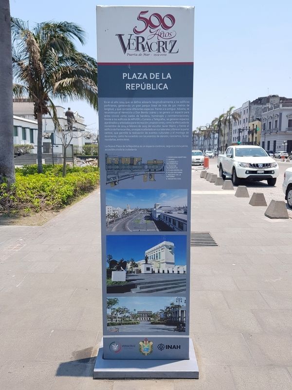
Es en el año 2014 que se define adosarla longitudinalmente a los edificios porfirianos, generando un gran parque lineal de más de 320 metros de longitud, y que contiene diferentes espacios: frente a la antigua Aduana, se reconstruye el Hemiciclo a Don Benito Juárez y se genera un espacio para actos cívicos como izados de bandera, homenajes y conmemoraciones frente a los edificios de APIVER y Correos y Telégrafos, se generan espacios ajardinadosy arbolados para recreación y exposiciones, como la efectuada de noviembre de 2014 a febrero de 2015 del escultor Javier Marin; y frente al edificio de Ferrocarriles, un espacio arbolado en sus laterales y libre en la parte central, que permite la realización de eventos culturales y el montaje de escenarios, como ha sucedido con los eventos de danzón, conciertos, ferias navideñas, entre otros.
La Nueva Plaza de la República es un espacio continuo, seguro e incluyente, accesible a toda la ciudadanía.
Mapa del área de la plaza
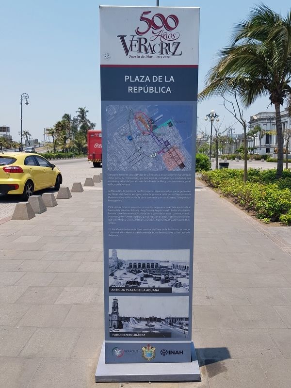
El espacio donde se ubica la Plaza de la República, en sus orígenes fue utilizado como patio de mercancias, ya que aquí se estibaban los productos que entraban y salían del país através de la Puerta de Mar, y posteriormente, por el edificio de la Aduana.
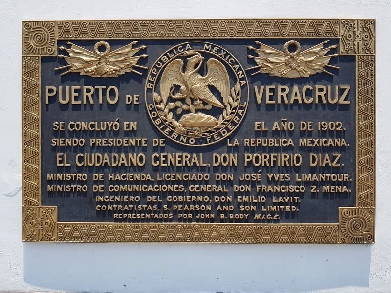
La Plaza de la República se conformó por el espacio residual que se generó en las Obras del Puerto en 1902, entre la primera calle de la Playa (avenida Morelos) y los edificios de la obra portuaria que son Correos, Telégrafos y Ferrocarriles.
Para 1910 se hicieron los primeros intentos de generar una Plaza ajardinada al frente de la entonces Aduana - hoy Primera Región Naval -. En los años treinta fue una zona densamente arbolada y es a partir de los años cuarenta, cuando se construye el Puente Morelos, que se realizan diversas intervenciones viales que la confinan y la convierten en un espacio fragmentado y además de difícil acceso.
En los años setentas se le da el nombre de Plaza de la República, ya que se construye ahí el Hemiciclo en homenaje a Don Benito Juárez y a las Leyes de Reforma.
Pie de dibujos: Antigua Plaza de la Aduana
Faro Benito Juárez
The Plaza of the Republic
500 Years Veracruz ∙ Door to the Sea ∙ 1519-2019
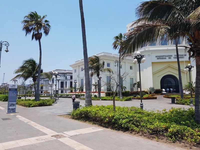
In 2014 this park is defined and attached to the nearby Porfirio-era buildings, creating a great linear park of more than 320 meters in length, containing different spaces. In front of the old Customs House, the Hemicycle to Benito Juárez is rebuilt and a space is created for civic events such as flag raisings, tributes and commemorations in front of the buildings of APIVER and Correos y Telégrafos (the Mail and Telegraph Building). Spaces were also generated, landscaped and wooded for recreation and exhibitions, such as the one carried out from November 2014 to February 2015 by the sculptor Javier Marin; and in front of the Railroads Building, a wooded space was added on its sides and an open space near its center, which allows for the realization of cultural events, as has happened with dances, concerts, Christmas fairs, among other events.
The new Plaza of the Republic is a continuous, safe and inclusive space, accessible to all citizens.
Map of the plaza area
The space where the Plaza of the Republic is located was originally used as a patio for merchandise storage where products were stowed as they were moved in and out of the country through the “Door to the Sea”, and later, through the Customs building.
The Plaza of the Republic was formed by the residual space that was generated by the creation of the port in 1902, between the previous First Street (Morelos Avenue) and the buildings of the port: Correos, Telégrafos and Ferrocarriles.
In 1910
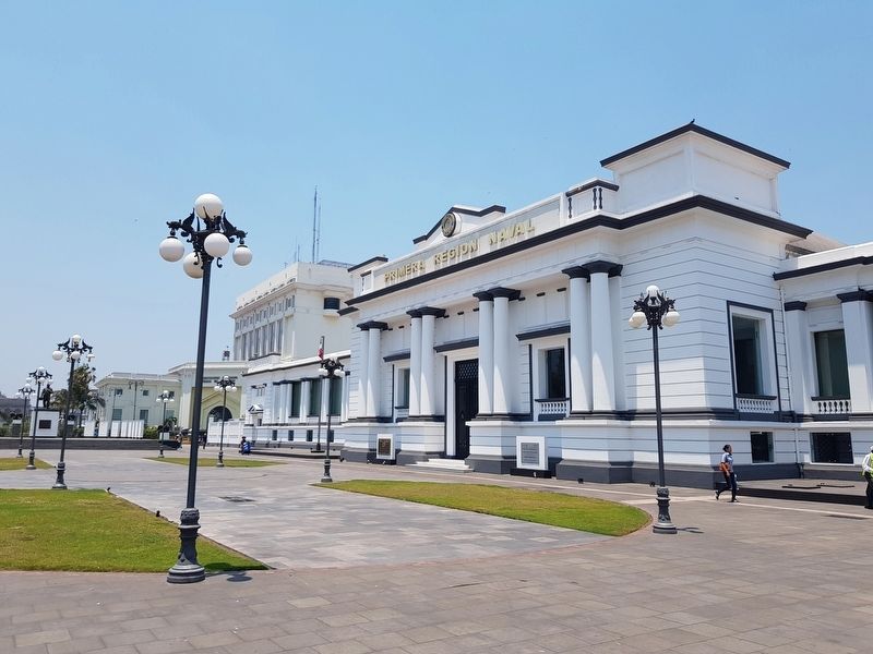
the first attempts to generate a garden plaza in front of the then Customs Building - today the headquarters of the First Naval Region – were made. In the thirties this was a densely wooded area, and since the forties, when the Morelos Bridge is built, various road interventions are made that confine it and made it a fragmented space that is difficult to access.
In the seventies it is first called the Plaza of the Republic, as the Hemicycle is built here in tribute to Benito Juárez and the Laws of Reform.
Captions: The old Customs Building Plaza
The Benito Juárez Lighthouse
Erected by Instituto Nacional de Antropología e Historia (INAH).
Topics. This historical marker is listed in these topic lists: Industry & Commerce • Parks & Recreational Areas. A significant historical month for this entry is February 2015.
Location. 19° 12.138′ N, 96° 8.306′ W. Marker is in Veracruz. Marker is on Marina Mercante just north of Calle Benito Juárez, on the right when traveling north. Touch for map. Marker is in this post office area: Veracruz 91700, Mexico. Touch for directions.
Other nearby markers. At least 8 other markers are within walking distance of this marker. The Hemicycle to Juárez (within shouting distance of this marker); Monument to Spanish Exiles in Mexico (within shouting distance of this marker); The Convent of San Francisco (within shouting distance of this marker); Mail and Telegraph Building
(about 90 meters away, measured in a direct line); Founding of Villa Rica de la Veracruz (about 150 meters away); Death of Aurelio Monfort (about 150 meters away); Rafael Solana Salcedo (about 210 meters away); First Municipal Council in Mexico (about 210 meters away). Touch for a list and map of all markers in Veracruz.
Credits. This page was last revised on January 4, 2023. It was originally submitted on July 10, 2019, by J. Makali Bruton of Accra, Ghana. This page has been viewed 106 times since then and 12 times this year. Photos: 1, 2, 3, 4. submitted on July 10, 2019, by J. Makali Bruton of Accra, Ghana. 5. submitted on July 11, 2019, by J. Makali Bruton of Accra, Ghana.
