Shepherdsville in Bullitt County, Kentucky — The American South (East South Central)
L & N Bridge - Civil War
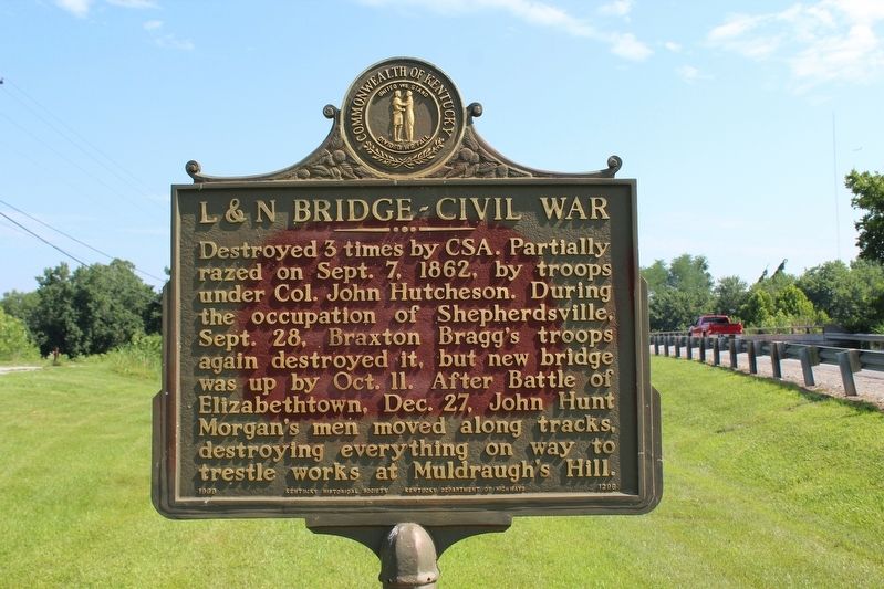
Photographed by Tom Bosse, July 5, 2018
1. L & N Bridge - Civil War Marker
Erected 1969 by Kentucky Historical Society & Kentucky Department of Highways. (Marker Number 1296.)
Topics and series. This historical marker is listed in these topic lists: Bridges & Viaducts • Railroads & Streetcars • War, US Civil. In addition, it is included in the Kentucky Historical Society series list. A significant historical date for this entry is September 7, 1862.
Location. 37° 59.024′ N, 85° 43.044′ W. Marker is in Shepherdsville, Kentucky, in Bullitt County. It is at the intersection of Preston Highway (Kentucky Route 61) and Old Preston Highway South ( Route 480c), on the left when traveling north on Preston Highway. Marker located in front of Maraman Billings Funeral Home. Touch for map. Marker is at or near this postal address: 605 Preston
this page online

Regionally, this marker is in Greater Louisville Area. It is also in the American South, specifically in the Upper South, and in the Ohio River Valley. Globally, it is in North America, the Western Hemisphere, the Western World, and the Anglosphere. Historically, it finds itself in what was once the territory of the Mississippian Culture and also the Antebellum South.
Other nearby markers. At least 8 other markers are within walking distance of this marker: Fort DeWolf (here, next to this marker); Morgan - On To Ohio (here, next to this marker); The 1917 Train Wreck (approx. ¼ mile away); Adam Shepherd (approx. 0.3 miles away); Kentucky Black Trailblazers (approx. 0.3 miles away); County Named, 1796 (approx. 0.3 miles away); Bullitt County Veterans Memorial (approx. 0.3 miles away); Shepherdsville Pioneer Graveyard (approx. 0.3 miles away). Touch for a list and map of all markers in Shepherdsville.
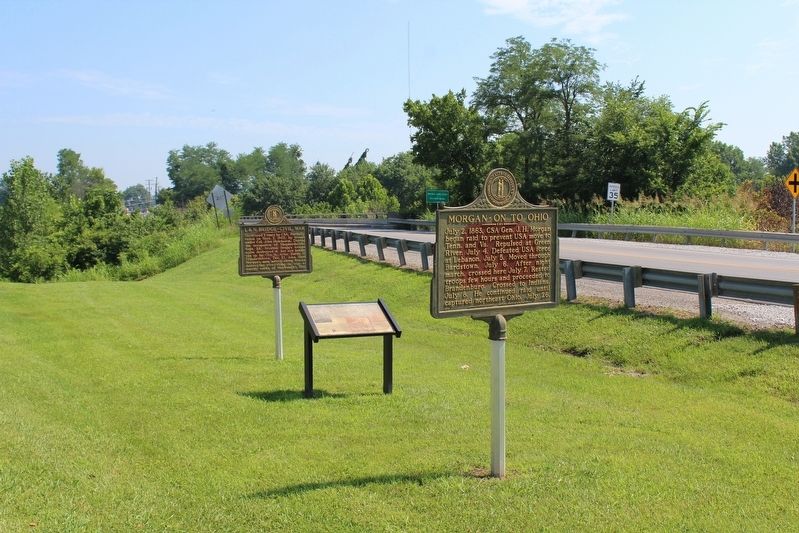
Photographed by Tom Bosse, July 5, 2018
2. L & N Bridge - Civil War Marker

Photographed by Richard Hawkins, July 11, 2025
3. L & N Bridge - Civil War Marker
Credits. This page was last revised on July 13, 2025. It was originally submitted on August 18, 2018, by Tom Bosse of Jefferson City, Tennessee. This page has been viewed 716 times since then and 73 times this year. Last updated on July 13, 2019, by Bradley Owen of Morgantown, West Virginia. Photos: 1, 2. submitted on August 18, 2018, by Tom Bosse of Jefferson City, Tennessee. 3. submitted on July 11, 2025, by Richard Hawkins of Phelan, California. • Andrew Ruppenstein was the editor who published this page.
