Marker Logo HMdb.org THE HISTORICAL
MARKER DATABASE
“Bite-Size Bits of Local, National, and Global History”
Near Fort Lawn in Chester County, South Carolina — The American South (South Atlantic)
 

Great Indian Warrior Trading Path

(The Great Philadelphia Wagon Road)


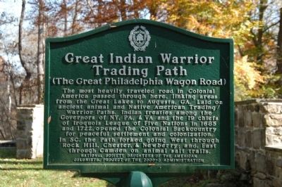
Great Indian Warrior Trading Path Marker image. Click for full size.
Photographed By Michael Sean Nix, November 21, 2008
1. Great Indian Warrior Trading Path Marker
Inscription. The most heavily traveled road in Colonial America passed through here, linking areas from the Great Lakes to Augusta, GA. Laid on ancient animal and Native American Trading/ Warrior Paths. Indian treaties among the Governors of NY, PA, & VA and the 19 chiefs of Iroquois League of Five Nations in 1685 and 1722, opened the Colonial Backcountry for peaceful settlement and colonization. In SC, the Path forked going West through Rock Hill, Chester, & Newberry; and, East through Camden on animal salt trails.
 
Erected by National Society Daughters of the American Colonist.
 
Topics and series. This historical marker is listed in this topic list: Colonial Era. In addition, it is included in the Daughters of the American Colonists, and the Great Indian Warrior / Trading Path series lists. A significant historical year for this entry is 1685.
 
Location. 34° 46.302′ N, 80° 52.71′ W. Marker is near Fort Lawn, South Carolina, in Chester County. Marker can be reached from Canal Road (State Highway 330) near Landsford Road (State Highway 843), on the right when traveling east. Where Landsford Road and Canal Road meet, there is a gravel road the runs east into the woods. The marker is at the end of the this road with parking and signs marking the area present. Touch for map
Paid Advertisement
Click on the ad for more information.
Please report objectionable advertising to the Editor.
Click or scan to see
this page online
. Marker is in this post office area: Fort Lawn SC 29714, United States of America. Touch for directions.
 
Other nearby markers. At least 8 other markers are within 2 miles of this marker, measured as the crow flies. Mill Complex (approx. 0.4 miles away); The Canal Bed (approx. half a mile away); Culvert (approx. 0.6 miles away); Footbridge (approx. 0.9 miles away); A Nest with a Bird's-Eye View (approx. 1.2 miles away); Landsford Canal State Park Trails (approx. 1.3 miles away); The Guardlock (approx. 1.3 miles away); The Dam (approx. 1.3 miles away). Touch for a list and map of all markers in Fort Lawn.
 
More about this marker. Marker is at the end of the Canal Trail of Landsford Canal State Park.
 
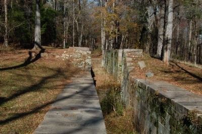
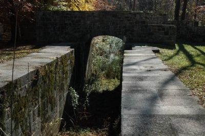
Foot bridge over Upper Lifting Locks of Landsford Canal image. Click for full size.
Photographed By Michael Sean Nix, November 21, 2008
2. Foot bridge over Upper Lifting Locks of Landsford Canal
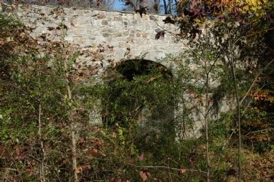
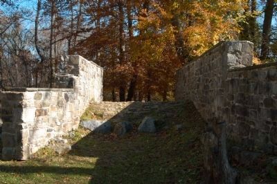
Upper Lifting Locks of Landsford Canal image. Click for full size.
Photographed By Michael Sean Nix, November 21, 2008
3. Upper Lifting Locks of Landsford Canal
Foot bridge over Upper Lifting Locks of Landsford Canal image. Click for full size.
Photographed By Michael Sean Nix, November 21, 2008
4. Foot bridge over Upper Lifting Locks of Landsford Canal
Foot bridge over Upper Lifting Locks of Landsford Canal image. Click for full size.
Photographed By Michael Sean Nix, November 21, 2008
5. Foot bridge over Upper Lifting Locks of Landsford Canal
 
 
Credits. This page was last revised on June 16, 2016. It was originally submitted on November 21, 2008, by Michael Sean Nix of Spartanburg, South Carolina. This page has been viewed 1,957 times since then and 50 times this year. Photos:   1, 2, 3, 4, 5. submitted on November 21, 2008, by Michael Sean Nix of Spartanburg, South Carolina. • Craig Swain was the editor who published this page.
Share this page.  
Share on Tumblr
m=13719

CeraNet Cloud Computing sponsors the Historical Marker Database.
This website earns income from purchases you make after using our links to Amazon.com. We appreciate your support.
Paid Advertisement
May. 6, 2024