Kinsale in County Cork, Munster, Ireland — Irish South-West ((Éire) North Atlantic Ocean)
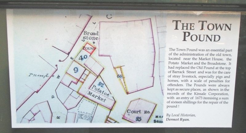
The Town Pound
Photographed by William Fischer, Jr., May 17, 2019
1. The Town Pound Marker
By Local Historian,
Dermot Ryan.
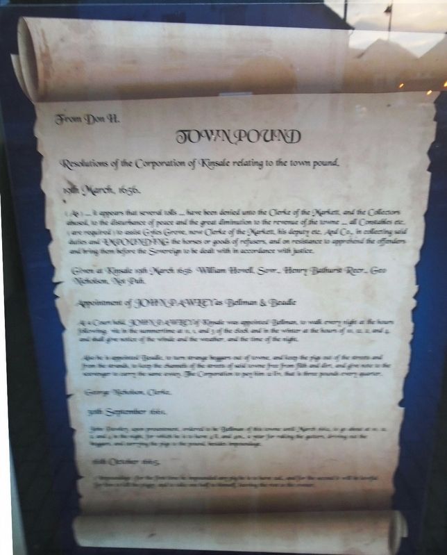
Town Pound
Resolution of the Corporation of Kinsale relating to the town pound.
19th March, 1656.
(As)... it appears that several tolls... have been denied unto the Clerke of the Markett, and the Collectors abused, to the disturbance of peace and the great diminution to the revenue of the towne... all Constables etc. (are required) to assist Gyles Grove, now Clerke of the Markett, his deputy etc. And Co., in collecting said duties and IMPOUNDING the horses or goods of refusers, and on resistance to apprehend the offenders.
Given at Kinsale 19th March 1656 William Howell, S[?].,
this page online
Appointment of JOHN PAWLEY as Bellman & Beadle
As a Court [?], JOHN PAWLEY of Kinsale was appointed Bellman, to walk every night at the hours following [?] in the summertime at 11, 1, and 3 of the clock and in the winter at the hours of 10, 12, 2, and 4, and shall give notice of the winds and the weather, and the time of the night.
Also he is appointed Beadle, to turn strange beggars out of towne, and keep the pigs out of the streets and from the strands, [balance illegible in photo].
George Nicholson, Clerke.
Erected by Town of Kinsale, Cork County Council, National Development Plan, et al.
Topics. This historical marker is listed in this topic list: Charity & Public Work. A significant historical year for this entry is 1673.
Location. 51° 42.366′ N, 8° 31.49′ W. Marker is in Kinsale, Munster, in County Cork. It is at the intersection of Market Square and Guardwell, on the right when traveling east on Market Square. Touch for map. Marker is in this post office area: Kinsale, Munster P17 AF50, Ireland. Touch for directions.

Regionally, it is on the Atlantic Ocean, in the North
Photographed by William Fischer, Jr., May 17, 2019
2. The Town Pound Mock Scroll Marker
Other nearby markers. At least 8 other markers are within walking distance of this marker: Kinsale (here, next to this marker); Nautical Artefacts at Kinsale Museum (within shouting distance of this marker); Múseum / Museum (within shouting distance of this marker); Peter Barry (within shouting distance of this marker); The Pauper's Well / Tobar na mbocht (within shouting distance of this marker); Kinsale Town Wall (within shouting distance of this marker); The James O'Neill Memorial Building (within shouting distance of this marker); Kinsale - A Walled Town (within shouting distance of this marker). Touch for a list and map of all markers in Kinsale.
Also see . . . History of Kinsale. (Submitted on July 29, 2019, by William Fischer, Jr. of Reynoldsburg, Ohio.)
Photographed by William Fischer, Jr., May 17, 2019
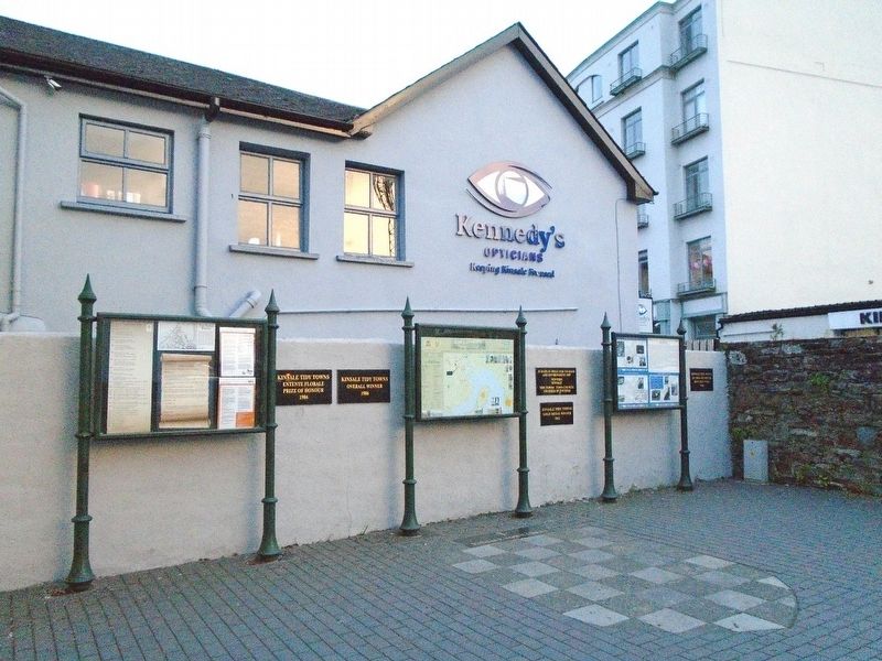
3. The Town Pound Markers
Credits. This page was last revised on October 13, 2024. It was originally submitted on July 29, 2019, by William Fischer, Jr. of Reynoldsburg, Ohio. This page has been viewed 429 times since then and 35 times this year. Photos: 1, 2, 3. submitted on July 29, 2019, by William Fischer, Jr. of Reynoldsburg, Ohio.
Editor’s want-list for this marker. Balance of transcription of Town Pound Mock Scroll text and better photo • Can you help?
