Hummelstown in Dauphin County, Pennsylvania — The American Northeast (Mid-Atlantic)
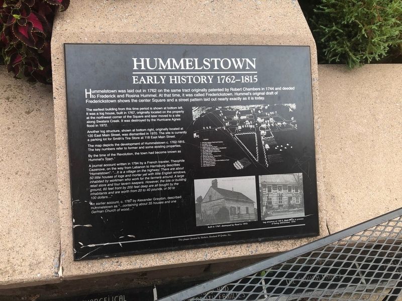
Hummelstown
Early History 1762-1815
The earliest building from this time period is shown at the bottom left. It was a log house, built in 1767, originally located on the property at the northwest corner of the Square and later moved to a site along Swatara Creek. It was destroyed by the Hurricane Agnes flood in 1972.
Another log structure, shown at bottom right, originally located at 120 East Main Street, was dismantled in 1970. The site is currently a parking lot for Smith's Tire Store at 118 East Main Street.
The map depicts the development of Hummelstown c. 1762-1815. The key numbers refer to former and some existing properties.
By the time of the Revolution, the town had become known as Hummel's Town.
A journal account written in 1794 by a French traveler, Theophile Cazenove, on the way from Lebanon to Harrisburg describes "Homelstown": "...It is a village on the highway. There are about 50 little houses of logs and mortar yet with little English windows, inhabited by workmen who work for the farmers around. A large retail store and four tavern keepers. However, the lots or building ground, 60 feet front by 200 feet deep are all bought by the inhabitants and are worth from 20 to 40 pounds, or 50 to 100 dollars...."
An earlier account, c. 1787 by Alexander Graydon, described Hummelstown as "...containing about 35 houses and one German Church of wood...."
Erected by Herbert, Rowland & Grubic, Inc.
Topics. This historical marker is listed in these topic lists: Colonial Era • Settlements & Settlers. A significant historical year for this entry is 1762.
Location. 40° 15.914′ N, 76° 42.462′ W. Marker is in Hummelstown, Pennsylvania, in Dauphin County. Marker can be reached from East Main Street east of South Hanover Street, on the right when traveling east. Touch for map. Marker is at or near this postal address: 1 East Main Street, Hummelstown PA 17036, United States of America. Touch for directions.
Other nearby markers. At least 8 other markers are within walking distance of this marker. Then And Now (here, next to this marker); The Developing Years (here, next to this marker); a different marker also named Hummelstown (here, next to this marker); On The Square (here, next to this marker); The Fountain (a few steps from this marker); The Arch (within shouting distance of this marker); Hotels of Hummelstown
Credits. This page was last revised on August 2, 2019. It was originally submitted on August 2, 2019, by Devry Becker Jones of Washington, District of Columbia. This page has been viewed 402 times since then and 51 times this year. Photos: 1, 2. submitted on August 2, 2019, by Devry Becker Jones of Washington, District of Columbia.

