Jefferson in Schoharie County, New York — The American Northeast (Mid-Atlantic)
Town of Jefferson
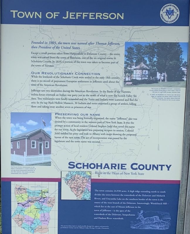
Founded in 1803, the town was named after Thomas Jefferson, then President of the United States.
Except a small portion taken from Harpersfield in Delaware County- the entire town was carved from the town of Blenheim, one of the six original towns in Schoharie County. In 1819, a portion of the town was taken to become part of the town of Summit.
Our Revolutionary Connection
While the lowlands of the Schoharie Creek were settled in the early 18th century there is no record of permanent European settlement in Jefferson until about the time of the American Revolution.
Jefferson saw two skirmishes during the American Revolution. In the Battle of the Narrows, militia forces overtook an Indian war party just to the north of what is now the Scotch Valley Ski Area. Two militiamen were fatally wounded and the Tories and Indians were scattered and fled the area. In the sap Bush Hollow Massacre, 30 Indians and Tories surprised a group of settlers, killing three and taking away another seven as prisoners of war.
Preserving Our Name
When the town was being formally organized, the name “Jefferson” desired by a community in the western part of New York State. It was the prompt action of local resident Colonel Stephen Judd that saved the name for our town. As the legislature was preparing to open its session, Colonel Judd saddled his pony and rode to Albany with maps showing the proposed layout of the new town. The act of incorporation passed legislature and the town name was secured. The town contains 24,930 acres. A high ridge extending north to south divides the town between the watersheds of the Delaware and Mohawk Rivers, and Utsyantha Lake on the southern border of the town is the source of the west branch of the Delaware. Interestingly, Woodchuck Hill- which lies to the east of Mount Jefferson in the town of Jefferson - is the apex of the watersheds of the Delaware, Susquehanna and Hudson Rivers.
photo captions:
Right The Village of Jefferson features a wonderful village green, established in 1817 from a deed of 108 rods of land from Colonel Stephen Judd.
In 1879, the Rev. C.H. Travis had 120 maple trees set around the green, some of whom are still standing. The annual Maple Festival had its origins on the village green.
Left The Fuller District Schoolhouse in the Town of Jefferson is a classic example of the one-room schoolhouse prevalent in the 19th Century. The schoolhouse has been transformed into a museum.
Erected by Schoharie County & Mohawk Valley Heritage Corridor Commission.
Topics. This historical marker is listed in this topic list: Settlements & Settlers. A significant historical year for this entry is 1803.
Location. 42° 28.869′ N, 74° 36.751′ W. Marker is in Jefferson, New York, in Schoharie County. Marker is on North Harpersfield Road (County Route 2A), on the left when traveling west. Touch for map. Marker is in this post office area: Jefferson NY 12093, United States of America. Touch for directions.
Other nearby markers. At least 8 other markers are within 4 miles of this marker, measured as the crow flies. Village Green (here, next to this marker); Town of Jefferson War Memorial (here, next to this marker); Jefferson Academy (within shouting distance of this marker); Mill Stones (about 300 feet away, measured in a direct line); Masonic Lodge 554 (about 400 feet away); Parker 13-Sided Barn (approx. 0.4 miles away); Site of Battle (approx. 3.2 miles away); Sugar Bush Raid (approx. 3.6 miles away). Touch for a list and map of all markers in Jefferson.
Credits. This page was last revised on August 8, 2019. It was originally submitted on August 6, 2019, by Steve Stoessel of Niskayuna, New York. This page has been viewed 320 times since then and 43 times this year. Photos: 1, 2. submitted on August 6, 2019, by Steve Stoessel of Niskayuna, New York. • Bill Pfingsten was the editor who published this page.

