Near Chippewa Falls in Chippewa County, Wisconsin — The American Midwest (Great Lakes)
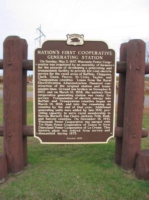
Nation's First Cooperative Generating Station
On Sunday, May 2, 1937, Wisconsin Power Cooperative was organized by an assembly of farmers for the purpose of developing a generating and transmission facility to provide low-cost electric service for the rural areas of Buffalo, Chippewa, Clark, Dunn, Pierce, St. Croix, Taylor, and Trempealeau counties. Loans from the Rural Electrification Administration financed construction of the original station and transmission lines. Ground was broken on November 8, 1937, and on March 12, 1938, the nation's first cooperative generating station was ready for service. Transmission of electric energy into Buffalo and Trempealeau counties began on March 14, 1938, and into the remaining six counties by the end of that year. Additional generating units were added by late 1941, providing capacity to serve rural membership in Barron, Burnett, Eau Claire, Jackson, Polk, Rusk, and Sawyer counties. On December 16, 1941, Wisconsin Power Cooperative was merged with Tri-State Power Cooperative of Genoa to form Dairyland Power Cooperative of La Crosse. This historic plant was retired from service and dismantled in 1975.
Erected 1976 by the Wisconsin Historical Society. (Marker Number 222.)
Topics and series. This historical marker is listed in these topic lists: Industry & Commerce • Notable Places. In addition, it is included in the Rural Electrification 💡, and the Wisconsin Historical Society series lists. A significant historical month for this entry is March 1864.
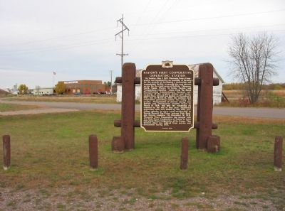
Location. 45° 0.282′ N, 91° 23.318′ W. Marker is near Chippewa Falls, Wisconsin, in Chippewa County. Marker is on 140th Street/REA Road north of 112th Avenue/Woodruff Avenue, on the left when traveling north. Marker can be reached from State Highway 124, approximately 3 miles north of Chippewa Falls. Marker is at a pull-off. Touch for map. Marker is in this post office area: Chippewa Falls WI 54729, United States of America. Touch for directions.
Other nearby markers. At least 8 other markers are within 4 miles of this marker, measured as the crow flies. Saint Peter's Catholic Church (approx. 2.4 miles away); Stanley's Mill (approx. 2.7 miles away); First Farm in Chippewa County (approx. 3.3 miles away); Bear Den Road Bridge (approx. 3˝ miles away); Sunny Valley School (approx. 3.6 miles away); Pioneer Norwegian Log Home (approx. 3.6 miles away); William Irvine (approx. 3.9 miles away); In Memory of Old Abe (approx. 4 miles away). Touch for a list and map of all markers in Chippewa Falls.
Credits. This page was last revised on February 11, 2022. It was originally submitted on November 23, 2008, by Keith L of Wisconsin Rapids, Wisconsin. This page has been viewed 1,814 times since then and 43 times this year. Photos: 1, 2. submitted on November 23, 2008, by Keith L of Wisconsin Rapids, Wisconsin. • Bill Pfingsten was the editor who published this page.

