Somerset in Niagara County, New York — The American Northeast (Mid-Atlantic)
30 Mile Point Lighthouse
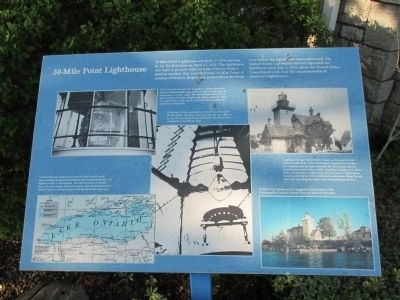
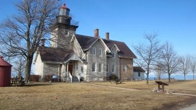
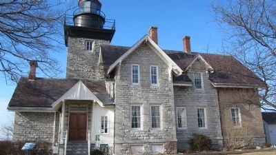
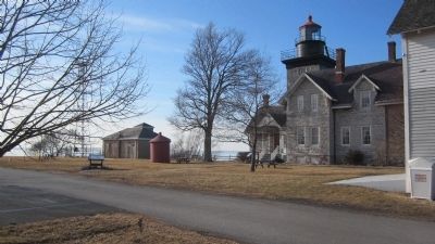
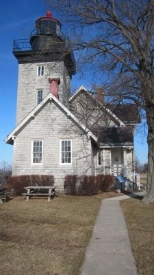
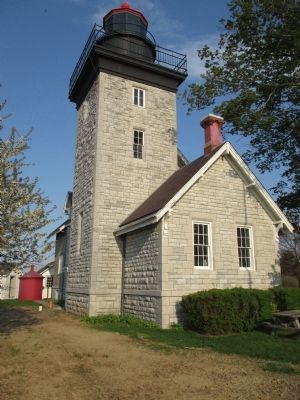
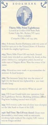
30-Mile Point Lighthouse was built in 1875 and was lit for the first time on April 27, 1876. The lighthouse was built to protect ships on Lake Ontario from a shallow sandbar the extended from 30-Mile Point. A number of historic shipwrecks occurred not far from here before the lighthouse was constructed. The United States Lighthouse Service operated the lighthouse until July 1, 1939, when the United States Coast Guard took over the administration of America's lighthouses.
This third-order fresnel lens magnified a simple lard oil or kerosene flame bright enough that it could be seen up to 16 miles away on a clear night. The one-ton lens stood six feet tall. A system of counterweights and cables, much like those in a grandfather clock, slowly rotated the lens, making the light flash periodically.
In the early 1930s, municipal electricity was extended to 30-Mile Point. The tower's kerosene burner was replaced by a 500-watt lightbulb pictured here. The frenel lens continued to magnify the light.
Lighthouse keeper Glenn Seeley stands on the porch in his keeper's uniform ca. 1903. The keeper's most important duty was ensuring that the light remained lit. The keeper and his assistant alternated 24-hour shifts, checking the light every three hours and making a weather log every four hours. Other duties included winding the lens's clockwork mechanism, filing the oil reservoir, trimming the light's wick, and polishing the lens.
30-Mile Point is the northernmost point of Lake Ontario's south shore, making it an important landmark when navigating the lake. All lighthouses had a characteristic that allowed seaman to identify them. The characteristic included the light's color, the frequency on its flash if it has one, and any fog signal that the lighthouse might have. Map modified from a larger map of the 10th Lighthouse District, in the 1894 Annual Report of the Light-House Board Annual Report. Courtesy of the New York State Library.
30-Mile Point lighthouse as it appeared from the lake in 1986. Photograph by Lorraine Wayner, Town of Somerset Historian.
Topics and series. This historical marker is listed in this topic list: Waterways & Vessels. In addition, it is included in the Great Lakes Seaway Trail National Scenic Byway, and the Lighthouses series lists. A significant historical year for this entry is 1875.
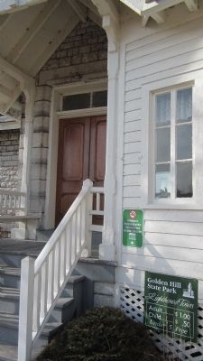
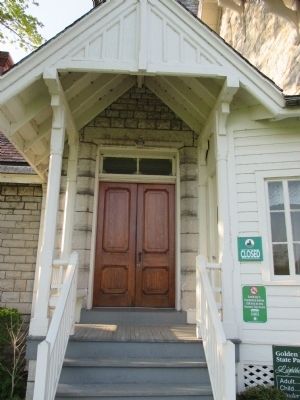
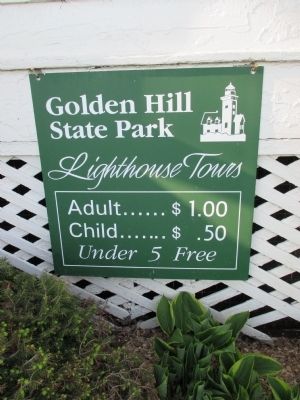
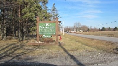
Location. 43° 22.49′ N, 78° 29.165′ W. Marker is in Somerset, New York, in Niagara County. Marker is located next to the front entrance to the lighthouse, which is within Golden Hill State Park, address 9691 Lower Lake Road, Barker, NY 14012. Look for the small lighthouse and park signs beginning on NY Route 18. Touch for map
. Marker is in this post office area: Barker NY 14012, United States of America. Touch for directions.
Other nearby markers. At least 8 other markers are within 5 miles of this marker, measured as the crow flies. Thirty Mile Point Lighthouse (a few steps from this marker); Lighthouse Buildings (a few steps from this marker); Foghorn, Pier, and Beacon Tower (within shouting distance of this marker); This Memorial (approx. 3.6 miles away); Salt Spring (approx. 3.6 miles away); In Honor of Those Who Served (approx. 4.2 miles away); United States Army (approx. 4.2 miles away); Jacob Fitts (approx. 4.3 miles away). Touch for a list and map of all markers in Somerset.
Regarding 30 Mile Point Lighthouse. Text of Thirty Mile Point Lighthouse - Lighthouse Architecture Marker, adjacent to the parking lot at the lighthouse:
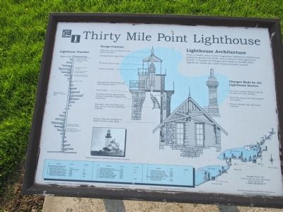
From a simple, even austere beginning, lighthouse architecture peaked in grand style while under control of the Lighthouse Service. A number of changes were made to 30-Mile Point Lighthouse before the Coast Guard assumed control.
Design Features:
Globe Vent Ball with Pedestal and Lightening Spike.
Standing Seam Copper Roof.
3rd Order Fresnel Lens.
Ornate Iron Rails.
Patterned Steel Plate Deck and Steel Armored Barrel.
Iron Cornice.
Cut Stone Facing with Quioned Corners. Limestone Shipped
from Chaumont.
Decorative Cast Iron Steps and Rail. Cast in Sections and Bolted Together.
Keeper's Quarters Designed in High Victorian Gothic Style.
Original Architectural Detailing Shown in this 1915 Photo.
Changes made by the Lighthouse Service
• Cut stone summer kitchen replaced by brick, two-story addition.
• Decorative panels and trim removed from gables.
• Ornate chimney caps and finials removed.
Lighthouse Timeline:
1984 Lighthouse Turned Over to NYS Office of Parks, Recreation and Historic Preservation.
1939 Coast Guard assumes ownership.
1934 Fog Horn Built. Keeper's Quarters Enlarged.
1931 Kerosene Lamp Replaced By 500 Watt Electric Lamp.
1875 Lighthouse Built.
1852 Lighhouse Board Established. Upgrading Begun.
1789 Lighthouses Became Federal Responsibility.
1781 First Light on the Great Lakes at the Mouth of the Niagara River.
Seaway Trail, Inc. Corner of Ray and West Main Streets, Sackets Harbor, NY 1-800-SEAWAY-T. This exhibit made possible by a FHWA Grant to Seaway Trails, Inc. Produced by the New York State Office of Parks, Recreation and Historic Preservation.
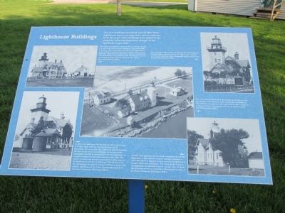
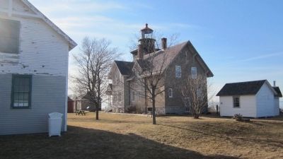
Text of Lighthouse Buildings Marker: The first buildings associated with 30-Mile Point Lighthouse were a carriage barn and an outhouse. Over the years, other buildings were added to the property, reflecting important
changes in the lighthouse's operation.
The original carriage barn, shown in this ca. 1898 photograph, was located directly east of the lighthouse. The present barn was built in 1904. These barns had stalls for the light keepers' horses and housed their sleighs and carriages, which were an important link to the town of Somerset and the world beyond. The wooden fence was installed in 1893. Photograph courtesy of Gambles Open Door Antique Shop and the Town of Somerset Historian's Office.
Note the large garden in this 1907 photograph of the lighthouse. Because of their relative isolation, the light keepers families grew much of their own food. Photograph courtesy of the Town of Somerset Historian's Office.
Note the outhouse picture in the foreground of this ca. 1945 photograph, located precariously close to the embankment. The outhouse was moved in the early 1950s to save it from an eroding shoreline. Photograph courtesy of the U.S. Coast Guard Historian's Office.
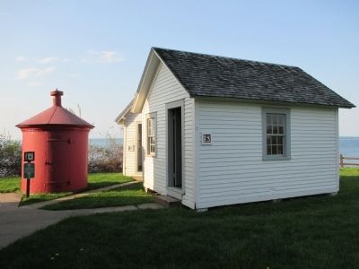
In 1881, the Lighthouse Service replaced the lard oil lamp at 30-Mile Point with one that burned mineral oil (kerosene). Ten years later, the Lighthouse Service installed the first two round, iron oil houses so that this more flammable oil could be stored away from the lighthouse. A second oil house was delivered sometime after 1900. the earlier oilhouse was moved to its present location
east of the lighthouse to serve as a well house. The oil houses in this photograph are typical of those installed at many of the nation's lighthouses in the 1890s. Photograph courtesy of the Town of Somerset Historian's Office.
In 1789, the Lighthouse Service built a woodshed east of the lighthouse. It was replaced with the existing woodshed in 1905. The shed was adapted to store coal for the lighthouse's furnace, which was installed in 1924. Each family living at the lighthouse was allotted 8 tons of coal per year. At times, this shed also served as a workshop. Photograph courtesy of the Town of Somerset Historian's Office.
Also see . . .
1. Friends of 30-Mile Point Lighthouse. Website homepage (Submitted on May 25, 2014, by Anton Schwarzmueller of Wilson, New York.)
2. Town of Somerset. Website homepage (Submitted on May 25, 2014, by Anton Schwarzmueller of Wilson, New York.)
3. Great Lakes Seaway Trail. Tourist information for the U.S. shoreline from the St. Lawrence River (Masena, NY) to Northwest Pennsylvania, marking the way by signs and contributing markers, and including the lighthouses. (Submitted on May 25, 2014, by Anton Schwarzmueller of Wilson, New York.)
4. US Stamp Gallery - 30-Mile Point Lighthouse. Image of the 1995 32 cent U.S. postage stamp depicting
the 30-Mile Point lighthouse (Submitted on May 25, 2014, by Anton Schwarzmueller of Wilson, New York.)
5. Thirty Mile Point Light. National Register of Historic Places, Historic American Engineering Record form, National Archives. (Submitted on September 14, 2023, by Anton Schwarzmueller of Wilson, New York.)
Credits. This page was last revised on September 14, 2023. It was originally submitted on May 25, 2014, by Anton Schwarzmueller of Wilson, New York. This page has been viewed 524 times since then and 24 times this year. Last updated on August 23, 2019, by Bradley Owen of Morgantown, West Virginia. Photos: 1, 2, 3, 4, 5, 6, 7, 8, 9, 10, 11, 12, 13, 14, 15, 16, 17. submitted on May 25, 2014, by Anton Schwarzmueller of Wilson, New York. • Andrew Ruppenstein was the editor who published this page.
