Jim Thorpe in Carbon County, Pennsylvania — The American Northeast (Mid-Atlantic)
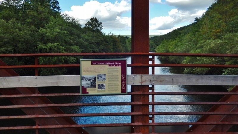
Coal Transport in Mauch Chunk
1792-1921
John Hoffman, Anthracite in the Lehigh Valley of Pennsylvania
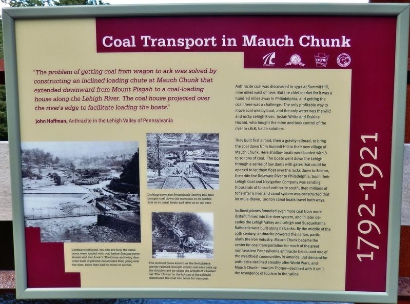
Anthracite coal was discovered in 1792 at Summit Hill, nine miles west of here. But the chief market for it was a hundred miles away in Philadelphia, and getting the coal there was a challenge. The only profitable way to move coal was by boat, and the only water was the wild and rocky Lehigh River. Josiah White and Erskine Hazard, who bought the mine and took control of the river in 1818, had a solution.
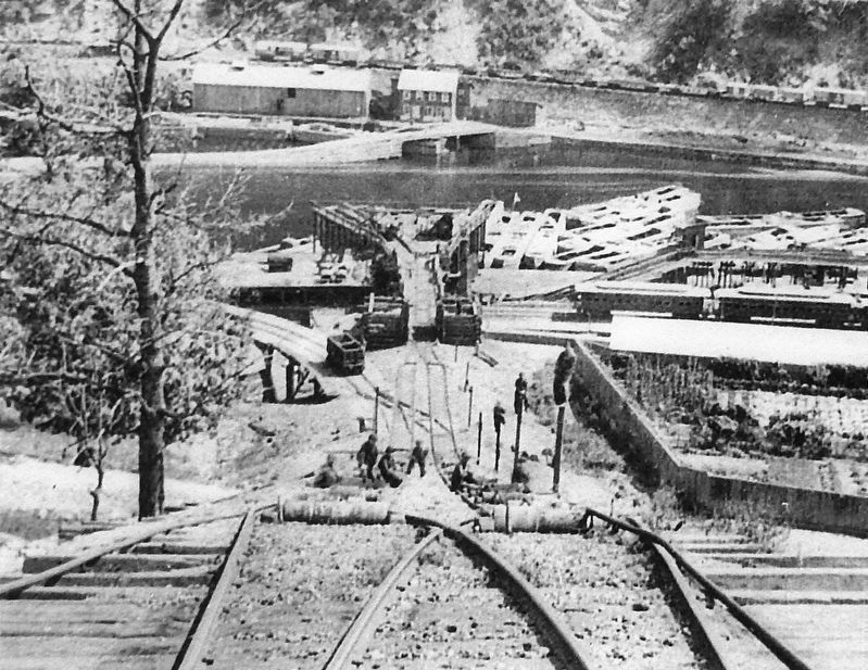
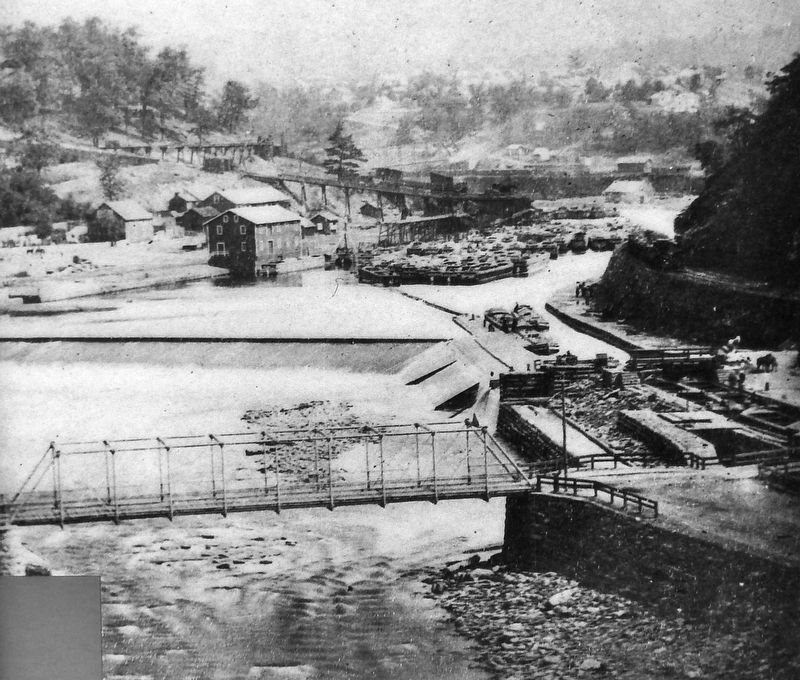
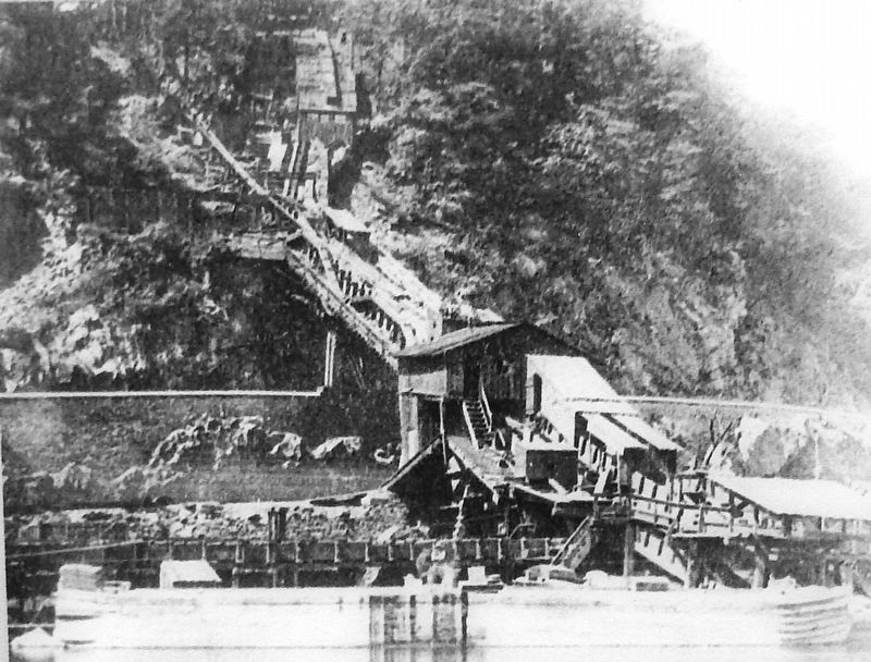
They built first a road, then a gravity railroad, to bring the coal down from Summit Hill to their new village of Mauch Chunk. Here shallow boats were loaded with 8 to 10 tons of coal. The boats went down the Lehigh through a series of low dams with gates that could be opened to let them float over the rocks down to Easton, then ride the Delaware River to Philadelphia. Soon their Lehigh Coal and Navigation Company was sending thousands of tons of anthracite south, then millions of tons after a river and canal system was constructed that let mule-drawn, 100 ton canal boats travel both ways.
Inclined planes funneled even more coal from more distant mines into the river system, and in later decades the Lehigh Valley and Lehigh and Susquehanna Railroads were built along its banks. By the middle of the 19th century, anthracite powered the nation, particularly the iron industry. Mauch Chunk became the center for coal transportation for much of the great northeastern Pennsylvania anthracite fields, and one of the wealthiest communities in America. But demand for anthracite declined steadily after World War I, and Mauch Chunk — now Jim Thorpe — declined with it until the resurgence of tourism in the 1980s.
Erected 2019 by Delaware & Lehigh National Heritage Corridor, Pennsylvania Department of Transportation, Pennsylvania State Parks, and Carbon County.
Topics and series. This historical marker is listed in these topic lists: Industry & Commerce • Railroads & Streetcars • Waterways & Vessels. In addition, it is included in the Lehigh Canal series list. A significant historical year for this entry is 1792.
Location. 40° 51.707′ N, 75° 44.247′ W. Marker is in Jim Thorpe, Pennsylvania, in Carbon County. Marker can be reached from Susquehanna Street (U.S. 209) 0.1 miles south of Race Street, on the left when traveling south
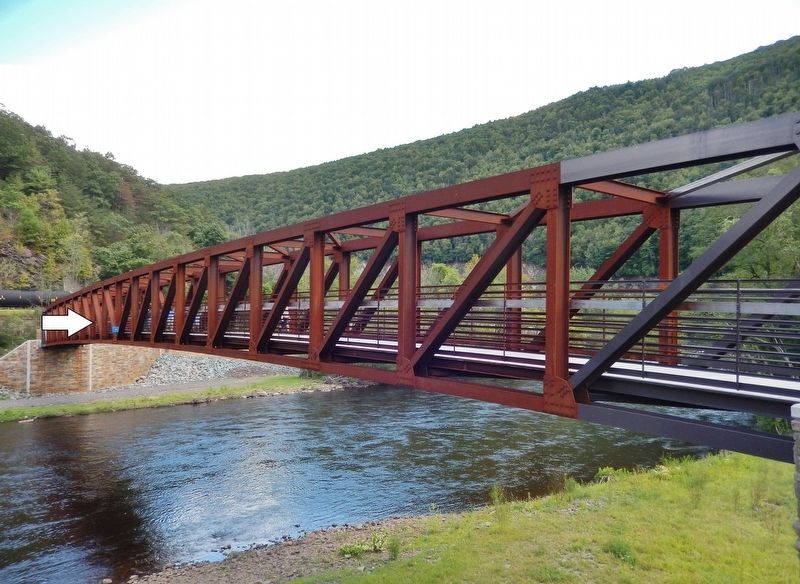
. Marker is mounted on the inside of the north railing, near the center of the pedestrian bridge that carries the Delaware & Lehigh Trail across the Lehigh River heading southeast from the Jim Thorpe/Mauch Chunk Railroad Station. Touch for map. Marker is at or near this postal address: 1 Susquehanna Street, Jim Thorpe PA 18229, United States of America. Touch for directions.
Other nearby markers. At least 8 other markers are within walking distance of this marker. Dams Made the Lehigh Canal (within shouting distance of this marker); The Mansion House (within shouting distance of this marker); Mauch Chunk Railroad Station (about 500 feet away, measured in a direct line); Anthracite (about 500 feet away); From Mountain to Market (about 500 feet away); Packer Mansion (about 500 feet away); Carbon County (about 700 feet away); Joe Boyle Plaza (about 800 feet away). Touch for a list and map of all markers in Jim Thorpe.
Also see . . .
1. Lehigh Coal & Navigation Company (Wikipedia). The Lehigh Coal & Navigation Company was a mining and transportation company that operated in Pennsylvania from 1818 to 1964. It ultimately encompassed source industries, transport, and manufacturing, making it the first vertically integrated company in the United States. The LC&N spearheaded the Industrial Revolution in the United States, accelerating regional industrial development by taking on civil engineering challenges thought impossible and creating
important transport and mining infrastructure. Most importantly, the LC&N established the Lower Lehigh Canal and taught America to burn anthracite. (Submitted on August 30, 2019, by Cosmos Mariner of Cape Canaveral, Florida.)
2. Mauch Chunk Switchback Railway (Wikipedia). The Mauch Chunk and Summit Railroad was a coal-hauling railroad in the mountains of Pennsylvania that operated between 1828 and 1932. It was the first operational US railway of any substantial length to carry paying passengers. A private line which moved coal for the Lehigh Coal & Navigation Company on 3 ft 6 in gauge track, it was not a common carrier which linked with other railroads. The rail line was laid on top of the company's earlier 9 mile constant-descent-graded wagon road. The railroad operated for over a hundred years until the middle of the Great Depression. (Submitted on August 30, 2019, by Cosmos Mariner of Cape Canaveral, Florida.)
Credits. This page was last revised on August 30, 2019. It was originally submitted on August 29, 2019, by Cosmos Mariner of Cape Canaveral, Florida. This page has been viewed 505 times since then and 41 times this year. Photos: 1. submitted on August 29, 2019, by Cosmos Mariner of Cape Canaveral, Florida. 2, 3, 4, 5, 6. submitted on August 30, 2019, by Cosmos Mariner of Cape Canaveral, Florida.
