Near Sanderson in Terrell County, Texas — The American South (West South Central)
Baxter's Curve Train Robbery
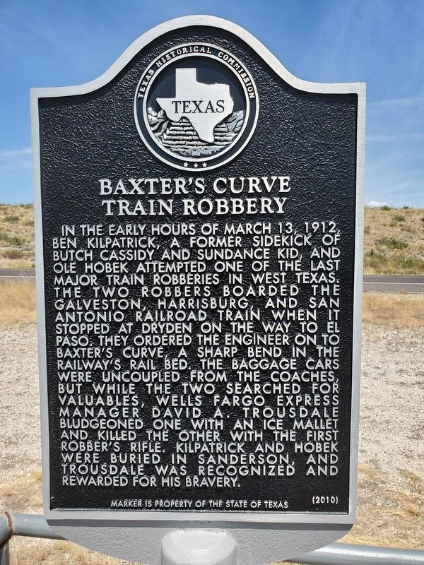
Photographed by Brian Anderson, August 31, 2019
1. Baxter's Curve Train Robbery Marker
Erected 2010 by Texas Historical Commission. (Marker Number 16553.)
Topics. This historical marker is listed in this topic list: Railroads & Streetcars. A significant historical date for this entry is March 13, 1912.
Location. 30° 3.721′ N, 102° 16.147′ W. Marker is near Sanderson, Texas, in Terrell County. It is on U.S. 90 9.4 miles west of Texas Highway 349, on the right when traveling east. Touch for map.
this page online

Regionally, this marker is in West Texas. It is also in the American Borderlands. Globally, it is in North America, a Gulf of Mexico state, the Western Hemisphere, the Western World, and the Anglosphere. Historically, it finds itself in what was once New Spain, the Republic of Texas, and one of the Confederate States of America.
Other nearby markers. At least 6 other markers are within 10 miles of this marker, measured as the crow flies: Dryden Intermediate Field Site 29 (approx. 3.4 miles away); El Buen Pastor Methodist Church (approx. 9.2 miles away); General Alexander W. Terrell / Texas in the Civil War (approx. 9.3 miles away); Sanderson Flash Flood (approx. 9.4 miles away); Terrell County Eagle (approx. 9.4 miles away); Terrell County (approx. 10 miles away).

Photographed by Brian Anderson, August 31, 2019
2. Baxter's Curve Train Robbery Marker
Credits. This page was last revised on September 4, 2019. It was originally submitted on September 4, 2019, by Brian Anderson of New Albany, Ohio. This page has been viewed 2,849 times since then and 237 times this year. Photos: 1, 2. submitted on September 4, 2019, by Brian Anderson of New Albany, Ohio.
