Marker Logo HMdb.org THE HISTORICAL
MARKER DATABASE
“Bite-Size Bits of Local, National, and Global History”
Saint John in Saint John County, New Brunswick — The Atlantic Provinces (North America)
 

Menahkwesk "Saint John"


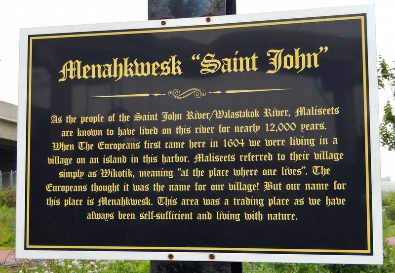
Menahkwesk "Saint John" Marker image. Click for full size.
Photographed By Cosmos Mariner, July 13, 2019
1. Menahkwesk "Saint John" Marker
Inscription. As the people of the Saint John River/Walastakok River, Maliseets are known to have lived on this river for nearly 12,000 years. When The Europeans first came here in 1604 we were living in a village on an island in this harbor. Maliseets referred to their village simply as Wikotik, meaning “at the place where one lives.” The Europeans thought it was the name for our village! But our name for this place is Menahkwesk. This area was a trading place as we have always been self-sufficient and living with nature.
 
Topics. This historical marker is listed in this topic list: Settlements & Settlers. A significant historical year for this entry is 1604.
 
Location. 45° 16.401′ N, 66° 4.365′ W. Marker is in Saint John, New Brunswick, in Saint John County. Marker can be reached from the intersection of Fort Latour Drive and Navy Way when traveling east. Marker is located along the Harbour Passage Trail, about 2/10 kilometer east of Navy Way. Touch for map. Marker is at or near this postal address: 124 Chesley Drive, Saint John NB E2K 1K7, Canada. Touch for directions.
 
Other nearby markers. At least 8 other markers are within walking distance of this marker. Fort La Tour (here, next to this marker); a different marker also named Fort La Tour (within shouting distance of this marker); a different marker also named Fort La Tour (within shouting distance of this marker); The Shards of Time
Paid Advertisement
Click on the ad for more information.
Please report objectionable advertising to the Editor.
Click or scan to see
this page online
(about 120 meters away, measured in a direct line); The Tides of Fundy (approx. 0.3 kilometers away); The Saint John Harbour Bridge | Le pont du port de Saint John (approx. 0.3 kilometers away); Fort Howe (approx. 0.4 kilometers away); Saint John – The Working Port (approx. 0.4 kilometers away). Touch for a list and map of all markers in Saint John.
 
Menahkwesk "Saint John" Marker (<i>wide view • St John Throughway/Canada Hwy 1 in background</i>) image. Click for full size.
Photographed By Cosmos Mariner, July 13, 2019
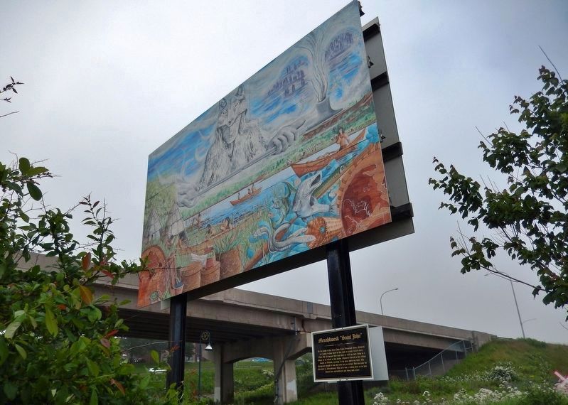
2. Menahkwesk "Saint John" Marker (wide view • St John Throughway/Canada Hwy 1 in background)
Menahkwesk "Saint John" Mural (<i>mounted above marker</i>) image. Click for full size.
Photographed By Cosmos Mariner, July 13, 2019
3. Menahkwesk "Saint John" Mural (mounted above marker)
 
 
Credits. This page was last revised on October 12, 2021. It was originally submitted on September 4, 2019, by Cosmos Mariner of Cape Canaveral, Florida. This page has been viewed 492 times since then and 52 times this year. Photos:   1, 2, 3. submitted on September 6, 2019, by Cosmos Mariner of Cape Canaveral, Florida.
Share this page.  
Share on Tumblr
m=138887

CeraNet Cloud Computing sponsors the Historical Marker Database.
This website earns income from purchases you make after using our links to Amazon.com. We appreciate your support.
Paid Advertisement
Apr. 25, 2024