Woodstock in Carleton County, New Brunswick — The Atlantic Provinces (North America)
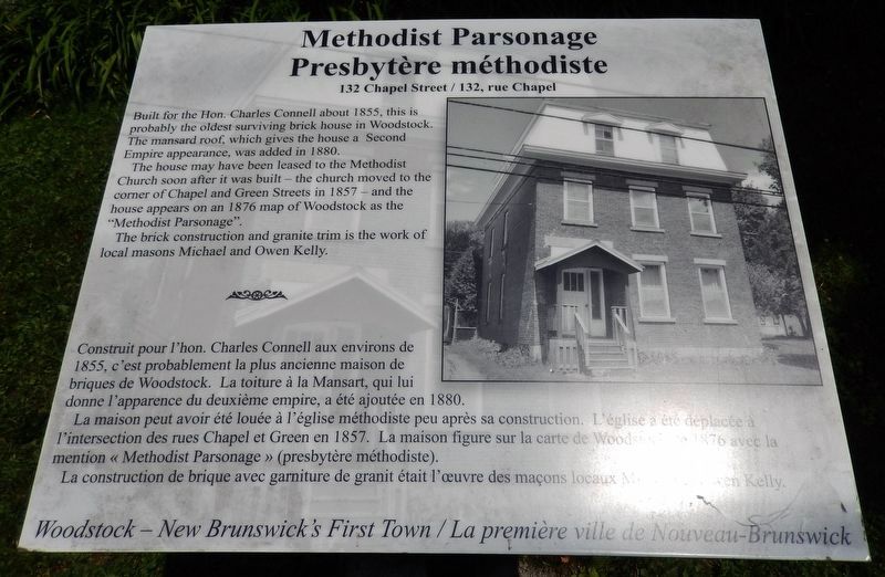
Methodist Parsonage / Presbytère méthodiste
132 Chapel Street / 132, rue Chapel
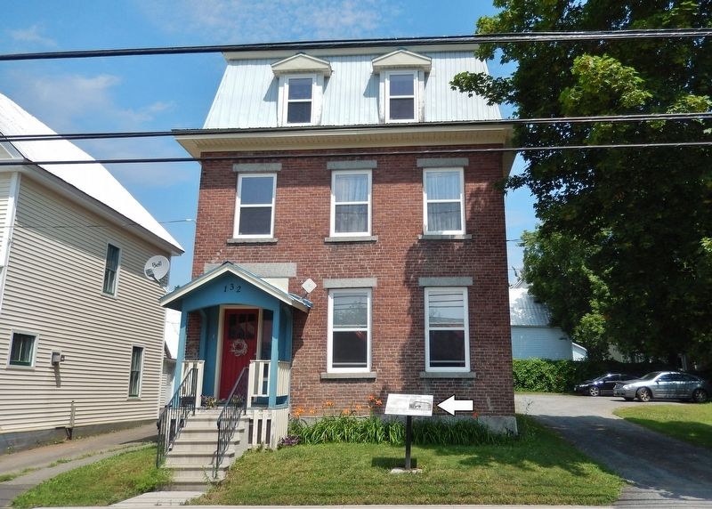
Built for the Hon. Charles Connell about 1855, this is probably the oldest surviving brick house in Woodstock. The mansard roof, which gives the house a Second Empire appearance, was added in 1880.
The house may have been leased to the Methodist Church soon after it was built — the church moved to the corner of Chapel and Green Streets in 1857 — and the house appears on an 1876 map of Woodstock as the "Methodist Parsonage".
The brick construction and granite trim is the work of local masons Michael and Owen Kelly.
Construit pour l'hon. Charles Connell aux environs de 1855, c'est probablement la plus ancienne maison de briques de Woodstock. La toiture à la Mansart, qui lui donne l'apparence du deuxième empire, a été ajoutée en 1880.
La maison peut avoir été louée à l'église méthodiste peu après sa construction. L'église a été déplacée à l'intersection des rues Chapel et Green en 1857. La maison figure sur la carte de Woodstock de 1876 avec la mention « Methodist Parsonage » (presbytère méthodiste).
La construction de brique avec garniture de granit était l'œuvre des maçons locaux Michael et Owen Kelly.
Erected by Woodstock — New Brunswick's First Town / La première ville du Nouveau-Brunswick.
Topics. This historical marker is listed in these topic lists: Architecture • Churches & Religion. A significant historical year for this entry is 1855.
Location. 46° 9.147′ N, 67° 34.645′ W. Marker is in Woodstock, New Brunswick, in Carleton County. Marker is on Chapel Street west of Orange Street, on the right when traveling west. Marker is located near the sidewalk, directly in front of the subject house. Touch for map. Marker is at or near this postal address: 132 Chapel Street, Woodstock NB E7M, Canada. Touch for directions.
Other nearby markers. At least 8 other markers are within walking distance of this marker. Bailey House / Maison Bailey (a few steps from this marker); Women's Institute Home / Maison de l'Institut féminin (within shouting distance of this marker); McLean Dairy / Laiterie McLean (within shouting distance of this marker); L.P. Fisher Vocational School / École professionnelle L.P. Fisher (within shouting distance of this marker); Flemming House / La Maison Flemming (within shouting distance of this marker); Wolverton House / Maison Wolverton (about 90 meters away, measured in a direct line); Dr. Brown House / Maison du Dr. Brown
(about 90 meters away); Saint James United Church / Église unie Saint James (about 150 meters away). Touch for a list and map of all markers in Woodstock.
Credits. This page was last revised on September 9, 2019. It was originally submitted on September 8, 2019, by Cosmos Mariner of Cape Canaveral, Florida. This page has been viewed 115 times since then and 8 times this year. Photos: 1, 2. submitted on September 9, 2019, by Cosmos Mariner of Cape Canaveral, Florida.

