Near Merritt Island in Brevard County, Florida — The American South (South Atlantic)
SATAN Tracking Antenna
Photographed by J. J. Prats, December 2003
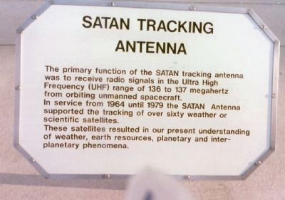
1. SATAN Tracking Antenna Marker
The primary function of the SATAN tracking antenna was to receive radio signals in the Ultra High Frequency (UHF) range of 136 to 137 megahertz from orbiting unmanned spacecraft.
In service from 1964 until 1979 the SATAN Antenna supported the tracking of over sixty weather or scientific satellites.
These satellites resulted in our present understanding of weather, earth resources, planetary and interplanetary phenomena.
Topics. This historical marker is listed in these topic lists: Air & Space • Communications. A significant historical year for this entry is 1964.
Location. 28° 31.499′ N, 80° 40.883′ W. Marker is near Merritt Island, Florida, in Brevard County. It is on NASA Parkway West (State Road 405) east of Government Road, on the right when traveling east. It is at the Kennedy Space Center Visitor Complex. Touch for map. Marker is at or near this postal address: 405 NASA Pkwy W, Merritt Island FL 32953, United States of America. Touch for directions.

Regionally, this marker is in Florida’s Space Coast. It is also in the American South and on the Eastern Seaboard. Globally, it is in the North Atlantic
this page online
Other nearby markers. At least 8 other markers are within walking distance of this marker: NASA’s Jet Set (a few steps from this marker); Mars Exploration Rover (about 300 feet away, measured in a direct line); Back On Top (about 300 feet away); Orion (about 400 feet away); Swords Into Plowshares (about 700 feet away); Delta II: By The Numbers (about 700 feet away); Shooting the Moon, Dreaming of Stars (about 700 feet away); The Power of Apollo (about 700 feet away). Touch for a list and map of all markers in Merritt Island.
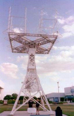
Regarding SATAN Tracking Antenna. SATAN stands for Satellite Automatic Tracking Antenna Network. This antenna was once one of many in the network. It was re-erected here at the visitors center as a museum piece.
Photographed by J. J. Prats, December 2003
2. SATAN Tracking Antenna and Marker
Photographed by Chuck Mulligan, circa August 1965
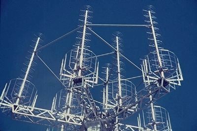
3. SATAN Tracking Antenna Marker
Used as part of NASA's STDAN network in Santiago, Chile.
Credits. This page was last revised on July 12, 2021. It was originally submitted on November 28, 2008, by J. J. Prats of Powell, Ohio. This page has been viewed 9,381 times since then and 288 times this year. Photos: 1, 2. submitted on November 28, 2008, by J. J. Prats of Powell, Ohio. 3. submitted on July 25, 2009, by Chuck Mulligan of Jupiter, Florida.
