St. George in Washington County, Utah — The American Mountains (Southwest)
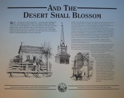
And the Desert Shall Blossom
William Carter who built his home on the southeast corner of this block, holds the distinction of plowing the first ditch in the valley. The water he channeled emerged from the spring which still flows from the eastern edge of the red sandstone ledge north of the city. Soon a ditch and wooden flume system was built throughout the town, conducting water from East and West springs to the town’s many lots. The water from the spring did not taste good, but was none-the-less life sustaining, and much better than the rank water from the Virgin River. In those days a “drinking hour” was established in the town. During a specified hour each morning, all irrigation diversions were taken out of the main ditch so that water flowed completely through the system. Members of each household dipped enough water from the ditch for the day’s needs and stored it in barrels. Though contention over water turns was unavoidable, completion of the Tabernacle with its punctual town clock in the tower helped synchronize the citizens and reduced disagreements.
To irrigate farms south of town, the pioneers began immediately to put dams and diversions in the Rio Virgin and building ditches to the fields. Project after project failed as the river’s unpredictable currents and periodic floods literally washed their dreams to sea. It was decades before the Virgin’s flow was effectively harnessed, yet even today the river still finds the means to have its way.
Historian Andrew Carl Larsen aptly described the dilema: “During the late 1860s, 70s, and 80s, floods roared down the Virgin and its tributaries with increasing frequency and volume. Its turbid waters, swelling in angry crescendo as the years passed, tore out dams as fast as the tired settlers on its uneasy banks could put them in. Worse still, much of the finest bottom land was carried to the Pacific by the wrathful Virgin who struck out blindly and even viciously at those who had so thoughtlessly violated her watersheds. Like an angry goddess, she turned upon her tormentors to destroy what they had built.”
Erected 1994 by Sons of Utah Pioneers.
Topics and series. This historical marker is listed in this topic list: Agriculture. In addition, it is included in the Sons of Utah Pioneers series list. A significant historical year for this entry is 1861.
Location.
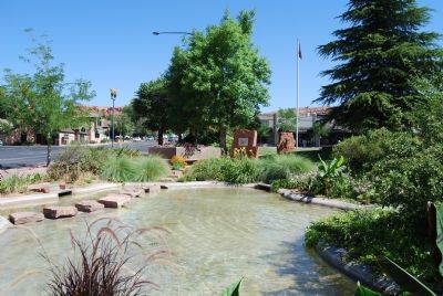
37° 6.566′ N, 113° 34.976′ W. Marker is in St. George, Utah, in Washington County. Marker can be reached from St. George Boulevard. It is in the park next to Zion’s Bank. Touch for map. Marker is at or near this postal address: 36 E St George Boulevard, Saint George UT 84770, United States of America. Touch for directions.
Other nearby markers. At least 8 other markers are within walking distance of this marker. Dixie Academy (a few steps from this marker); St. George Tabernacle (a few steps from this marker); Gardeners’ Club Hall (a few steps from this marker); St. George Social Hall “Opera House” (a few steps from this marker); The Woodward School (a few steps from this marker); Erastus Snow's Big House (a few steps from this marker); St. George Temple (a few steps from this marker); Pioneer Courthouse (within shouting distance of this marker). Touch for a list and map of all markers in St. George.
Credits. This page was last revised on June 16, 2016. It was originally submitted on June 27, 2007, by Dawn Bowen of Fredericksburg, Virginia. This page has been viewed 1,515 times since then and 8 times this year. Photos: 1, 2. submitted on June 27, 2007, by Dawn Bowen of Fredericksburg, Virginia. • J. J. Prats was the editor who published this page.

