Warwick in Newport News, Virginia — The American South (Mid-Atlantic)
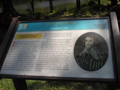
Waters Creek
Dammed in 1930
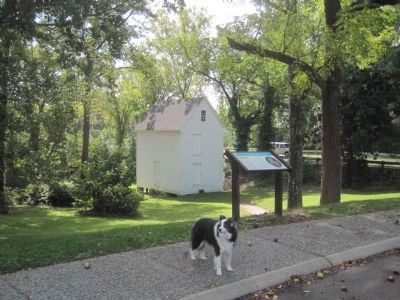
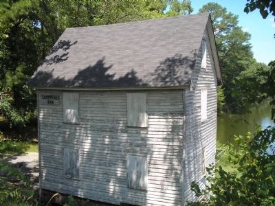
In 1624, Governor Sir Francis Wyatt granted Edward Waters a patent for 100 acres between Waters Creek and Blunt Point. Waters had served on the ill-fated voyage of the ship Sea Venture under Sir George Somers in 1609. After the vessel wrecked off Bermuda, the survivors constructed the ship Deliverance and sailed on to Virginia. It was this wreck that William Shakespeare immortalized in his play, The Tempest. Waters continued to serve at sea until his marriage to Grace O’Neil in 1618. The couple settled on his patent six years later and then acquired another hundred acres in Buckroe. Before his death in 1629, Waters served as a member of the House of Burgesses, a militia officer, and a justice. His name remained linked to the waterway until the creek was dammed in 1930. A gristmill was erected on Waters Creek sometime in the seventeenth century, and successive mills (including Causey’s Mill, completed in 1866) operated there until the late nineteenth century.
Ownership of this land passed through several families until the twentieth century. William Whitby received a patent in 1652 for a 1,300-acre tract, including this property, on Waters Creek. In 1675, John Langhorne purchased this tract from William Whitby, Jr. Six years later, Langhorne acquired another 690 acres. The Langhorne property of 1,990 acres was included in a new patent dated September 11, 1681. The Langhorne family owned this land for another five generations, with their family seat located near the mouth of Waters Creek on the James River. John Mallicote purchased the property from William Langhorne in 1815. The Mallicote family retained this tract until John Gambol purchased it in 1845. He died seven years later, and the land remained with his descendants until the Mariners’ Museum acquired it in 1930.
Erected 2007 by Newport News Founders’ Trail.
Topics. This historical marker is listed in this topic list: Colonial Era. A significant historical date for this entry is September 11, 1880.
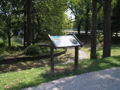
Location. 37° 3.553′ N, 76° 29.018′ W. Marker is in Newport News, Virginia. It is in Warwick. Marker can be reached from Warwick Boulevard (U.S. 60), on the right when traveling north. Touch for map. Marker is in this post office area: Newport News VA 23601, United States of America. Touch for directions.
Other nearby markers. At least 8 other markers are within walking distance of this marker. Estelle and George Abernathy (a few steps from this marker); Leifr Eiriksson
(approx. ¼ mile away); Captain Christopher Newport (approx. ¼ mile away); Spanish Bronze Gun (approx. 0.4 miles away); a different marker also named Spanish Bronze Gun (approx. 0.4 miles away); Walking Beam and A-Frame (approx. 0.4 miles away); Sloop La Nube (approx. 0.4 miles away); US Navy Admiralty Pattern Anchor (approx. 0.4 miles away). Touch for a list and map of all markers in Newport News.
More about this marker. The right side of the marker contains a portrait of Governor Sir Francis Wyatt.
Credits. This page was last revised on February 1, 2023. It was originally submitted on November 29, 2008, by Bill Coughlin of Woodland Park, New Jersey. This page has been viewed 1,577 times since then and 87 times this year. Photos: 1, 2. submitted on November 29, 2008, by Bill Coughlin of Woodland Park, New Jersey. 3. submitted on September 30, 2014, by Kevin W. of Stafford, Virginia. 4. submitted on November 29, 2008, by Bill Coughlin of Woodland Park, New Jersey. 5. submitted on September 30, 2014, by Kevin W. of Stafford, Virginia.
