Rolla in Phelps County, Missouri — The American Midwest (Upper Plains)
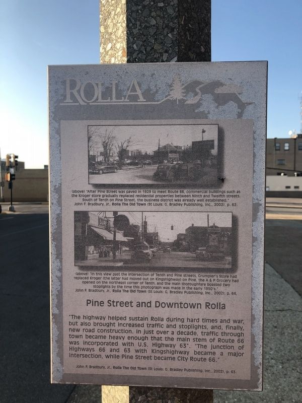
Pine Street and Downtown Rolla
Rolla

Photographed By Devry Becker Jones (CC0), September 15, 2019
1. Pine Street and Downtown Rolla Marker
John F. Bradbury, Jr., Rolla The Old Town (St. Louis: G. Bradley Publishing, Inc., 2002), p. 63.
[Captions:]
(above) "After Pine Street was paved in 1929 to meet Route 66, commercial buildings such as the Kroger store gradually replaced residential properties between North and Twelfth streets. South of Tenth and Pine Street, the business district was already well established."
John F. Bradbury, Jr., Rolla The Old Town (St. Louis: G. Bradley Publishing, Inc., 2002), p. 62
(above) "In this view past the Intersection of Tenth and Pine streets, Crumpler's Store had replaced Kroger (the latter had moved out on Kingshighway) on Pine, the A & P Grocery had opened on the northeast corner of Tenth, and the main thoroughfare boasted two stoplights by the time this photograph as made in the early 1950's."
John F. Bradbury, Jr., Rolla The Old Town (St. Louis: G. Bradley Publishing, Inc., 2002), p. 64.
Topics and series. This historical marker is listed in this topic list: Roads & Vehicles. In addition, it is included in the U.S. Route 66 series list. A significant historical year for this entry is 1929.
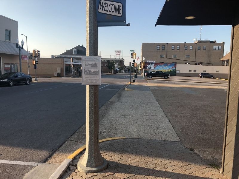
Location. 37° 57.108′ N, 91° 46.298′ W. Marker has been reported damaged. Marker is in Rolla, Missouri, in Phelps County. Marker is on North Pine Street just north of West 10th Street (Missouri Highway BB), on the left when traveling north. Touch for map. Marker is at or near this postal address: 1005 North Pine Street, Rolla MO 65401, United States of America. Touch for directions.
Other nearby markers. At least 8 other markers are within walking distance of this location. "White" USO (about 400 feet away, measured in a direct line); "Black" USO (about 400 feet away); Scott's Drugs (about 600 feet away); Grant Hotel (about 600 feet away); National Bank (about 700 feet away); a different marker also named Pine Street and Downtown Rolla (about 700 feet away); Hotel Edwin Long (about 700 feet away); Rollamo Theater (about 700 feet away). Touch for a list and map of all markers in Rolla.

Photographed By Devry Becker Jones (CC0), September 15, 2019
2. Pine Street and Downtown Rolla Marker
Credits. This page was last revised on September 18, 2019. It was originally submitted on September 18, 2019, by Devry Becker Jones of Washington, District of Columbia. This page has been viewed 447 times since then and 72 times this year. Photos: 1, 2. submitted on September 18, 2019, by Devry Becker Jones of Washington, District of Columbia.