Independence in Jackson County, Missouri — The American Midwest (Upper Plains)
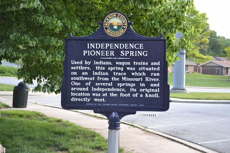
Independence Pioneer Spring
Erected 1974 by Jackson County Historical Society.
Topics. This historical marker is listed in these topic lists: Native Americans • Settlements & Settlers.
Location. 39° 5.595′ N, 94° 24.686′ W. Marker is in Independence, Missouri, in Jackson County. Marker is at the intersection of North Dodgion Street and East Truman Road, on the right when traveling south on North Dodgion Street. Touch for map. Marker is at or near this postal address: 187 North Dodgion Street, Independence MO 64050, United States of America. Touch for directions.
Other nearby markers. At least 8 other markers are within walking distance of this marker. Trail of Death (a few steps from this marker); Second Baptist Church (approx. 0.2 miles away); Twyman Hotel - Kenton House (approx. ¼ mile away); Fire Station No. 1 (approx. ¼ mile away); Jackson County Marshal's House and Jail Museum (approx. ¼ mile away); Harpie Club (approx. ¼ mile away); Truman's First Job (approx. ¼ mile away); Clinton's Drugstore (approx. ¼ mile away). Touch for a list and map of all markers in Independence.
Credits. This page was last revised on January 16, 2020. It was originally submitted on September 20, 2019, by Michael E Sanchez, Jr. of Kansas City, Missouri. This page has been viewed 348 times since then and 56 times this year. Photos: 1. submitted on September 20, 2019, by Michael E Sanchez, Jr. of Kansas City, Missouri. 2, 3. submitted on January 16, 2020, by Michael E Sanchez, Jr. of Kansas City, Missouri. • Bernard Fisher was the editor who published this page.


