Northside District in Lexington in Fayette County, Kentucky — The American South (East South Central)
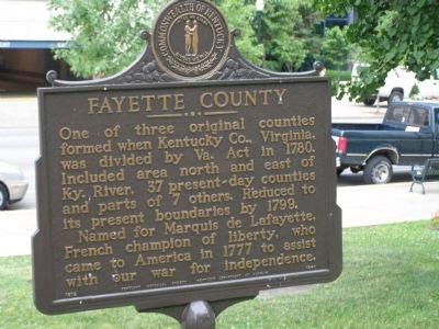
Fayette County
Named for Marquis de Lafayette, French champion of liberty, who came to America in 1777 to assist with our war for independence.
Erected 1972 by Kentucky Historical Society and Kentucky Department of Highways. (Marker Number 1440.)
Topics and series. This historical marker is listed in these topic lists: Patriots & Patriotism • Political Subdivisions. In addition, it is included in the Kentucky Historical Society series list. A significant historical year for this entry is 1780.
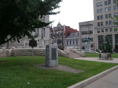
Location. 38° 2.857′ N, 84° 29.89′ W. Marker is in Lexington, Kentucky, in Fayette County. It is in the Northside District. Marker is on West Main Street (U.S. 421). Located in front of the historic courthouse. Touch for map. Marker is in this post office area: Lexington KY 40507, United States of America. Touch for directions.
Other nearby markers. At least 8 other markers are within walking distance of this marker. Fayette County World War I Memorial (here, next to this marker); Lexington Courthouses / Cheapside (within shouting distance of this marker); U.S. Vice President (within shouting distance of this marker); Fayette National Bank Building (within shouting distance of this marker); Slavery in Fayette Co. / Cheapside Slave Auction Block (within shouting distance of this marker); Peaceful Protests for Equality / Turning a Blind Eye to a Movement (about 300 feet away, measured in a direct line); Silversmith Shop (about 300 feet away); Skuller's Clock (about 500 feet away). Touch for a list and map of all markers in Lexington.
Credits. This page was last revised on February 12, 2023. It was originally submitted on December 1, 2008, by Christopher Light of Valparaiso, Indiana. This page has been viewed 1,191 times since then and 18 times this year. Photos: 1, 2, 3. submitted on December 1, 2008, by Christopher Light of Valparaiso, Indiana. • Kevin W. was the editor who published this page.


