
Saint Joseph du Moine in Inverness County, Nova Scotia — The Atlantic Provinces (North America)
Founders of the Parish of St-Joseph du Moine
Fondateurs de la Paroisse de St-Joseph du Moine
Photographed by Cosmos Mariner, July 22, 2019
1. Founders of the Parish of St-Joseph du Moine Marker
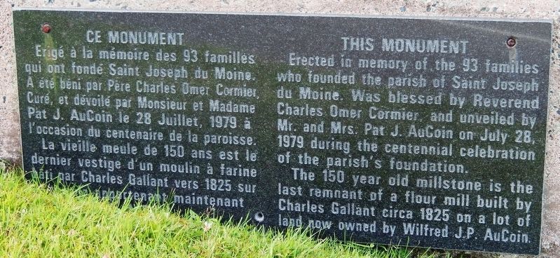
(monument bottom panel)
(monument bottom panel)

The 150 year old millstone is the last remnant of a flour mill built by Charles Gallant circa 1825 on a lot of land now owned by Wilfred J.P. Aucoin.
La vieille meule de 150 ans est le dernier vestige d'un moulin à farine bâti par Charles Gallant vers 1825 sur un terrain qui appartient maintenant à Wilfred J.P. Aucoin.
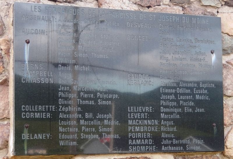
AuCoin : Amédée, Antoine, Baptiste, Charles, Dositée, Hippolyte, Joseph, Maurice, Patrick, Pépin, Simon, Thomas, William.
Burns : Denis, Michel.
Campbell
this page online
Chiasson : Ben, David, Elie, Germain, Jean, Marcellin, Paul, Philippe, Pierre, Polycarpe, Olivier, Thomas, Simon.
Collerette : Zéphirin.
Cormier : Alexandre, Bill, Joseph, Louison, Marcellin, Médric, Nectaire, Pierre, Simon.
Delaney : Edouard, Stephen, Thomas, William.
Desveau : Charles, Frederic, Auguste, John.
Doucet : Arséne, Celixite, Dominique, Elie, Grigole, Jean-F., John, Joseph-F., Jullen, King, Louison, Moise-F., Narcisse, Paulette, Phillippe, Pierre, Simon, Simon-F.
Gaudet : Elie, Vital.
Leblanc : Abraham, Alexandre, Baptiste, Etienne-Odillon, Eusèbe, Joseph, Laurent, Médric, Philippe, Placide.
Lelievre : Dominique, Elie, Jean.
Levert : Marcellin.
Mackinnon : Angus.
Pembroke : Richard.
Porier : Alexis.
Ramard : John-Bertrand, Pépin.
Shomphe : Anthanase, Siméon.
Erected 1979.
Topics. This historical marker is listed in these topic lists: Religion & Religious Structures • Settlements & Settlers.
Location. 46° 31.664′ N, 61° 3.737′ W. Marker is in Saint Joseph du Moine, Nova Scotia, in Inverness County. It is on Cabot Trail 0.2 kilometers north
Photographed by Cosmos Mariner, July 22, 2019
2. Founders of the Parish of St-Joseph du Moine Marker
(monument top panel)
(monument top panel)

Regionally, this marker is on Nova Scotia’s Cape Breton Island. It is also in the Maritimes and in Atlantic Canada. Globally, it is in the North Atlantic Region, North America, the Western Hemisphere, the Western World, and the Anglosphere. Historically, it finds itself in what was once a British colony, the Viceroyalty of New France, and Acadia.
Other nearby markers. At least 8 other markers are within 13 kilometers of this marker, measured as the crow flies: St. Joseph du Moine War Memorial (a few steps from this marker); Belle Côte War Memorial (approx. 9.6 kilometers away); The Cabot Trail (approx. 10.8 kilometers away); 1790 - 1990 (approx. 11.4 kilometers away); Chéticamp War Memorial (approx. 11.4 kilometers away); The Gypsum Mine / La Mine De Plâtre (approx. 12 kilometers away); La Bouée du havre / The Harbour Bouy (approx.
Photographed by Cosmos Mariner, July 22, 2019
3. Parish of St-Joseph du Moine
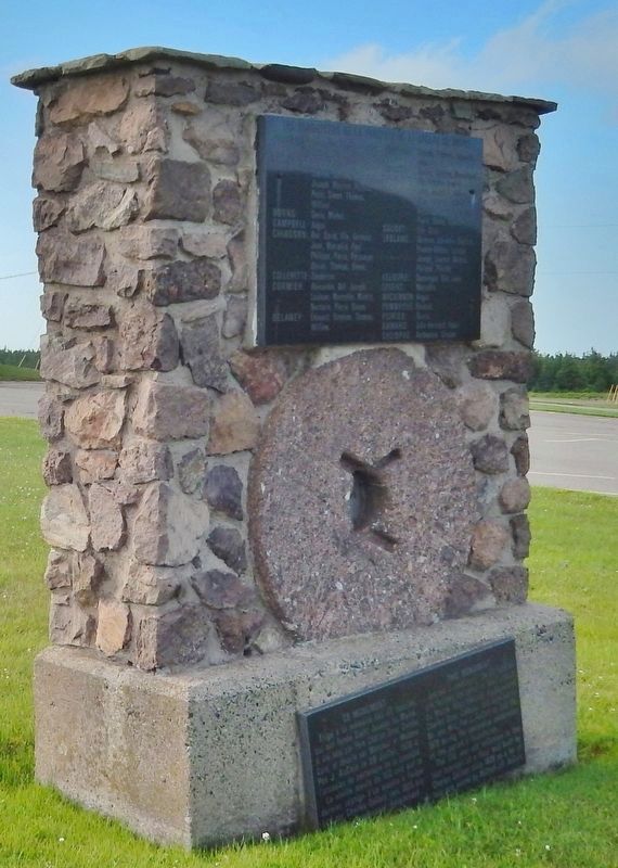
Founders Monument
Founders Monument
Also see . . . Saint Joseph du Moine, Nova Scotia (Wikipedia). Together with Chéticamp, its larger neighbour, Saint-Joseph-du-Moine makes up an Acadian enclave on Cape Breton Island that remains Francophone to this day; the inhabitants speak their own French dialect. (Submitted on September 29, 2019, by Cosmos Mariner of Cape Canaveral, Florida.)
Photographed by Cosmos Mariner, July 22, 2019
4. Founders of the Parish of St-Joseph du Moine
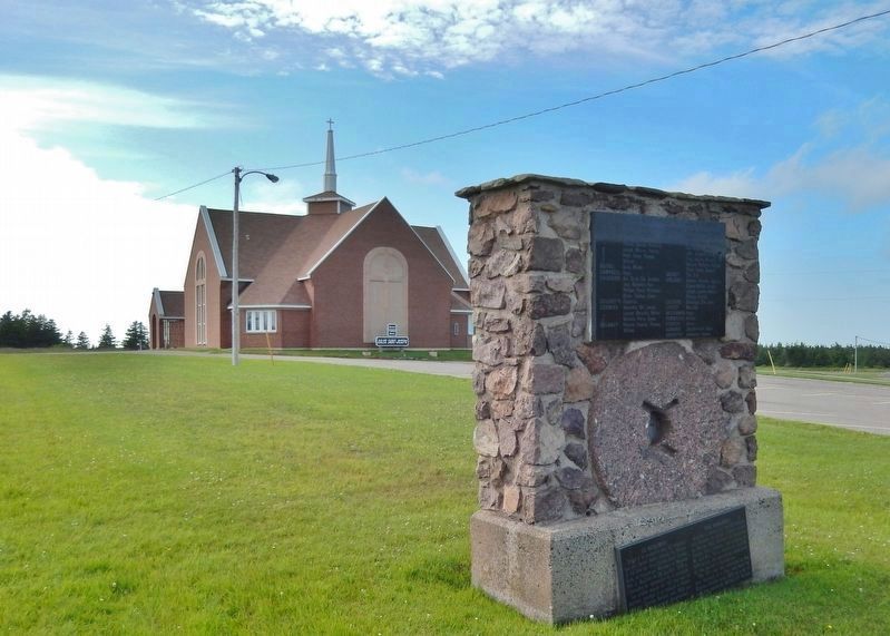
Monument (wide view)
Monument (wide view)
Credits. This page was last revised on September 29, 2019. It was originally submitted on September 29, 2019, by Cosmos Mariner of Cape Canaveral, Florida. This page has been viewed 698 times since then and 63 times this year. Photos: 1, 2, 3, 4. submitted on September 29, 2019, by Cosmos Mariner of Cape Canaveral, Florida.
