Whipple Junction in Fayette County, West Virginia — The American South (Appalachia)
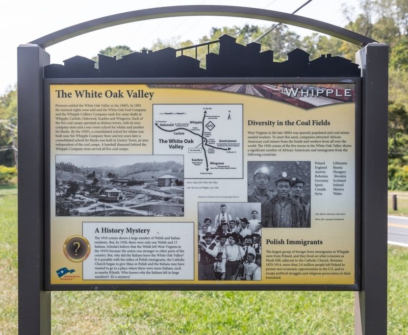
The White Oak Valley
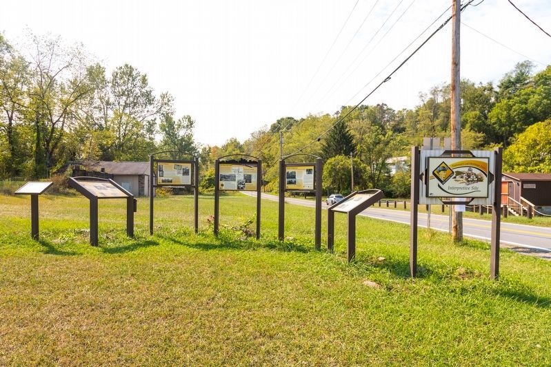
Coal Heritage Trail National Coal Heritage Area Interpretive Site
Diversity in the Coal Fields. West Virginia in the late 1800s was sparsely populated and coal mines needed workers. To meet this need, companies attracted African-American coal miners from the South and workers from all over the world. The 1920 census of the five towns in the White Oak Valley shows a significant number of African-Americans and immigrants from the following countries: Poland Lithuania England Russia Austria Hungary Bohemia Slovakia Germany Scotland Spain Ireland Canada Mexico Syria Wales.
Polish Immigrants. The largest group of foreign-born immigrants in Whipple were from Poland, and they lived on what is known as Hunk Hill, adjacent to the Catholic Church. Between 1870-1914, more than 2.6 million people left Poland to pursue new economic opportunities in the U.S. and to escape political struggles and religious persecution in their homeland.
A History Mystery. The 1910 census shows a large number of Welsh and Italian residents. But, by 1920, there were only one Welsh and 13 Italians. Scholars believe that the Welsh left West Virginia in the 1910s because the union was stronger in other parts of the country. But, why did the Italians leave the White Oak Valley? It is possible with the influx of Polish immigrants, the Catholic Church began to give Mass in Polish and the Italians may have wanted to go to a place where there were more Italians, such as nearby Kilsyth. Who knows why the Italians left in large numbers? It's a mystery!
Topics. This historical marker is listed in these topic lists: Industry & Commerce • Labor Unions • Natural Resources. A significant historical year for this entry is 1892.
Location. 37° 57.51′ N, 81° 9.949′ W. Marker is in Whipple Junction, West Virginia, in Fayette County. Marker is at the intersection of Okey L Patterson Road (West Virginia Route 612) and Scarbro Road (Route 1/5), on the right when traveling east on Okey L Patterson Road. Touch for map. Marker
is at or near this postal address: 7485 Okey L Patteson Rd, Scarbro WV 25917, United States of America. Touch for directions.
Other nearby markers. At least 8 other markers are within 2 miles of this marker, measured as the crow flies. Labor Strikes and Conflicts (here, next to this marker); Disaster Underground (here, next to this marker); Community Life in a Coal Camp (here, next to this marker); The Coal Barons (a few steps from this marker); Hank Williams Memorial (approx. 1.2 miles away); Hank Williams The Last Ride (approx. 1.4 miles away); Oakwood Mine Complex (approx. 1.4 miles away); Oak Hill Railroad Depot (approx. 1.6 miles away). Touch for a list and map of all markers in Whipple Junction.
More about this marker. This interpretive panel has a map of the White Oak Valley showing locations described in the text. It also contains three photographs (clockwise from right-most photograph) captioned, “African-American coal miners,” “A group of immigrants,” and “the town of Whipple, circa 1926.”
Also see . . . Coal Industry Immigration. Excerpt:
The ethnic composition of immigrant coal miners changed dramatically toward the end of the nineteenth century as large numbers of eastern and southern European immigrants flooded into coal mining towns and camps. As both demand for mine labor and demands of miners for better pay and working conditions increased, coal mine operators began actively recruiting immigrants from these regions to increase their labor pools and to foster linguistic, religious, and cultural divisions intended to complicate the efforts of miners to organize. These divisions, often exacerbated by the physical separation of ethnic groups within coal mining towns and camps, occasionally resulted in violent clashes.(Submitted on October 1, 2019.)
Credits. This page was last revised on October 3, 2019. It was originally submitted on October 1, 2019, by J. J. Prats of Powell, Ohio. This page has been viewed 344 times since then and 60 times this year. Photos: 1. submitted on October 1, 2019, by J. J. Prats of Powell, Ohio. 2. submitted on September 26, 2019, by J. J. Prats of Powell, Ohio.

