Castlecove in County Kerry, Munster, Ireland — Irish South-West ((Éire) North Atlantic Ocean)
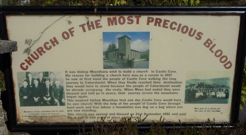
Church of the Most Precious Blood
Photographed by William Fischer, Jr., May 19, 2019
1. Church of the Most Precious Blood Marker

It was [B]ishop Moynihans wish to build a church in Castle Cove. His reason for building a church here was, as a curate in 1917 he saw first hand the people of Castle Cove walking the long journey to Caherdaniel. When they finally reached their destination they would have to stand because the people of Caherdaniel would be already occupying the seats. When Mass had ended they were blessed and told go in peace, their journey across the mountains began again.
This inspired [B]ishop Moynihans that one day Castle Cove would have its own church. With the help of the people of Castle Cove through hard work and free labour a foundation was dug on a bog where you are now standing.
The church was opened and blessed on 21st September 1961 and paid for in full. It was pride of place at its best.
[Photo captions, from left to right, read]
• Members of the committee left to right
J. Clifford, F. o Sullivan, M. Fitzgerald,
D. MacGillycuddy, E. o Sullivan, J. o Leary, D. Clifford
• [Photo of the church]
• Men join in a photo on the day of the opening
Erected by Church of the Most Precious Blood.
Topics.
this page online
Location. 51° 46.748′ N, 10° 2.162′ W. Marker is in Castlecove, Munster, in County Kerry. It is on Ring of Kerry (National Route N70), on the right when traveling west. Touch for map. Marker is in this post office area: Castlecove, Munster V93 X522, Ireland. Touch for directions.

Regionally, it is on the Atlantic Ocean, in the North Atlantic Region, on the Atlantic Arc, in Europe, on the Island of Ireland, on the Celtic Fringe, in the European Union, in Atlantic Europe, on one of the British Isles, in the Western World, and in the Anglosphere.
Other nearby markers. At least 8 other markers are within 11 kilometers of this marker, measured as the crow flies: Cathair na Stéige / Staigue Fort (approx. 3.2 kilometers away); Bóthar an Ime / Bóthar an Chuinsailéara (approx. 4.5 kilometers away); The Sun / An ghrian (approx. 4.5 kilometers away); Teach do laoch / Home for a hero (approx. 6.6 kilometers away); Com an Chiste (approx. 9.1 kilometers away); Colonel Patrick J. Quinlan (approx. 9.1
Photographed by William Fischer, Jr., May 19, 2019
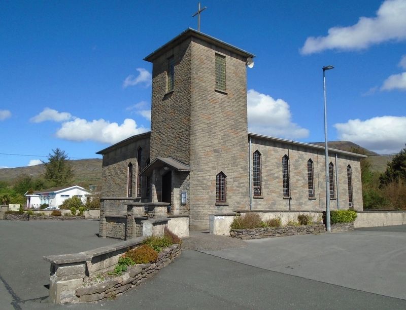
2. Church of the Most Precious Blood and Marker
Credits. This page was last revised on October 13, 2024. It was originally submitted on October 3, 2019, by William Fischer, Jr. of Reynoldsburg, Ohio. This page has been viewed 689 times since then and 55 times this year. Photos: 1, 2. submitted on October 3, 2019, by William Fischer, Jr. of Reynoldsburg, Ohio.
