Canso in Guysborough County, Nova Scotia — The Atlantic Provinces (North America)
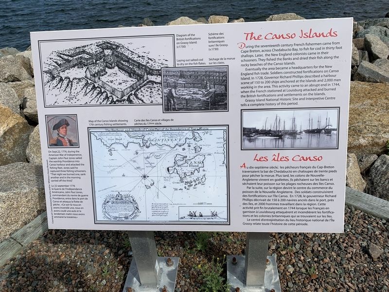
The Canso Islands/ Les îles Canso
Eventually the area became a headquarters for the New England fish trade. Soldiers constructed fortifications on Canso Island. In 1728, Governor Richard Phillips described a harbour scene of 150 to 200 ships anchored at the Islands and 2,000 men working in the area. This activity came to an abrupt end in 1744, when the French stationed at Louisburg attacked and burned the British fortifications and settlements on the Islands.
Grassy Island National Historic Site and Interpretive Centre tells a complete history of this period.
Par la suite, sur la région devint le centre du commerce du poisson de la Nouvelle-Angleterre. Des soldats construisirent des fortifications sur île Canso. En 1728, le gouverneur Richard Phillips décrivait de 150 à 200 navires ancrés dans le port, près des îles, et 2000 hommes travaillant dans la région. Cette activité prit fin brutalement en 1744 lorsque les Français en garnison à Louisbourg attaquèrent et incendiérent les fortifications et les colonies britanniques qui se trouvaient sur les îles.
Le centre d'entreprétation du lieu historique national de l'île Grassy relate toute l'histoire de cette période.
Left Inset:
Topics and series. This historical marker is listed in these topic lists: Settlements & Settlers
• War, US Revolutionary. In addition, it is included in the Acadian History series list. A significant historical date for this entry is September 22, 1776.
Location. 45° 20.241′ N, 60° 59.557′ W. Marker is in Canso, Nova Scotia, in Guysborough County. Marker can be reached from Water Street. Touch for map. Marker is in this post office area: Canso NS B0H 1H0, Canada. Touch for directions.
Other nearby markers. At least 8 other markers are within 19 kilometers of this marker, measured as the crow flies. Where Fishermen Meet / Lieu de rencontre des pêcheurs (about 90 meters away, measured in a direct line); Harbour Traffic/Le traffic du port (about 150 meters away); Welcome to Canso Harbour/Bienvenue au Port de Canso (about 180 meters away); In Memory of Tusker 914 En mémoire de (about 210 meters away); We Heard the News First/Nous étions les premiers à avoir les nouvelles (approx. 0.2 kilometers away); Canso (approx. 0.4 kilometers away); Canso Soldiers Memorial (approx. 0.9 kilometers away); Folklore & Trivia (approx. 18.8 kilometers away). Touch for a list and map of all markers in Canso.
Credits. This page was last revised on October 7, 2019. It was originally submitted on October 4, 2019, by Steve Stoessel of Niskayuna, New York. This page has been viewed 142 times since then and 6 times this year. Photos: 1, 2, 3. submitted on October 4, 2019, by Steve Stoessel of Niskayuna, New York. • Andrew Ruppenstein was the editor who published this page.


