Clinton in Hunterdon County, New Jersey — The American Northeast (Mid-Atlantic)
The Lime Kilns
Red Mill Museum Village
The Mulligan Quarry was a low-tech operation where burning and sorting limestone was hard and dirty work.
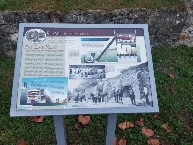
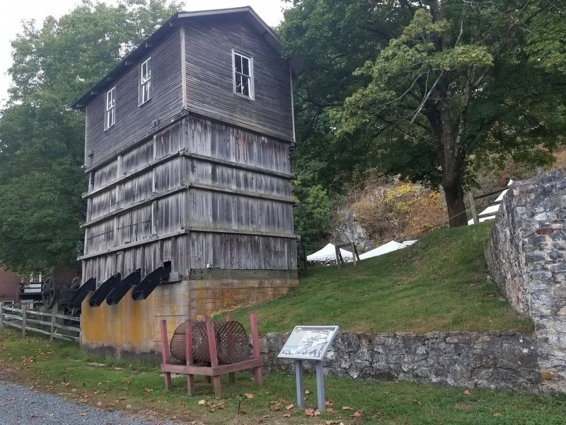
At the Mulligan Quarry, pieces of limestone were broken and sorted at the stone crusher and screen house. The crushed stone was used as a building material in road and railroad construction. Crushed stone was also charged into the lime kilns and burned to produce quick lime, an excellent fertilizer, needed by farmers to open and loosen heavy clay soil and consolidate loose, sandy soil. It was applied at the rate of forty to fifty bushels per acre. At the lime kilns, alternate layers of limestone and pea coal were loaded into the open top of the kilns. When the chamber was filled it was capped with clay, which was called topping the kiln. A fire, kindled from below, worked its way up through the charge, burning the limestone into quicklime. A burn usually lasted two to three weeks, depending on the weather. After the kiln cooled, the finished quicklime was raked out through an opening near the bottom of the stack.
The stone crusher, powered by a 35-horsepower steam engine, broke large chunks of stone from the quarry down to a manageable size. The machine was fed by hand from a platform above and could pulverize five tons an hour. A bucket conveyer, run by a belt from the steam engine, took the broken stone to the top of the screen house where it was sorted by size.
From the shoots at the bottom of the screen house different grades of stone could be loaded into wagons, half inch stone was used for road work. One inch stone was used for concrete aggregate and three inch stone for railroad ballast.
The Lime Kiln
Work at the lime kiln was all done by hand. Workers loaded, burned and raked out a number of kilns in rotation. Burning kilns needed constant attention. Heating the charge changed the limestone from calcium carbonate to calcium oxide (quicklime), liberating large quantities of dangerous carbon dioxide.
As soon as the lime was cool enough to handle, wagons pulled up to the kiln and loaded bushel baskets full for delivery to farms in a thirty mile market area. The average kin could make enough lime in one charging to cover approximately nine acres of land.
( photo captions )
- Farrell-Bacon Jaw Crusher, c. 1905-1912
The stone crusher, which will reduce the material for use on the new turnpike, has been placed in the Mulligan Quarry last Friday. It was hauled into position by the steam roller, the two making a formidable looking combination traveling down west Main Street. Two sluices were broken en route by the weight of the big machines.
Hunterdon Democrat, Wednesday, May 10, 1916
- Crusher & Screen House
Stone was shoveled from a platform above into the jaws of the crusher. The pulverized stone was collected in a bin then taken by an inclined bucket elevator to the top of the screen house. Inside the screen house the crushed stone tumbled through a cylindrical metal trommel screen with graduated holes permitting the stone to be separated by size. Different grades of stone were collected in bins below.
- One of the products produced at the Mulligan Quarry was crushed stone for road construction. This 1911 picture shows a crew doing road work in the Clinton area.
- Michael Mulligan proudly stands along with his teamsters and their wagons in front of his bank of kilns.
Topics. This historical marker is listed in this topic list: Industry & Commerce. A significant historical date for this entry is May 10, 1916.
Location. 40° 38.203′ N, 74° 54.802′ W. Marker is in Clinton, New Jersey, in Hunterdon County. Marker can be reached from the intersection of W. Main Street and Quarry Road, on the right when traveling west. Touch for map. Marker is at or near this postal address: 56 Main Street, Clinton NJ 08809, United States of America. Touch for directions.
Other nearby markers. At least 8 other markers are within walking distance of this marker. The Mulligans (within shouting distance of this marker); The Mill (within shouting distance of this marker); The Quarry (within shouting distance of this marker); Cornerstone, 1754 (about 300 feet away, measured in a direct line); Red Mill Museum Village (about 300 feet away); Hunterdon Historical Museum (about 400 feet away); Mulligan Quarry (about 400 feet away); a different marker also named Lime Kilns (about 400 feet away). Touch for a list and map of all markers in Clinton.
Also see . . . The Red Mill Museum Village. (Submitted on October 8, 2019, by Michael Herrick of Southbury, Connecticut.)
Credits. This page was last revised on October 8, 2019. It was originally submitted on October 8, 2019, by Michael Herrick of Southbury, Connecticut. This page has been viewed 233 times since then and 23 times this year. Photos: 1, 2. submitted on October 8, 2019, by Michael Herrick of Southbury, Connecticut.

